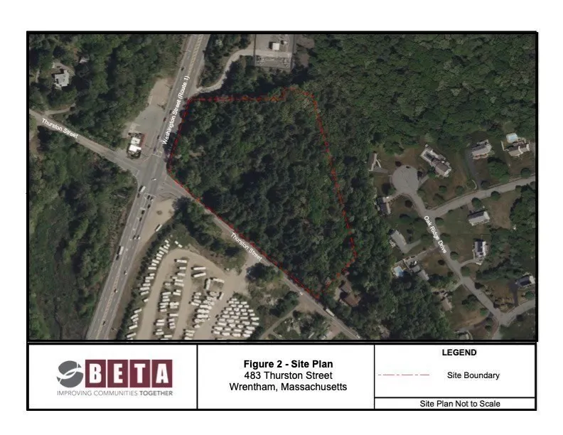
483 Thurston Street Wrentham, Wrentham, MA 02093
ORAD-approved corner parcel at a traffic-light intersection with water and electricity available on-street.
- Added:
- Jun 4, 2026
- Days on Market:
- 9
- Last Refresh:
- Jun 6 at 5:16 am
Property Features for 483 Thurston Street Wrentham
General Information
- Standard status
- Active
- Lot size
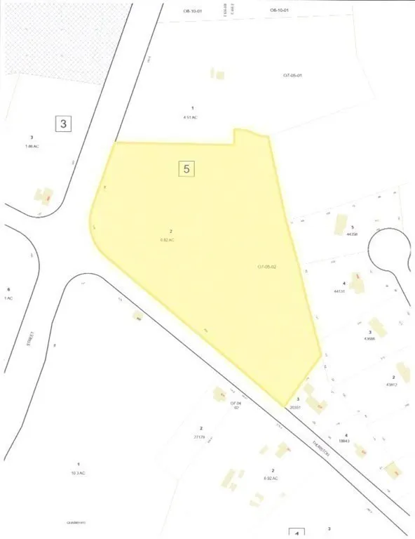
- 6.82 Acres
- Property subtype
- Land
Listing agent Derek DaRosa (508) 501-1443
Listing office (508) 501-1443
Listing date Jun 4, 2026
Source Milestonerealtyinc
Displayed information is deemed reliable but is not guaranteed and should be independently verified.
All listing content including descriptions, pricing, images are the copyrighted material of Derek DaRosa
HighLights
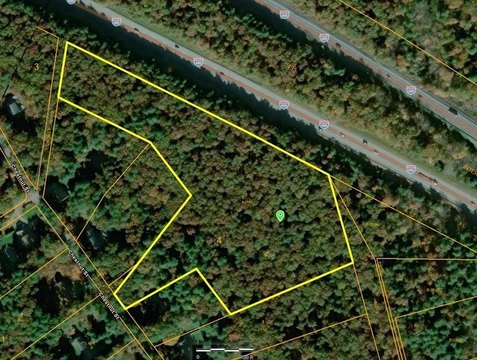
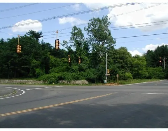
- 6.82‑acre corner commercial land parcel at the Route 1 and Thurston St. traffic‑light intersection
- ORAD‑approved site with water and electricity available on‑street
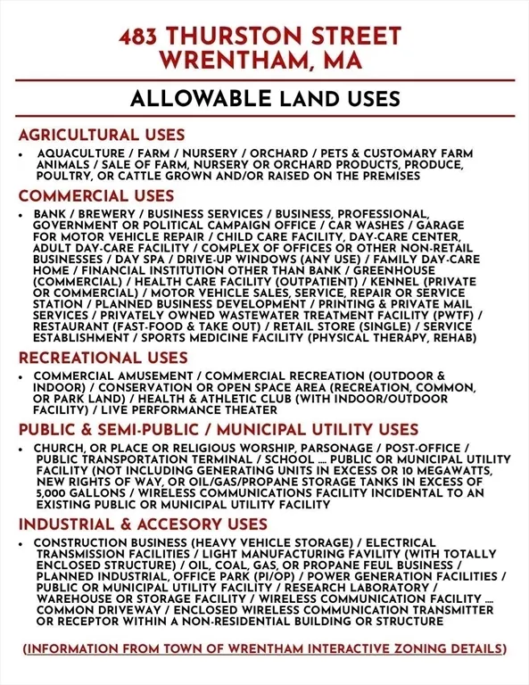
- Located in the C‑1S Route 1 South District; uses per C‑1S zoning as per town site pending approval for an individual project
- Multiple permitted use types listed, including restaurant/fast food, motel/hotel, bank, medical facility, car service/repair, office, warehouse, and car wash
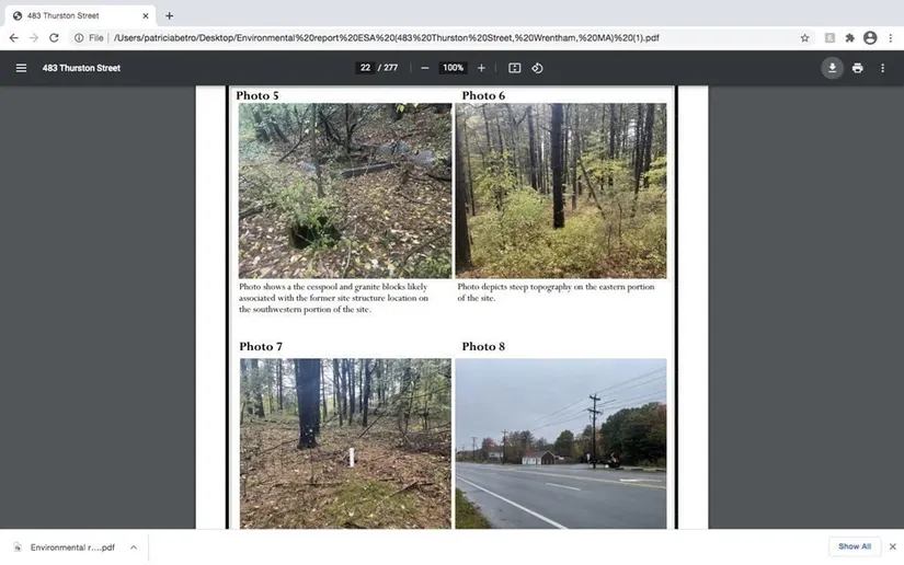
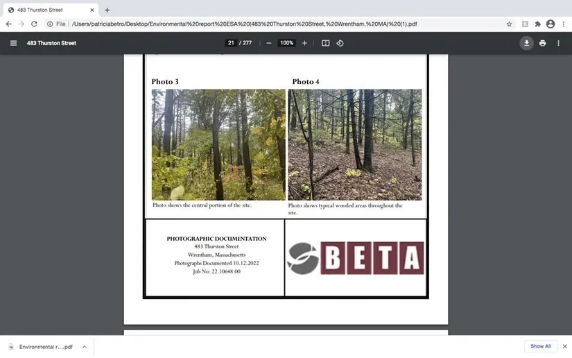
- Engineering attached; Environmental Engineering Report available upon request
- Southern exposure; about 2 miles south of Patriot Place and convenient to RT 95 and 495 via the 4‑way intersection
Overview
The site is located in Wrentham, approximately 2 miles south of Patriot Place and Gillette Stadium, and it sits at a traffic-light intersection. Access is described as easy to Route 95 and Route 495 via a four-way intersection.
Under C-1S zoning (with site-plan approval for an individual project as noted), the property is positioned for a broad range of commercial and mixed-service uses. Examples listed for C-1S include restaurant or fast food with potential drive-up services, motel or hotel, banks, medical facilities, car service and repair, trailer or motor vehicle sales, child care, office building, brewery, car wash, recreation or amusement, warehouse and construction-related uses, heavy equipment storage, schools, and places of worship. The wide permitted-use range may support multiple development concepts depending on final approvals.
Current Use by Public Records
Location Insight
- Map
- Local Demand
- City
- Wrentham
- County
- Norfolk
- State
- Massachusetts
- Longitude
- -71.2972053
- Latitude
- 42.0544915