Industrial Land Bisected by
4700 W 600 N, Cedar City, UT 84721
For Sale


$5,779,500
Pending
Land, Cedar City, UT
Property Size330,446 SF
Lot Size77.06 Acres
Days on Market1261
Property Features for 4700 W 600 N
General Information
Property type
Property subtype
Zoning description
Lot features
Elementary school
Middle school
High school
Directions
Subdivision
Standard status
APN
Size
Lot size
Taxes and HOA fees
Tax Annual Amount
Listing Agency:
Coldwell Banker Comm Adv
(888) 586-8181
Listed By:
Daniel S Roberts · License #5480148-PB00
(435) 559-2221
Added: May 29, 2023
Changed: Aug 31
Last Checked: Nov 9 at 6:06AM
MLS# 23-241766
Copyright © 2026 Washington County Board of Realtors. All rights reserved. All information provided by the listing agent/broker is deemed reliable but is not guaranteed and should be independently verified.

Ask AI about this property
Review the available facts, identify missing information and prepare questions for the agent.
Investment Insights
Based on property information with market context.
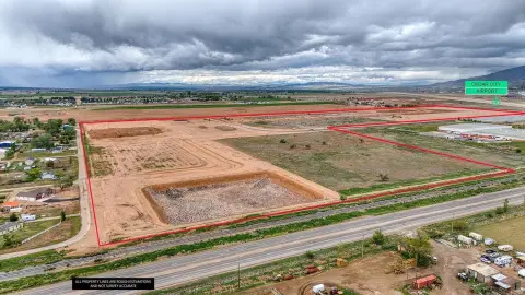
This industrial land tract is located in Cedar City, Utah, with Union Pacific railroad tracks crossing through the property. The site adjoins Port 15 Industrial Park and a GAF plant, placing it within an established industrial setting.
Key Highlights
- 77.06‑acre industrial land tract
- Union Pacific railroad bisects the property
- Adjacent to Port 15 Industrial Park
Property Analytics
Who owns this building?
See the owner, sales and loan history
Open Analytics
Location Intelligence
Trade Area within ½ mile
48
Businesses Nearby
Explore this area
Business Placement
Demographics for 84721, UT
27,329
Population
9,638
Households
2.8
Avg Household Size
29
Median Age
29%
College-Educated
92%
High-School Grad
186.9 sq mi
ZIP Area
146
Density / Sq Mi
$73,342
Median Household Income
$30,662
Median Earnings
$1,076
Median Rent
$345,000
Median Home Value
Check the figures for this property
Cap Rate, Value Estimation, Potential NOI and more
View Realmo Analytics
Market
Average Price Trend$/SF for Industrial land in Cedar City, UT
Properties on Market for Industrial land in Cedar City
Vacancy Rate% for Industrial in West region




Frequently Asked Questions
What type of property is this?
Industrial land - Railroad tracks cross the property, which adjoins Port 15 Industrial Park and a GAF plant.
Where is this industrial land located?
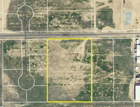
The property is located at 4700 W 600 N Cedar City, UT.
What is the asking price?
The asking price for this property is $5,779,500.
What are key features of this property?
This property features: 77.06‑acre industrial land tract; Union Pacific railroad bisects the property; Adjacent to Port 15 Industrial Park