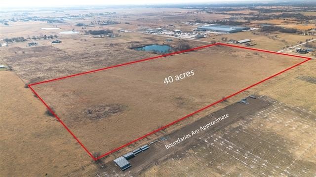
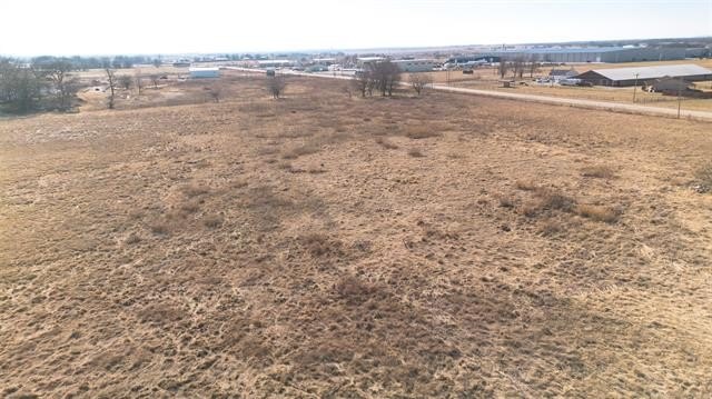
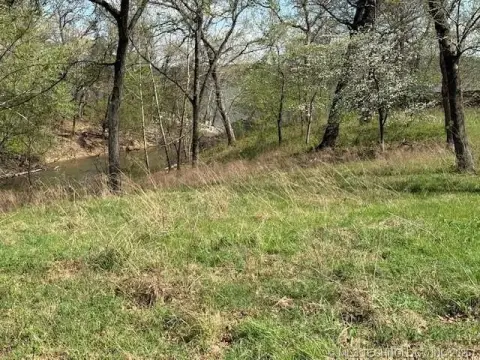
AG Zoned Development
N 4350 Road Pryor, OK 74361
For Sale
$295,000
Pending
LAND - Pryor, OK
Lot Size38.93 Acres
Days on Market182
Property Features for N 4350 Road
General Information
- Property type
- Land
- Property subtype
- Other
- Zoning
- AG
- Standard status
- Pending
- APN
- 0000-11-21N-19E-3-008-00
- Lot size
- 38.93 Acres
Taxes and HOA fees
- Tax Year
- 2025
- Tax Description
- 11-21N-19E A TRACT IN SW/4 BEGINNING AT NW/C SW THEN THEN N88 degrees 12'38"E A DISTANCE OF 1978.93 FT THEN S01 degrees 40'14"E A DISTANCE OF 870.84 FT THEN S89 degrees 00'54"W A DISTANCE OF 1979.05 FT THEN NO1 degrees 40'19"W A DISTANCE O F 843.05 FT TO POB CONTAINING 38.93 ACRES MORE OR LESS
- Tax Annual Amount
- 2585
Listing Agency:
Keller Williams Premier
(918) 283-2252
Listed By:
Darren DeLozier · License #184377
(918) 283-2252
Added: Jan 23
Changed: Jul 8
Last Checked: Jul 24 at 1:06PM
MLS# 2602754
Copyright © 2026 MLS Technology, Inc. All rights reserved. All information provided by the listing agent/broker is deemed reliable but is not guaranteed and should be independently verified.
Investment Insights
Based on property information with market context.
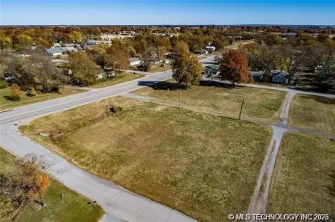
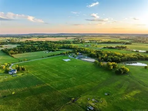
This agricultural-zoned acreage totals 38.93 acres and is offered for sale in its entirety or as two separate 19.45-acre tracts. The property is described as having 3-phase electricity and rural water available, which can support a range of rural and agricultural uses.
The land is located on “True Road” approximately 1.5 miles north of Highway 20, providing straightforward access from the primary highway corridor. The offering is in Pryor, within Mayes County.
With utilities already identified as available, this property may appeal to buyers looking for flexible rural development options within AG zoning. The ability to purchase either the full tract or split parcels provides additional flexibility for individuals or investors planning phased acquisition or separate use areas. Call for a showing to review the site and confirm tract options.
Key Highlights
- 38.93 Acres of Land
- Available 3‑Phase Electricity ensures you have the power you need.
- Rural Water Available
Property Analytics
Location Intelligence
Current Use by Public Records
Agricultural land / Farmland


FAQs
What type of property is this?
Agricultural land / Farmland - Agricultural land with access to 3-phase electricity and rural water, offered as a single tract or two 19.45-acre parcels.
Where is this agricultural land / farmland located?
The property is located at N 4350 Road Pryor, OK.
What is the asking price?
The asking price for this property is $295,000.
What are key features of this property?
This property features: 38.93 Acres of Land; Available 3‑Phase Electricity ensures you have the power you need.; Rural Water Available


