Wooded Recreational Development
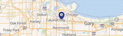
4302 Oak Avenue Hammond, IN 46327


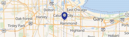
4302 Oak Avenue, Hammond, IN, 46327
$125,000
For Sale
$125,000
LAND - Hammond, IN
Lot Size2.17 Acres
Days on Market192
Property Features for 4302 Oak Avenue
General Information
- Property type
- Land
- Property subtype
- Other
- Standard status
- Active
- APN
- 450330176017000023
- Lot size
- 2.17 Acres
Taxes and HOA fees
- Tax Year
- 2025
- Tax Description
- C HOHMANS NORTH SIDE ADD BLK 2 LOTS 1 TO 23 EX PART IN TOLL ROAD And Triangular Parcel in NE. SW. NW. 386.89 X 405.61 X 126.18 FT S.30 T.37 R.9 Subj to Easement .62 Ac
- Tax Annual Amount
- 2112
Utilities
- Utilities
- Water Available
- Sewer type
- Public Sewer
- Water source
- Public
Listing Agency
Weichert, Realtors-Moke Agency
(219) 662-3000
617 N. Main St, Crown Point, IN
Listed by
John Jurisa · License #RB14015060
(219) 718-5531
Added: Jan 9 Updated: Jun 16 at 1:06 pm Checked: Jul 20 at 8:06 pm
MLS# 832562
Listing URL
Copyright © 2026 Greater Northwest Indiana Association of REALTORS. All rights reserved. All information provided by the listing agent/broker is deemed reliable but is not guaranteed and should be independently verified.
Investment Insights
Based on property information with market context.
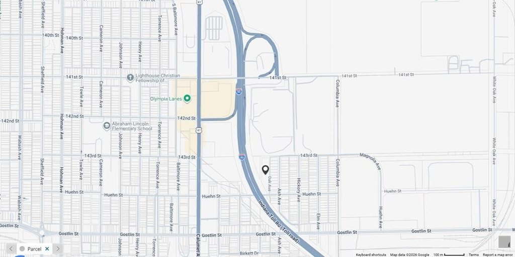
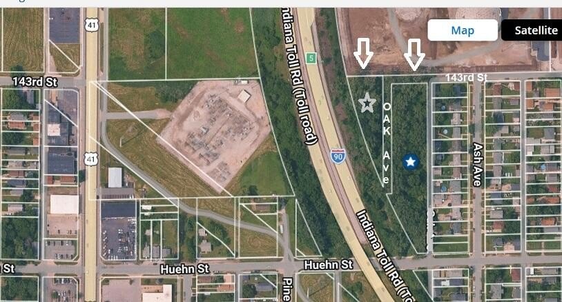
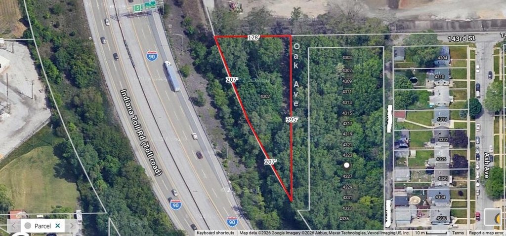
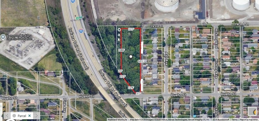
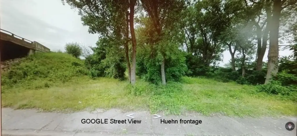
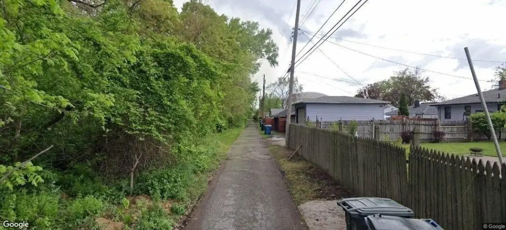
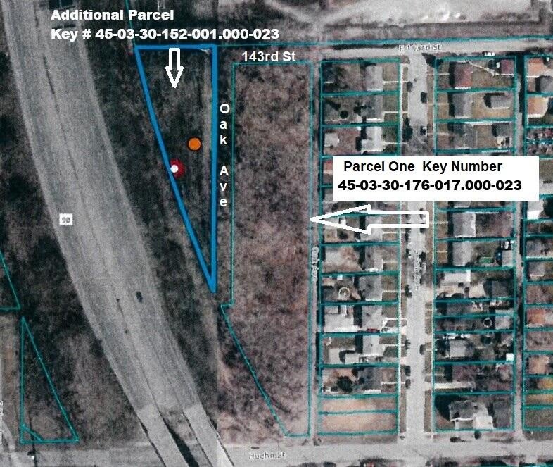
Offered for sale are two wooded parcels totaling 2.17 acres. The site includes approximately 331 feet of exposure to the East-West Toll Road, along with additional east-to-west dimensions of roughly 255 feet at the widest part. A pipeline easement runs across the northern portion of the parcel closest to the Toll Road. The property line references an alley behind homes on the west side of Ash (and an alley shown as Oak Street on some mapping sites), with Oak platted but not developed between these two parcels.
Access and surrounding context include proximity to the Wolf Lake Park, listed as less than 3 miles away. The remarks note the parcels are just around the corner from the Toll Road/US 41/Calumet Avenue exit, and they include frontage on Huehn and on 143rd Avenue extended. The east boundary is described as the alley behind the homes on the west side of Ash, and the alley is referenced as Oak Street in some mapping.
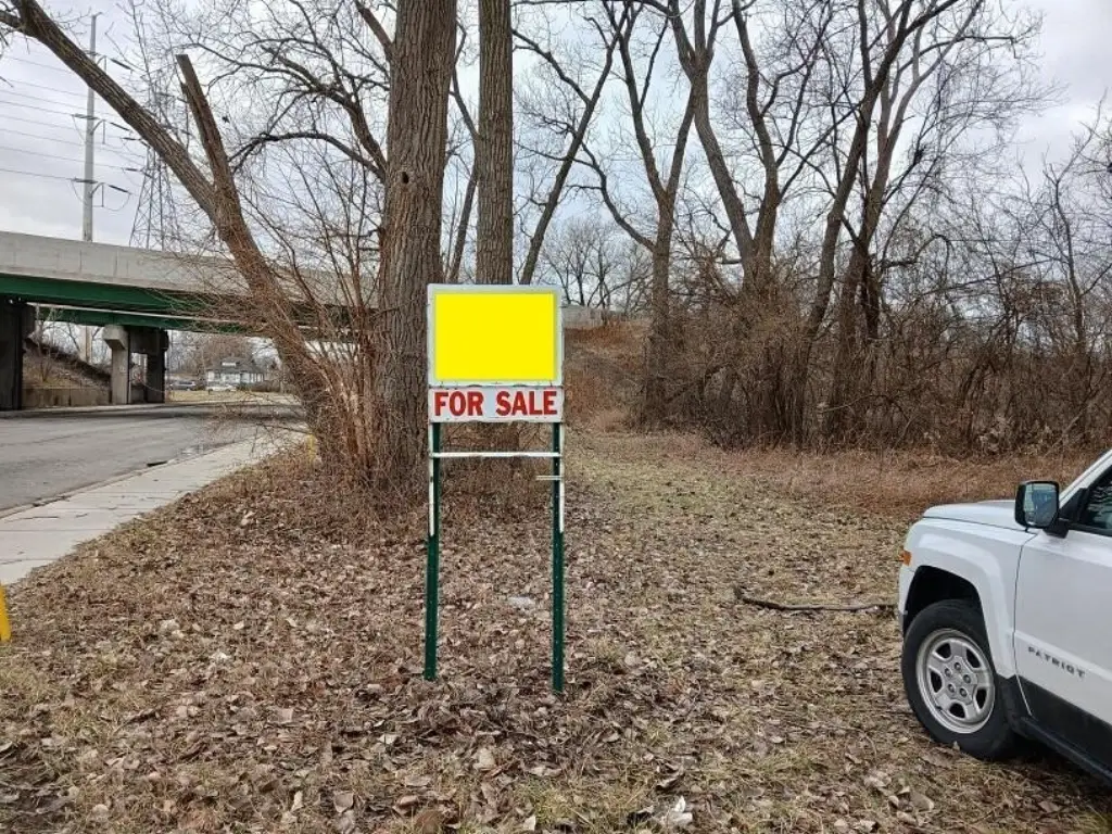
This is positioned for recreational development, with the Hammond online zoning map indicating S-1 for these parcels and the seller noting that city zoning information is attached. Prospective buyers are encouraged to review allowed uses with the Hammond zoning department, particularly for any recreational, event, or lodging-type concepts discussed in the remarks. Please also note the Toll Road-side marker visibility and confirm any impacts related to the pipeline easement and the platted-but-undeveloped alley area.
Access and surrounding context include proximity to the Wolf Lake Park, listed as less than 3 miles away. The remarks note the parcels are just around the corner from the Toll Road/US 41/Calumet Avenue exit, and they include frontage on Huehn and on 143rd Avenue extended. The east boundary is described as the alley behind the homes on the west side of Ash, and the alley is referenced as Oak Street in some mapping.
This is positioned for recreational development, with the Hammond online zoning map indicating S-1 for these parcels and the seller noting that city zoning information is attached. Prospective buyers are encouraged to review allowed uses with the Hammond zoning department, particularly for any recreational, event, or lodging-type concepts discussed in the remarks. Please also note the Toll Road-side marker visibility and confirm any impacts related to the pipeline easement and the platted-but-undeveloped alley area.
Key Highlights
- Two wooded parcels totaling 2.17 acres, zoned for recreational development (Hammond online map shows S‑1).
- Frontage on Huehn with frontage on 143rd Avenue extended; approximately 331 ft exposure to the East‑West Toll Road.
- Public utilities available: public water and public sewer.
Property Analytics
Property Profile
Location Intelligence
Current Use by Public Records
Recreation land
Similar For Sale Nearby


FAQs
What type of property is this?
Recreation land - Two wooded parcels total 2.17 acres with frontage on Huehn and exposure to the East-West Toll Road.
Where is this recreation land located?
The property is located at 4302 Oak Avenue Hammond, IN.
What is the asking price?
The asking price for this property is $125,000.
What are key features of this property?
This property features: Two wooded parcels totaling 2.17 acres, zoned for recreational development (Hammond online map shows S‑1).; Frontage on Huehn with frontage on 143rd Avenue extended; approximately 331 ft exposure to the East‑West Toll Road.; Public utilities available: public water and public sewer.


