Wooded Northwoods Land
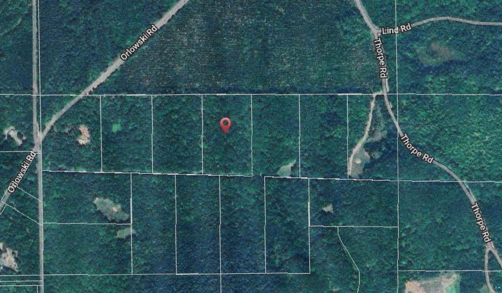
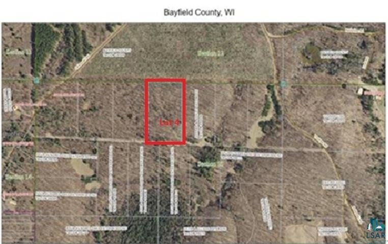
TBD Lot #4 Tressel Trail lot #4 Iron River, WI 54847
For Sale
$63,000
LAND - Iron River, WI
Lot Size5.04 Acres
Days on Market158
Property Features for TBD Lot #4 Tressel Trail lot #4
General Information
Property type
Land
Property subtype
Other
Standard status
Active
Lot size
5.04 Acres
Taxes and HOA fees
Tax Year
2025
Tax Annual Amount
146
Utilities
Utilities
Cable Available
Listing Agency:
RE/MAX Results
(952) 829-2900
Listed By:
Sherri Dehahn
(952) 829-2900
Added: Feb 21
Changed: Jun 10
Last Checked: Jul 29 at 9:06PM
MLS# 6122642
Copyright © 2026 Lake Superior Association of REALTORS®. All rights reserved. All information provided by the listing agent/broker is deemed reliable but is not guaranteed and should be independently verified.
Investment Insights
Based on property information with market context.
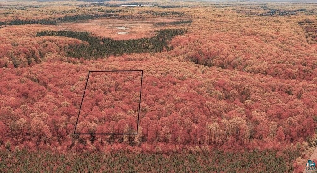
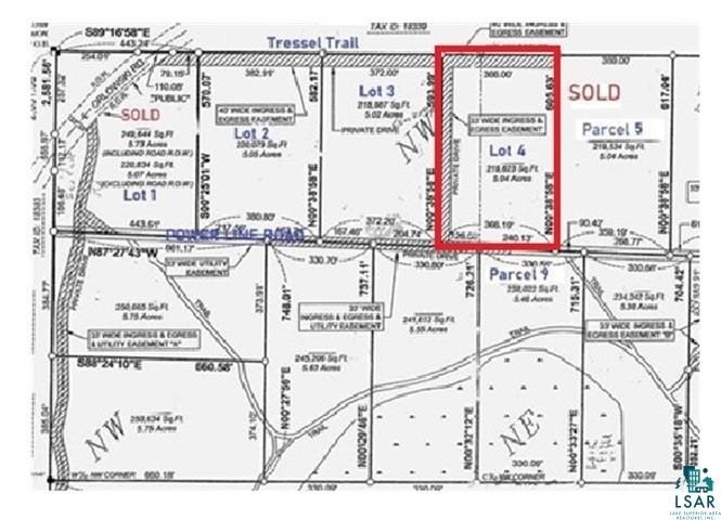
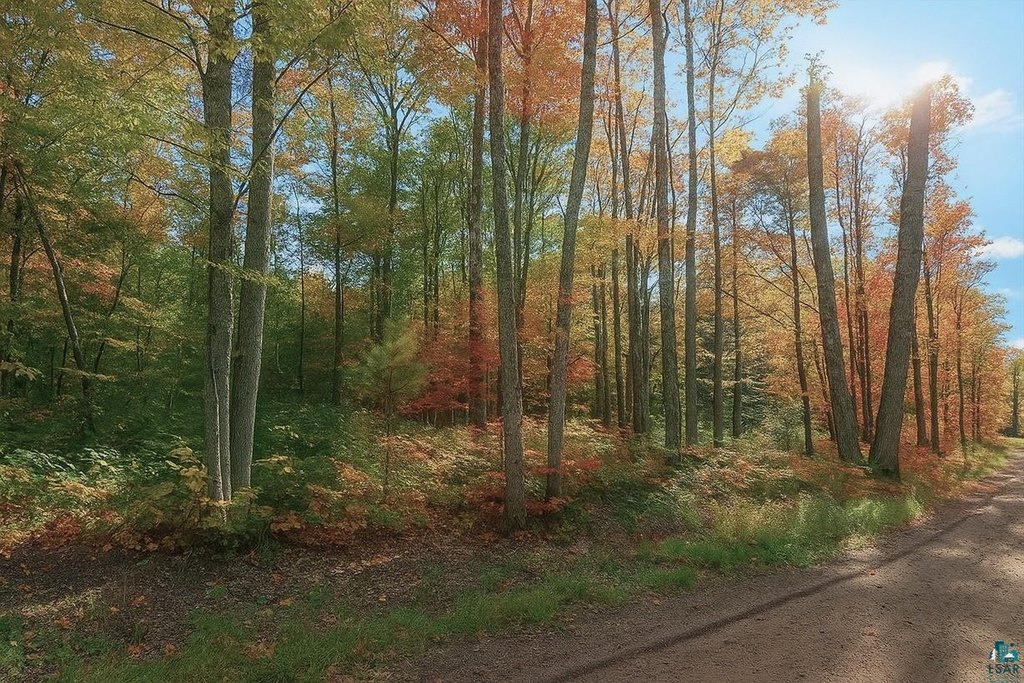
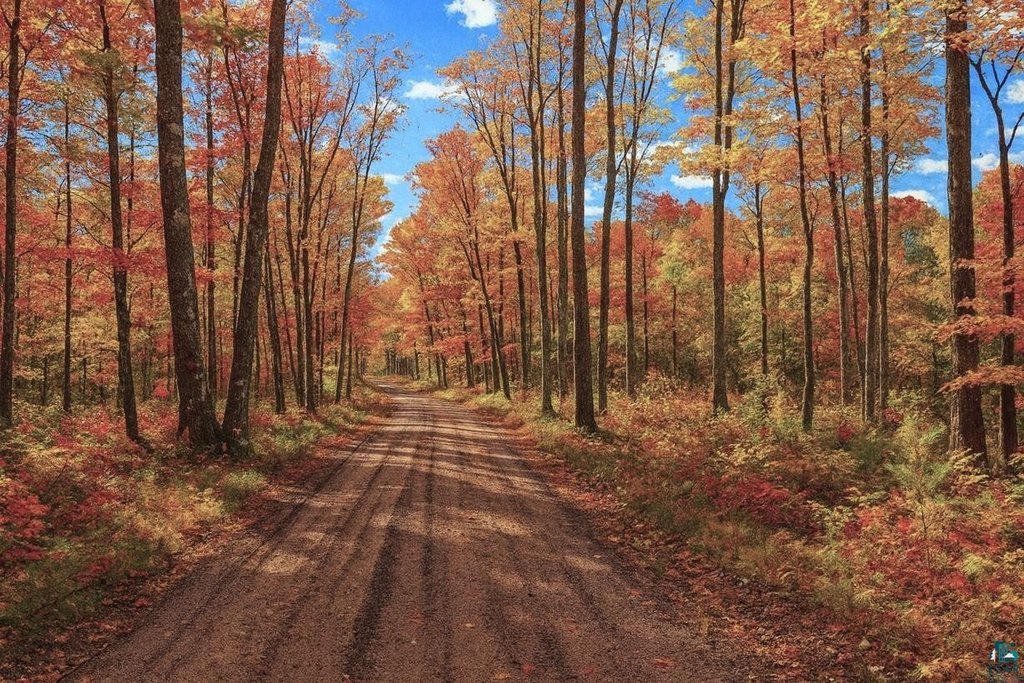
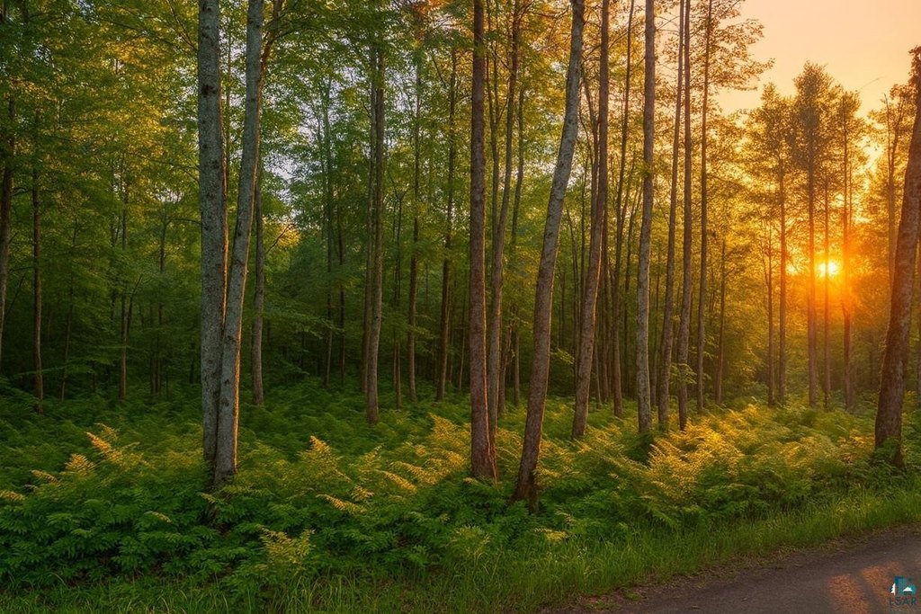
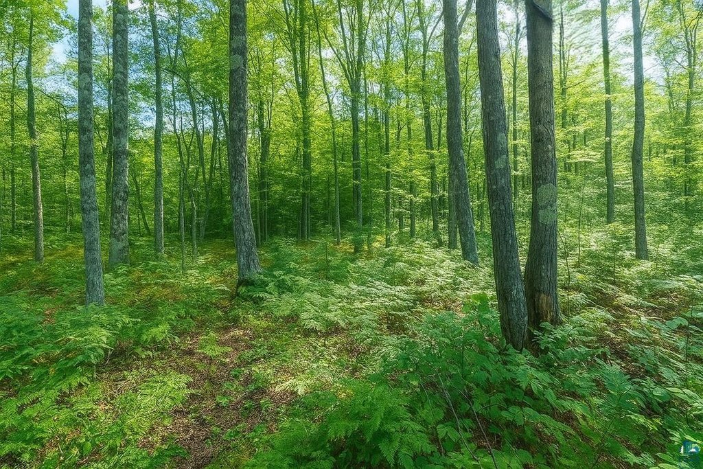
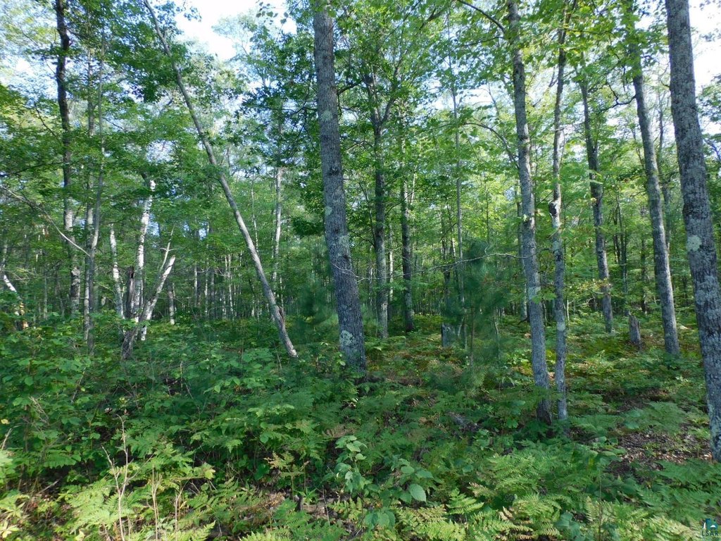
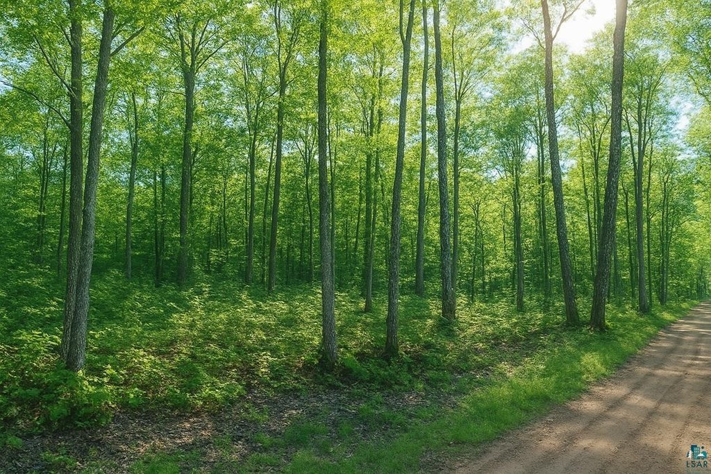
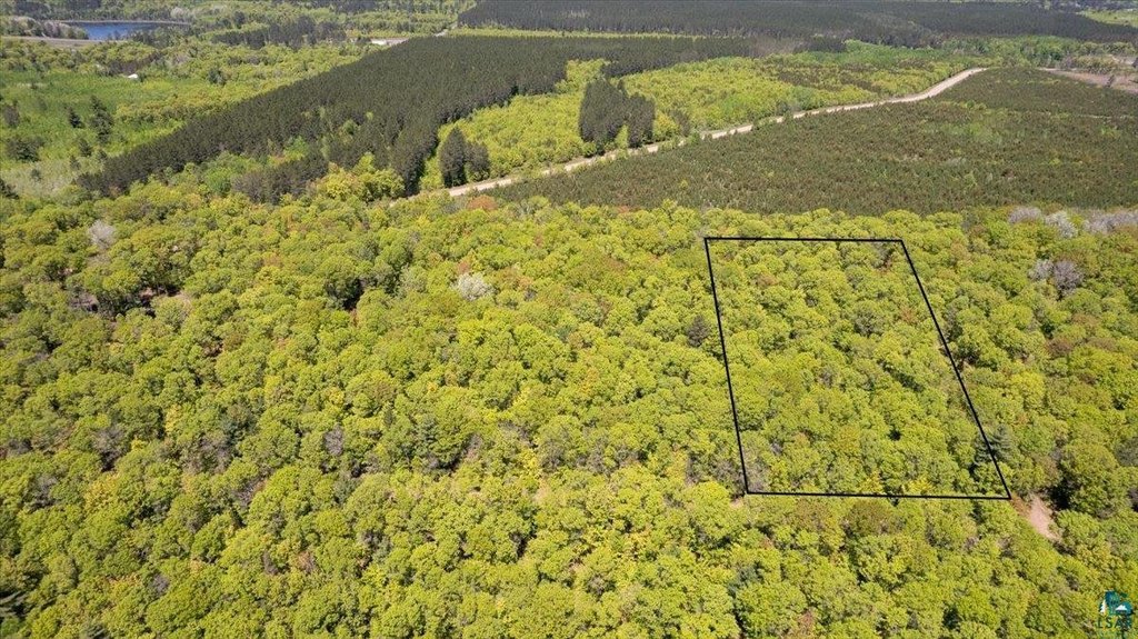
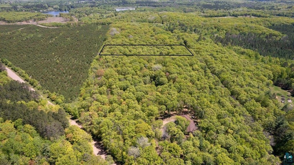
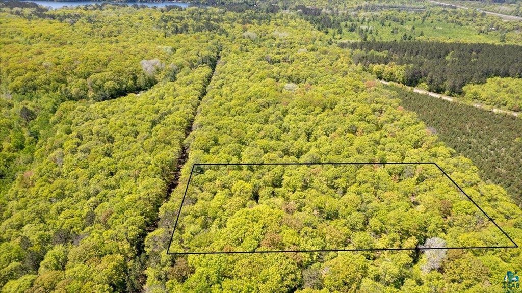
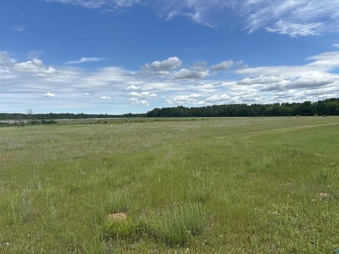
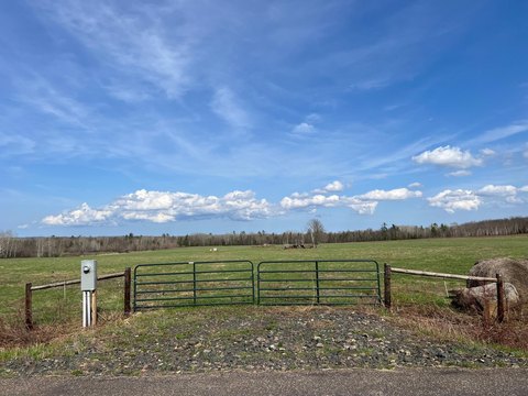
Lot 4 on Tressel Trail is a wooded parcel in the Northwoods with mature oak, maple, birch, ash, and towering pine trees. The property includes marked boundaries with pink flags and orange ribbons indicating an ideal high-ground building site or driveway area. If you’re looking for more room to plan your layout, the remarks note the ability to clear roughly 2 to 3 acres of high ground for a future home or cabin, a pole barn, or a private driveway. The sandy soil is described as making drainage favorable for a conventional septic system, and power is available from Bayfield Electric at the south end of the lot.
For utilities and communications, the seller states fiber optic internet, telephone, and premium TV service are also being brought to the property. The listing further describes direct access to miles of groomed ATV and snowmobile trails, plus nearby public land for hunting, hiking, and wildlife watching. Iron River is referenced as being accessible via Iron Lake Road for canoe or kayak launching.
This lot is a practical fit for buyers seeking a quiet wooded setting with designated building space, conventional septic suitability, and existing power access. It supports a range of uses described in the remarks, including a year-round residence, weekend cabin, or recreational basecamp.
Key Highlights
- Just over 5 acres of Northern Wisconsin wooded land with mature oak, maple, birch, ash, and towering pine trees
- Power is available from Bayfield Electric at the south end of the lot
- Cable available; fiber optic internet, telephone, and premium TV service are being added (Norvado)
Property Analytics
Location Intelligence
Current Use


Frequently Asked Questions
What type of property is this?
Residential land & home lot - A 5-acre wooded lot with power available and high-ground building areas, suited for a home or cabin site.
Where is this residential land & home lot located?
The property is located at TBD Lot #4 Tressel Trail lot #4 Iron River, WI.
What is the asking price?
The asking price for this property is $63,000.
What are key features of this property?
This property features: Just over 5 acres of Northern Wisconsin wooded land with mature oak, maple, birch, ash, and towering pine trees; Power is available from Bayfield Electric at the south end of the lot; Cable available; fiber optic internet, telephone, and premium TV service are being added (Norvado)


