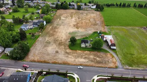
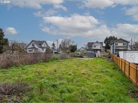
Agricultural Land with Water
For Sale
$2,100,000
37486 S Highway 213, Mount Angel, OR 97362
Eighty acres with fertile silt loam soils, tiling and drainage, and established water rights for productive crop operations.
Lot Size80.00 Acres
Days on Market646
Property Features for 37486 S Highway 213
General Information
Standard status
Active
Lot size
80.00 Acres
Property subtype
Land
Site & Location
Highway Access
Yes
Road Access
Yes
Additional Details
Water Rights
Yes
Listing Agency:
BERKSHIRE HATHAWAY HOMESERVICES R E PROF
(503) 983-4405
Listed By:
MARK SHADRIN · License #201215479
(503) 983-4405
Source:
Exprealty
Added: Oct 23, 2024
Changed: Jul 10
Last Checked: Jul 30 at 4:44PM
Displayed information is deemed reliable but is not guaranteed and should be independently verified. All listing content including descriptions, pricing, images are the copyrighted material of BERKSHIRE HATHAWAY HOMESERVICES R E PROF
Investment Insights
Based on property information with market context.
This offering is a total of 80 acres of agricultural land described as having high-quality, fertile Amity Silt Loam soils. The property is equipped with tiling and drainage systems to support crop production. Water resources are a key component of the parcel, including groundwater and surface water rights established in 1983, with surface water sourced from Butte Creek.
The land is located at 37486 S Highway 213 in Mount Angel, Oregon, and benefits from visibility along Highway 213. That frontage can support business-to-business and business-to-consumer agricultural enterprise use, depending on the operating model. The property’s water base and drainage improvements are intended to make it usable for a range of high-value agricultural crops.
Based on the stated soil quality and available water rights, the property is suited for cultivating high-value crops such as hazelnuts, hops, fruit trees, or nursery plants. There is also the potential to qualify for a dwelling unit, which may allow an operator to establish a home base on the property, subject to applicable requirements. For buyers seeking an agricultural parcel with both production infrastructure and documented water rights, this tract presents a clear foundation for long-term land use planning.
Key Highlights
- 80‑acre farm with high‑quality, fertile Amity silt loam soils for productive crop operations
- Groundwater and surface water rights established in 1983
- Surface water sourced from Butte Creek
Property Analytics
Property Profile
Current Use
Lease Details
Yes
Highway access
Yes
Paved road access
Yes
Water rights
Location Intelligence
Trade Area within ½ mile
8
Businesses Nearby
Explore this area
Business Placement
Demographics for 97362, OR
4,397
Population
1,377
Households
3.2
Avg Household Size
39
Median Age
19%
College-Educated
78%
High-School Grad
23.4 sq mi
ZIP Area
188
Density / Sq Mi
$62,813
Median Household Income
$37,177
Median Earnings
$1,199
Median Rent
$420,400
Median Home Value

Questions? Ask Rey
Realmo’s AI knows this listing — price, zoning, demand, history. Ask anything.


Frequently Asked Questions
What type of property is this?
Agricultural land / Farmland - Eighty acres with fertile silt loam soils, tiling and drainage, and established water rights for productive crop operations.
Where is this agricultural land / farmland located?
The property is located at 37486 S Highway 213 Mount Angel, OR.
What is the asking price?
The asking price for this property is $2,100,000.
What are key features of this property?
This property features: 80‑acre farm with high‑quality, fertile Amity silt loam soils for productive crop operations; Groundwater and surface water rights established in 1983; Surface water sourced from Butte Creek