Property summary
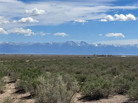
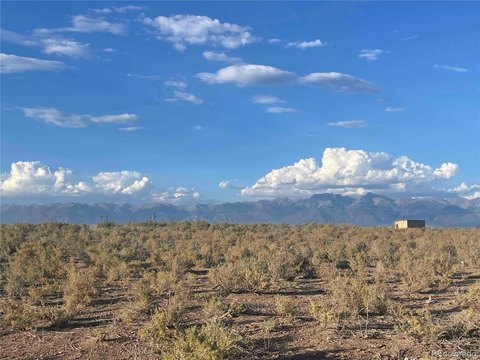
Under $900 an acre. Prime location. Legal access secured. Electricity at the road. This is the most affordable entry point into one of the San Luis Valley's most desirable land corridors — and it's priced to move! This 40-acre parcel is the SW corner of a larger 160-acre property that includes a free-flowing artesian well. We're offering this corner separately to create a lower $$$ entry point for buyers who want a foothold in this valley without the commitment of a larger purchase. What makes this different from other similarly priced 40-acre parcels in Saguache County is the certainty behind it. We've done the due diligence, all documentation is in order, legal access deeded and recorded at closing, and electricity is at the road. It is rare to find that combination at this price point. Most 40-acre parcels priced under $40K come with question marks — either difficult to reach, informal access, or utilities miles away. This parcel offers the peace of mind that comes from buying a property that's been properly prepared for sale...yet retains the ability to become a landowner affordably at one of Colorado's most sought-after landscapes! - Access is guaranteed, documented via deed at closing, and permanent. - Access is guaranteed, documented via deed at closing, and permanent - Borders BLM land to the south. - Borders BLM land to the south - Ready to build, flat, usable acreage. - Ready to build, flat, usable acreage - No HOA. No covenants. No covenants - Views of the Sangre de Cristo mountain range to the east and the San Juans to the west. - Views of the Sangre de Cristo mountain range to the east and the San Juans to the west - Some of the best stargazing in Colorado with Bortle Class 2 Dark Skies - Direct views of the Great Sand Dunes National Park. Wells in the nearby area reach water at just 80–90 feet with yields around 25 GPM. This makes it very affordable to drill (around $10K). Septic system runs around $15K to $20K with design. Local company Naturalia Construction (naturaliaconstruction.com) is owned by listing agent and can help coordinate infrastructure installation (septic, well, driveway), provide construction services, or guide you in the right direction free of cost! Zoning: Residential PSF Lot: $0 Lot Features: Borders Public Land, Level, Near Ski Area, Open Space, Subdividable, Suitable For Grazing Lot Size Acres: 40.00 Property Exclusions: N/A Waterfront Features: Pond, Stream Zoning Jurisdiction: County High School District: Mountain Valley RE 1 Lot Size Square Feet: 1742400 Accessibility Features: Level, Abuts Pond/Lake, Abuts Stream/Creek/River, Abuts Public Open Space Elementary School District: Mountain Valley RE 1 Middle Or Junior School District: Mountain Valley RE 1
Property profile
VerifiedCap rate & NOI
Location
Value estimations
Owner & transaction history
Comparables
6 recent transactions · within 1.5 miComparable in this City




Similar Nearby for Sale

Value estimation
Instant AI valuation built from comps, income signals, and proprietary benchmarks. A defensible range, not a single guess.
from $99/month
Cap rate
Cap rate calculated from real income and expense signals, benchmarked against sales of similar assets nearby.
from $99/month
Property description
Physical attributes from public recordsZoning & alternative use
Zoning
The recorded zoning designation, what the district officially allows, and the municipal source it comes from.
No zoning code is on file for this parcel. Zoning coverage grows with every catalog release — check back, or open Location Intelligence for use analysis of this corner.
Find the owner behind the property.
Unlock the evidence behind ownership: portfolio, transactions, debt and signals that help you decide who to contact next.
Registration is required before any owner information is shown.
- Full Property Data
- Historical Records
- Value Estimation
- NOI Potential
- Cap Rate Calculation
- Ownership
- Location Insight
- Alternative use
- Local Zoning Insight
Cancel anytime.
- 30 reports a month
- Location Analytics
- Market Trends
- Full Property Data
- Historical Records
- Value Estimation
- NOI Potential
- Cap Rate Calculation
- Ownership
- Location Insight
- Alternative use
- Local Zoning Insight
Cancel anytime.
- 300 reports a month
- Location Analytics
- Market Trends
- Full Property Data
- Historical Records
- Value Estimation
- NOI Potential
- Cap Rate Calculation
- Ownership
- Location Insight
- Alternative use
- Local Zoning Insight
and get 1 Light Report
- Property Information
- Historical Records
- Value Estimation
- NOI Potential
- Cap Rate Potential
- Location Insight
- Alternative use
- Local Zoning Insight


