329 C Street, West Sacramento, CA 95605
Four contiguous infill parcels with C Street frontage and Mixed-use Neighborhood Commercial zoning under a Planned Development Overlay.
- Added:
- May 13, 2026
- Days on Market:
- 44
- Last Refresh:
- Jun 24 at 4:57 am
Property Features for 329 C Street
General Information
- Standard status
- Active
- Lot size
- 0.60 Acres
- Property subtype
- Commercial/Industrial

Listing office Ken Turton, Broker (916) 710-0753
Listing date May 13, 2026
Source Exitrealty
Displayed information is deemed reliable but is not guaranteed and should be independently verified.
All listing content including descriptions, pricing, images are the copyrighted material of Ken Turton, Broker
HighLights
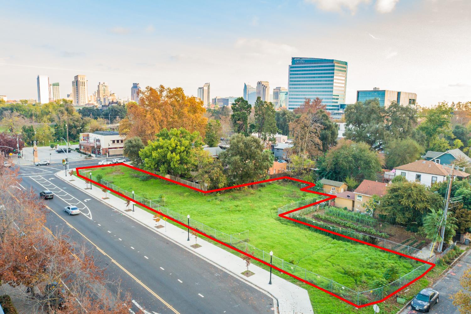
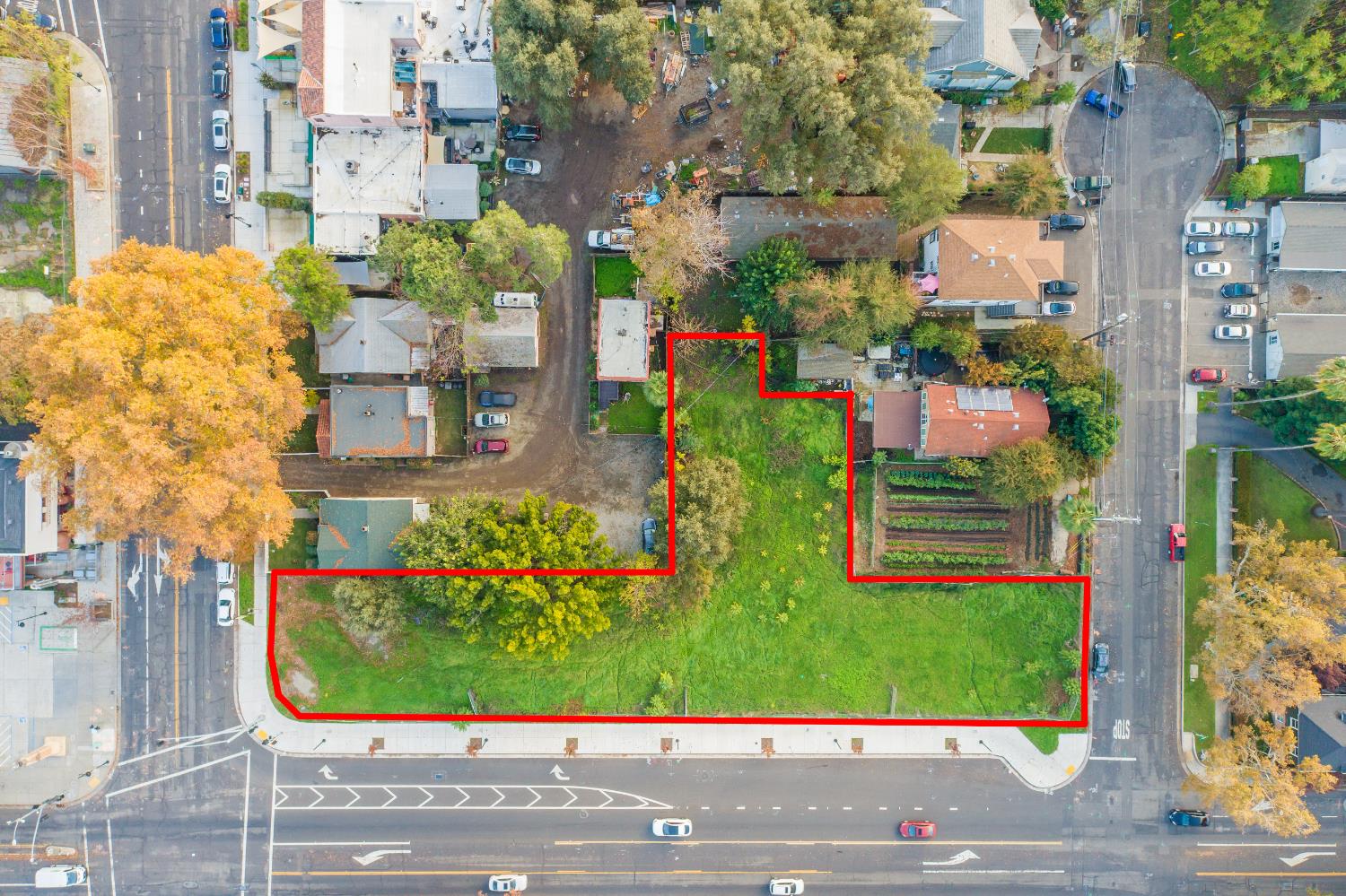
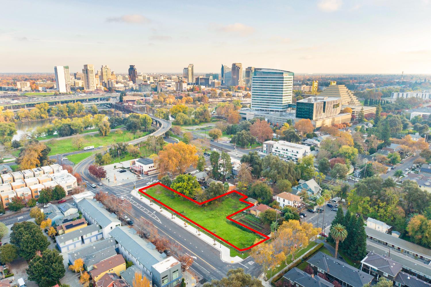
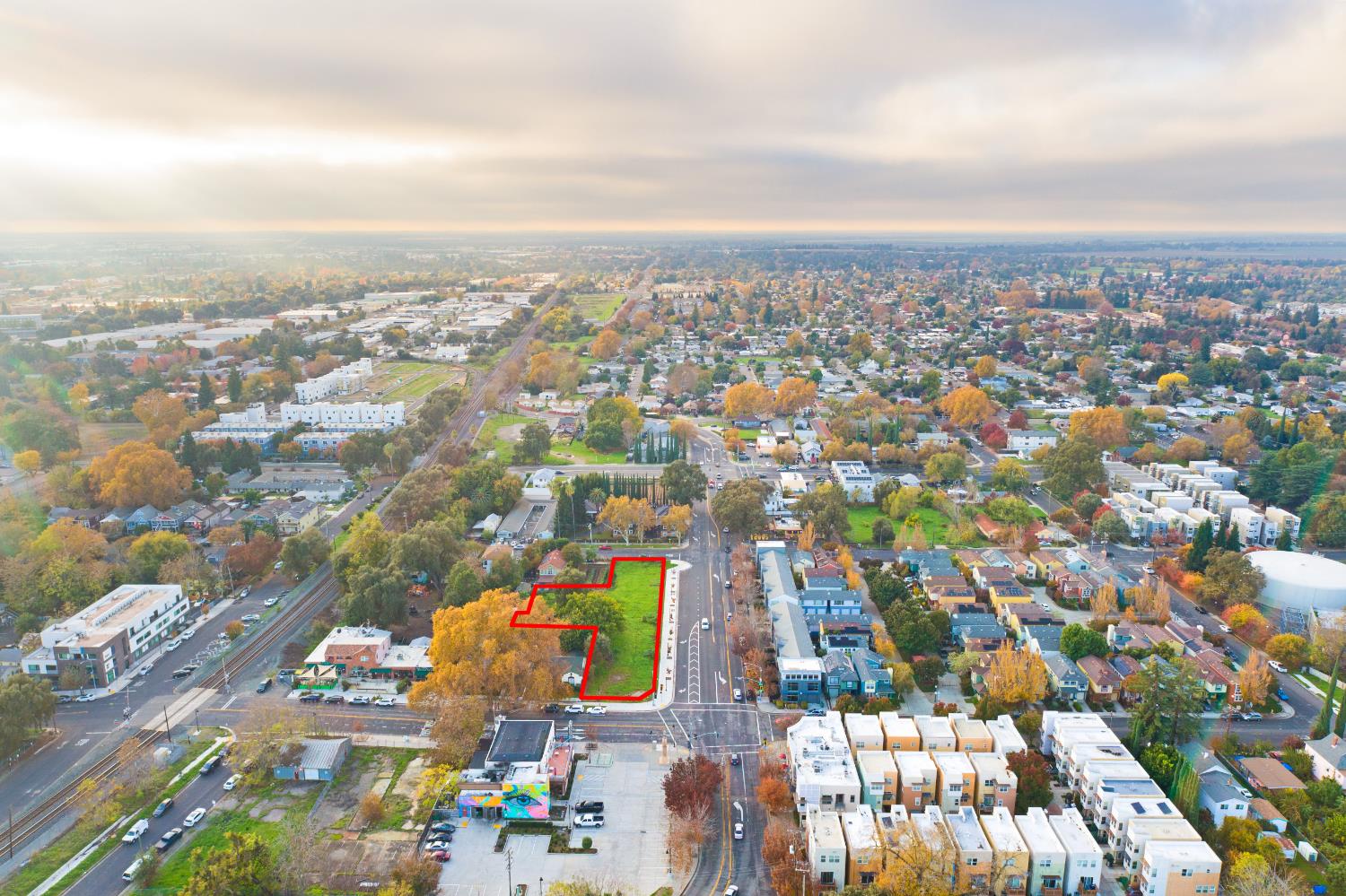
- 0.60‑acre (26,136 SF) C Street infill assemblage with four contiguous parcels
- Approximately 325 linear feet of frontage along C Street in West Sacramento's Washington District
- Zoned Mixed‑use Neighborhood Commercial with a Planned Development Overlay supporting residential and commercial uses by right
- Zoning can accommodate up to 18 three‑story townhomes or a larger mixed‑use project with upwards of 40 units
- City variance referenced as allowing potential development of 100+ units
- Sidewalk and curb infrastructure added along C Street in 2024
Overview
Located in the West Sacramento Washington District, the site is just block from the entrance to the new I Street Bridge that will connect the River District and Railyards to West Sacramento. The offering sits within the Bridge District. The planned River Walk Trail is about 1.5 blocks away, linking parks, local restaurants, and other riverfront destinations. The property is also within the Bridge District area associated with the Oakland A’s temporary relocation to Sutter Health Park, with attention directed through at least 2027.
Development planning under the current zoning supports a smaller residential project with up to 18 three-story townhomes and also accommodates a larger mixed-use project with upwards of 40 units. With a variance from the city, the remarks indicate it may be plausible to construct a 100+ unit project. The Planned Development Overlay is described as supporting a variety of residential and commercial uses by right, subject to city requirements.
Current Use by Public Records
Location Insight
- Map
- Local Demand
- City
- West Sacramento
- County
- Yolo
- State
- California
- Longitude
- -121.5111806
- Latitude
- 38.5883665