
315 Forest Service Road, Crystal, CO 81623
- Added:
- Dec 23, 2023
- Days on Market:
- 906
- Last Refresh:
- Jun 16 at 10:06 pm
Property Features for 315 Forest Service Road
General Information
- Property type
- Land
- Property subtype
- Other
- Standard status
- Active
- APN
- 2915-270-00-016
- Lot size
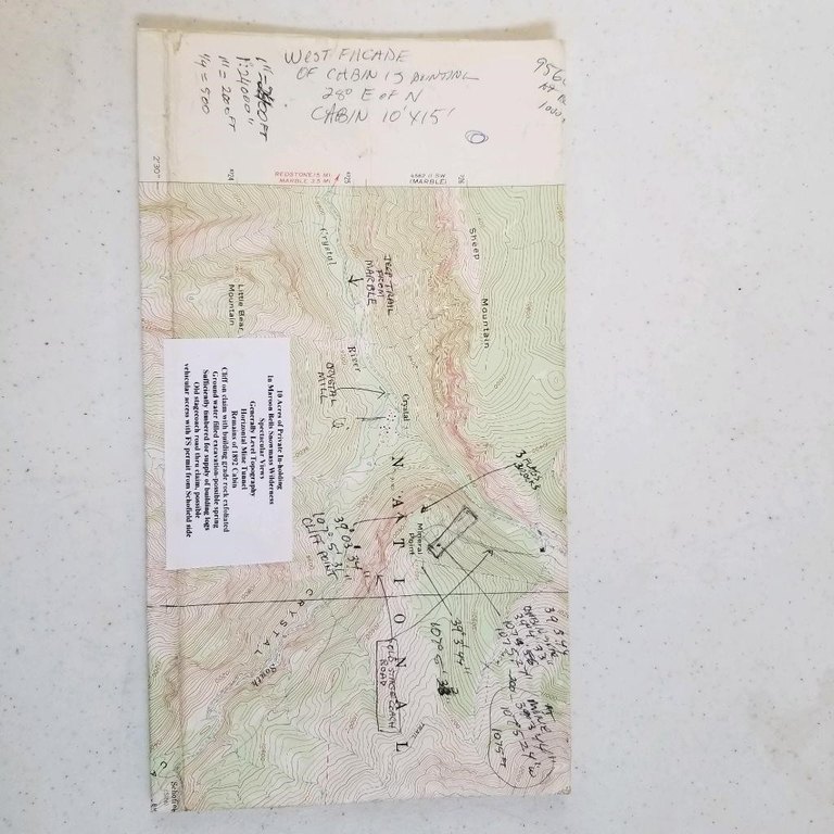
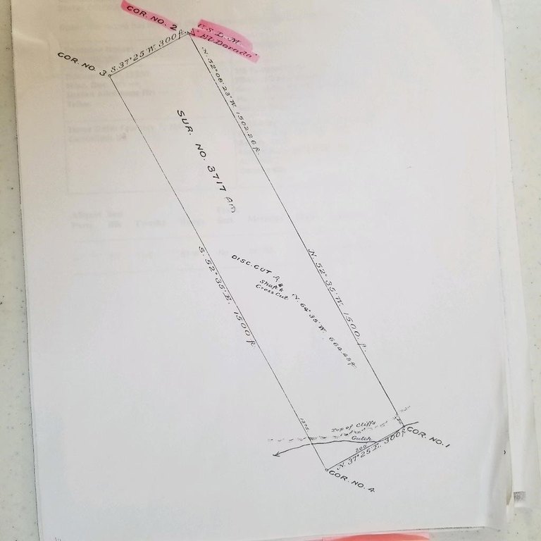
- 10.33 Acres
Taxes and HOA fees
- Tax Year
- 2022
- Tax Annual Amount
- 384
Listing agent Marie Ramstetter License #EI96401 (970) 245-0769
Listing office PAVLAKIS REALTY WEST,LLC 929 MAIN, GRAND JUNCTION, CO (970) 245-0769
Listing date Dec 23, 2023
Copyright © 2026 Grand Junction Area Association of Realtors. All rights reserved. All information provided by the listing agent/broker is deemed reliable but is not guaranteed and should be independently verified.
HighLights
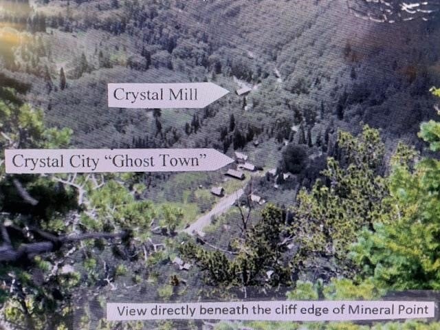
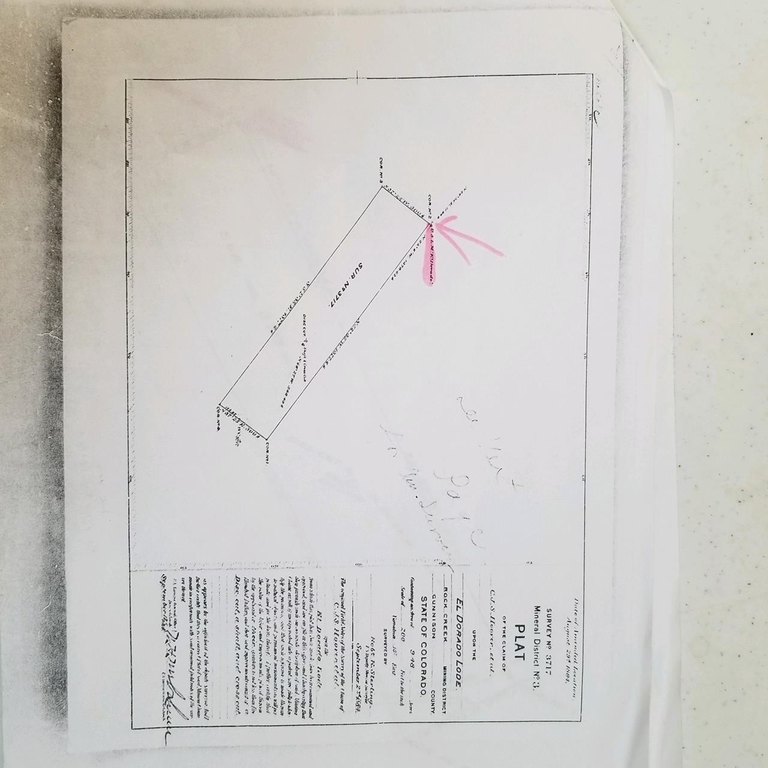
- Rare patented mining claim within the Maroon Bells/Snowmass Wilderness.
- Strategically situated for potential cable‑car gondola access from Crystal City to the top of Mineral Point.
- Proximity to the historic Crystal Mill and Crystal City, undergoing high‑end resort development.
- 10.3 acres of mostly level ground with views overlooking Crystal City and surrounding wilderness.
- Access to wilderness trails for trekking, llama trekking, or horseback riding.
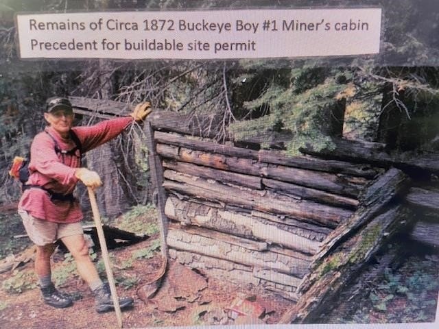
- Features remnants of the original log miners' cabin and a 30 ft tunnel into the quartz cliff.
Overview
Access is limited to a single-wide wilderness trail, passing waterfalls and mine tunnel portals. The claim sits within an in-holding context in the Maroon Bells/Snowmass Wilderness, and the old stagecoach trail runs through the Buckeye Boy No. 1 claim area described in the remarks.
The layout and setting make this a compelling fit for buyers looking for a private backcountry parcel where views and seclusion are part of the value proposition. The remarks also note the claim’s strategic position to support a potential cable-car gondola concept connecting Crystal City to the top of Mineral Point, as well as the ability to support guest trekking or private horseback riding without requiring a backcountry outfitter’s permit, depending on the operator’s plan.
Current Use by Public Records
Map
- City
- Crystal
- County
- Garfield
- State
- Colorado
- Longitude
- -107.1139212
- Latitude
- 39.0532368


