Ozarks Recreational


For Sale
$47,500
229 Mayapple Road, Harriet, AR 72639
Land, Harriet, AR
Property SizeContact for details
Lot Size7.51 Acres
Days on Market350
Property Features for 229 Mayapple Road
General Information
Property type
Land
Property subtype
Other
Vegetation
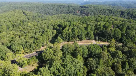
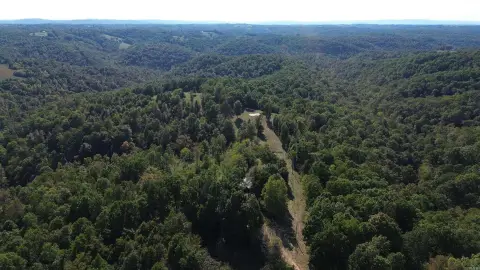
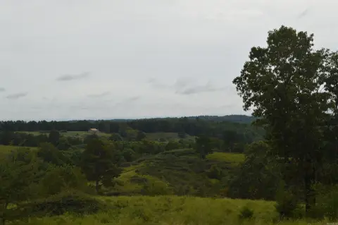
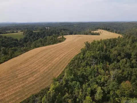
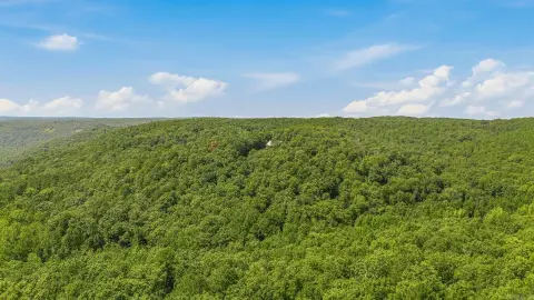
Wooded
Lot features
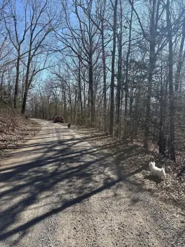
Dead End, Hardwood Trees, Mobile Home Allowed, Not In Subdivision, Outside City Limits, Recreational, Rural Lot, Level, Wooded
Elementary school district
SearcyCounty
Middle school district
SearcyCounty
High school district
SearcyCounty
Directions
From Harriet, AR take Hwy 14 N and turn L on Spring Creek Rd. Turn R on Mayapple. Property is in the fork of the road where Wrinkle Road veers R from Mayapple.
Standard status
Active
APN
001-03420-004
Lot size
7.51 Acres
Taxes and HOA fees
Tax Description
Pt W 1/2 SW NW 15-16-15
Tax Annual Amount
10
Legal Description
Pt W 1/2 SW NW 15-16-15
Utilities
Sewer type
Septic Needed
Water source
Well Needed
Listing Agency:
Goodman Realty
(870) 448-2391
Listed By:
Randy McCallister · License #PB00074974
(870) 448-6444
Added: Nov 6, 2025
Changed: Sep 7
Last Checked: Oct 22 at 5:06AM
MLS# 1327835
Copyright © 2026 ArkansasONE MLS. All rights reserved. All information provided by the listing agent/broker is deemed reliable but is not guaranteed and should be independently verified.

Ask AI about this property
Review the available facts, identify missing information and prepare questions for the agent.
Investment Insights
Based on property information with market context.
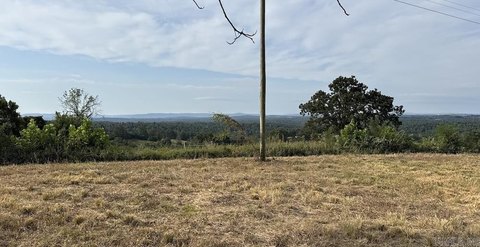
This 7.51-acre land tract in the Ozarks Mountains is mostly level with some slope and includes multiple level areas suitable for a cabin, house, or travel trailer. The property sits at the end of Mayapple Road and offers a rural setting near the Buffalo National River boundary.
The tract is 0.25 miles from the boundary line and 1.75 miles from the river’s edge, where a canoe and kayak launch site provides access for floating, swimming, and fishing. Electric lines are nearby, subject to permission to connect to a neighboring power pole. A private well and septic system would be needed.
The tract is 0.25 miles from the boundary line and 1.75 miles from the river’s edge, where a canoe and kayak launch site provides access for floating, swimming, and fishing. Electric lines are nearby, subject to permission to connect to a neighboring power pole. A private well and septic system would be needed.
Key Highlights
- 7.51‑acre tract in the Ozarks Mountains
- 0.25 miles from the Buffalo National River boundary
- 1.75 miles to the river’s edge and a canoe/kayak launch site
Property Analytics
Contact the owner directly
Get the owner's phone numbers and email
Open Analytics
Location Intelligence
Trade Area within ½ mile
1
Businesses Nearby
Explore this area
Business Placement
Demographics for 72639, AR
572
Population
405
Households
1.4
Avg Household Size
52
Median Age
5%
College-Educated
72%
High-School Grad
68.9 sq mi
ZIP Area
8
Density / Sq Mi
$51,908
Median Household Income
$29,688
Median Earnings
$127,200
Median Home Value
Check the figures for this property
Cap Rate, Value Estimation, Potential NOI and more
View Realmo Analytics





Frequently Asked Questions
What type of property is this?
Land - Mostly level wooded acreage near the Buffalo National River offers space for a cabin, house, or travel trailer.
Where is this land located?
The property is located at 229 Mayapple Road Harriet, AR.
What is the asking price?
The asking price for this property is $47,500.
What are key features of this property?
This property features: 7.51‑acre tract in the Ozarks Mountains; 0.25 miles from the Buffalo National River boundary; 1.75 miles to the river’s edge and a canoe/kayak launch site