213 ac M/L Highway 78 Dr, Palo Verde, CA 92283
- Added:
- May 5, 2025
- Days on Market:
- 406
- Last Refresh:
- Jun 14 at 7:06 pm
Property Features for 213 ac M/L Highway 78 Dr
General Information
- Property type
- Land
- Property subtype
- Other
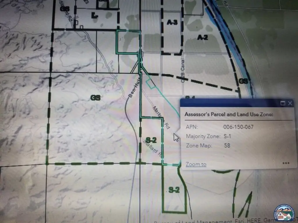
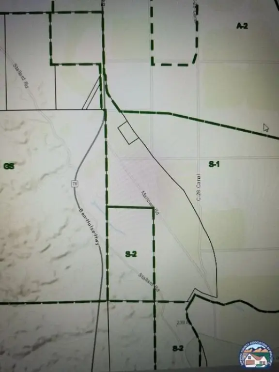
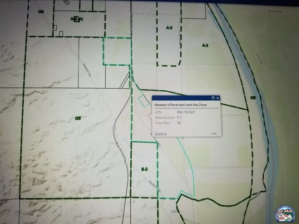
- Zoning
- S1
- Standard status
- Active
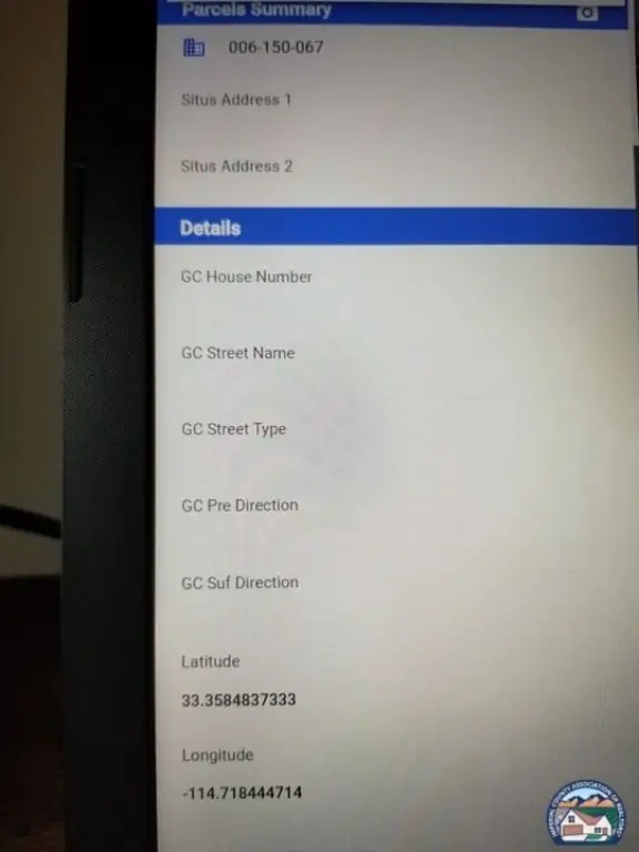
- APN
- 006-150-067-000
- Lot size
- 213.75 Acres
Taxes and HOA fees
- Tax Description
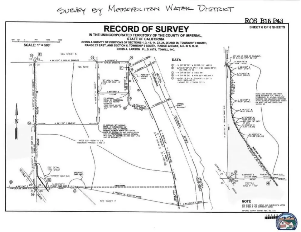
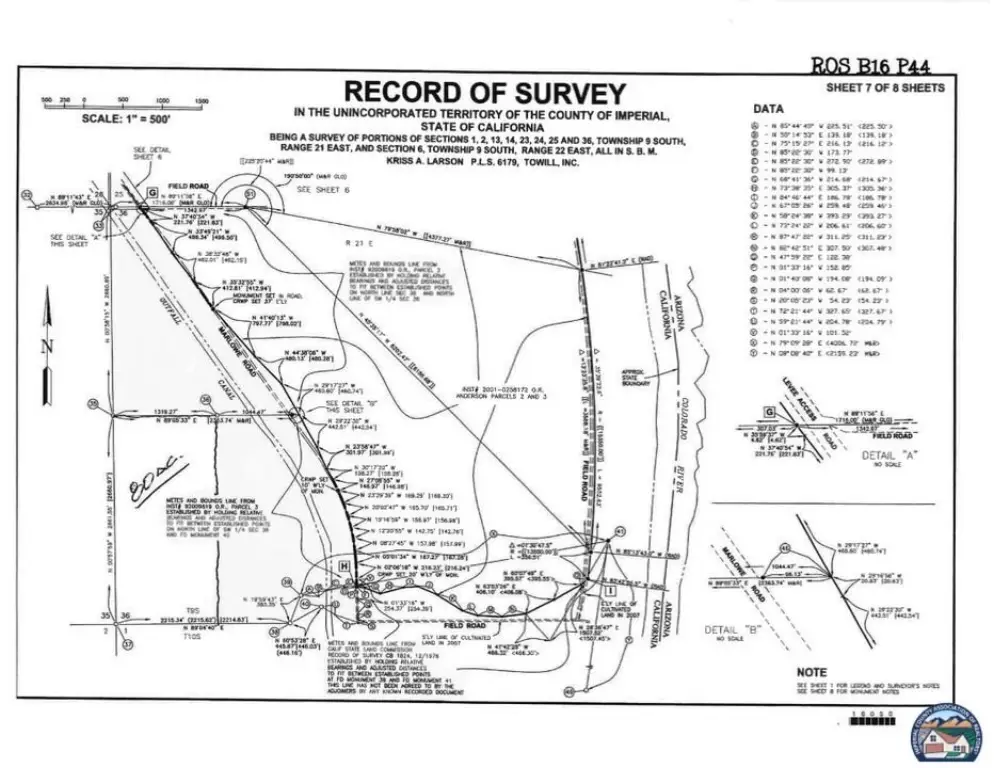
- APN 006-150-067-000. 213.75 ac M/L Por Sec 25, 26 & 36 T 9 S, R 21 E

Listing agent Michelle Gold License #01042978 (760) 285-6271
Listing office Desert Gold Properties Inc. 32742 Lamtarra Loop, Menifee, CA (760) 285-6271
Listing date May 5, 2025
Copyright © 2026 Imperial County Association of Realtors®. All rights reserved. All information provided by the listing agent/broker is deemed reliable but is not guaranteed and should be independently verified.
HighLights
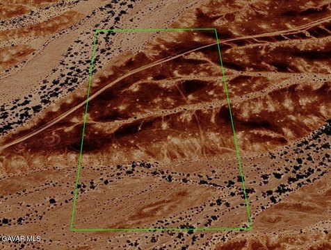
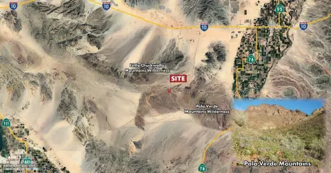
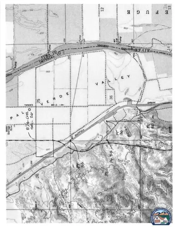
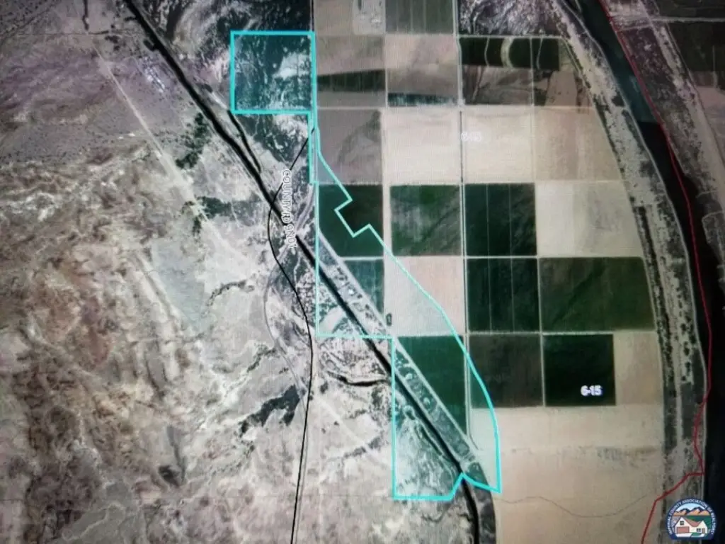
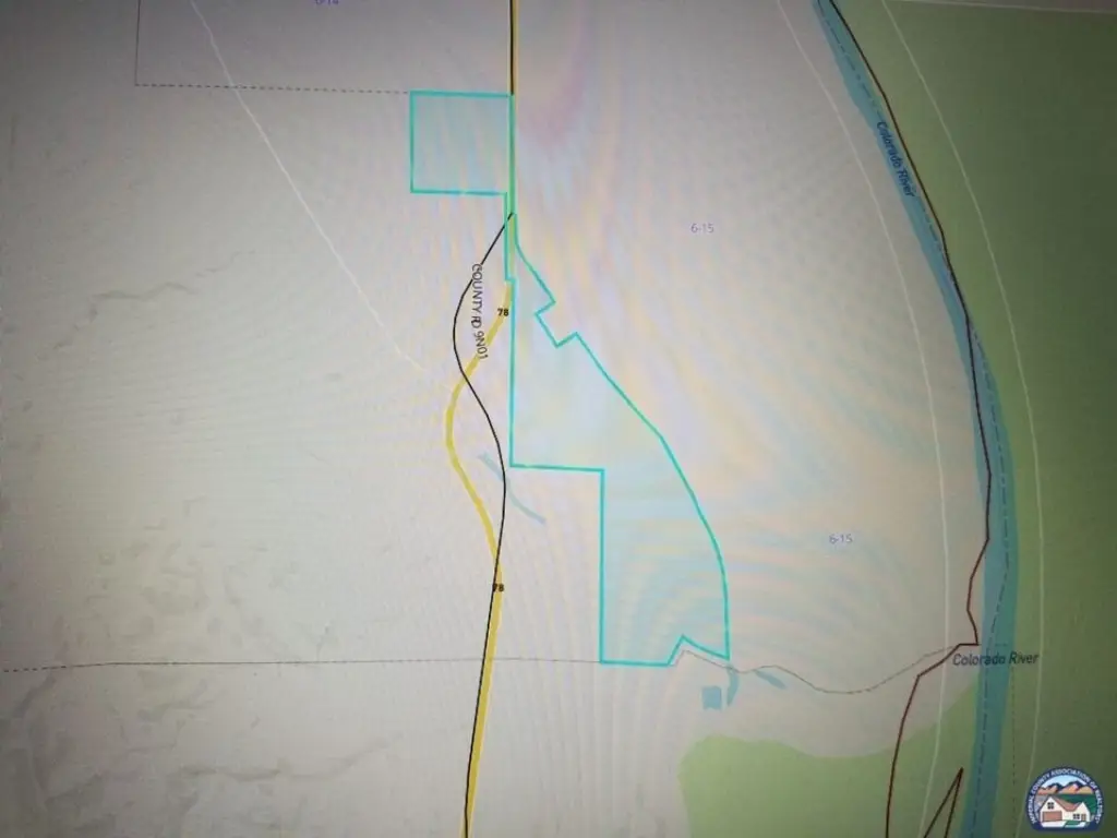
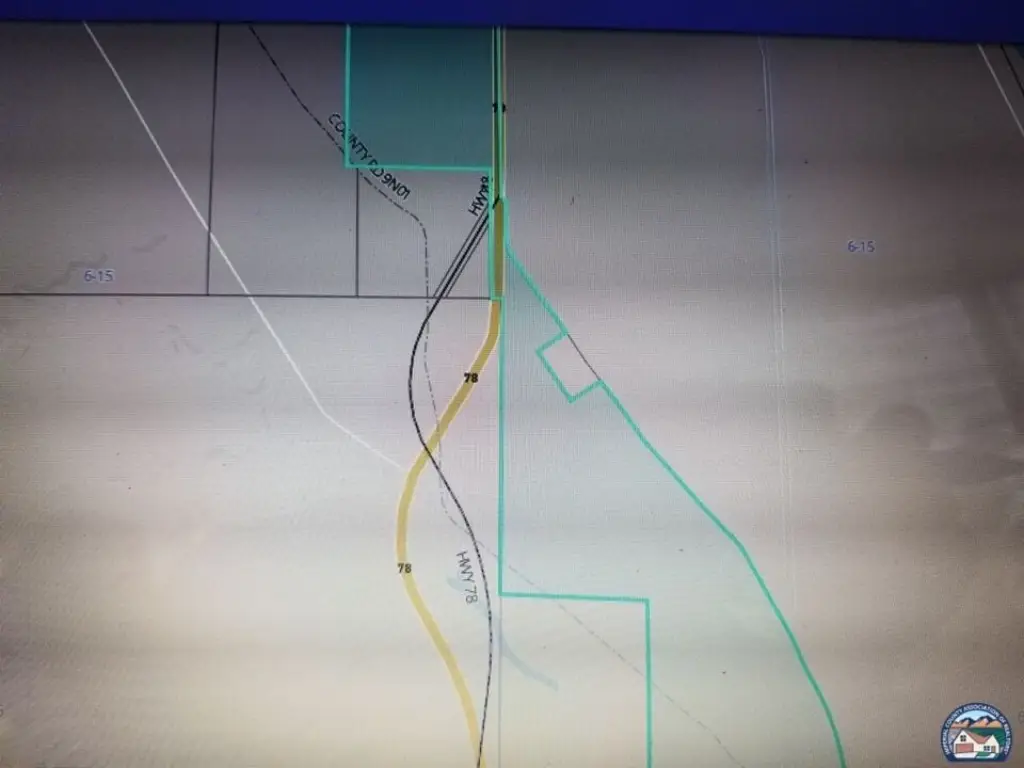
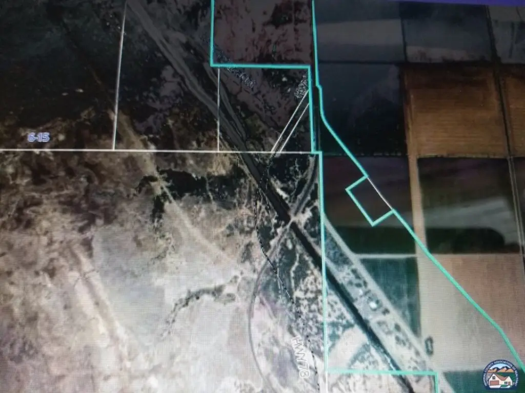
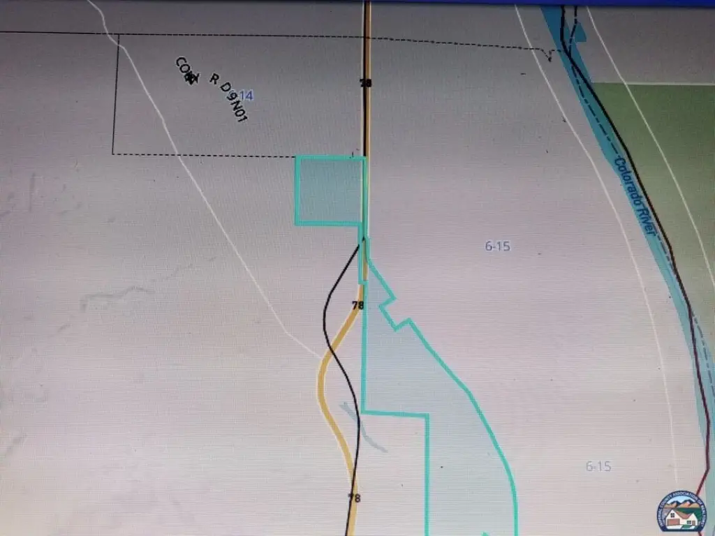
- 213.75± acres in Palo Verde, CA, located off Highway 78 just before the town of Palo Verde
- Zoned S‑1 (Imperial County); many potential uses listed, including crops/tree farming, duck clubs, fish farms, and animal grazing
- Property allows additional uses such as gun clubs, harvesting of wild crops, mobile home/RV park, residence, and solar energy extraction
- Close to water and the Palo Verde Lagoon
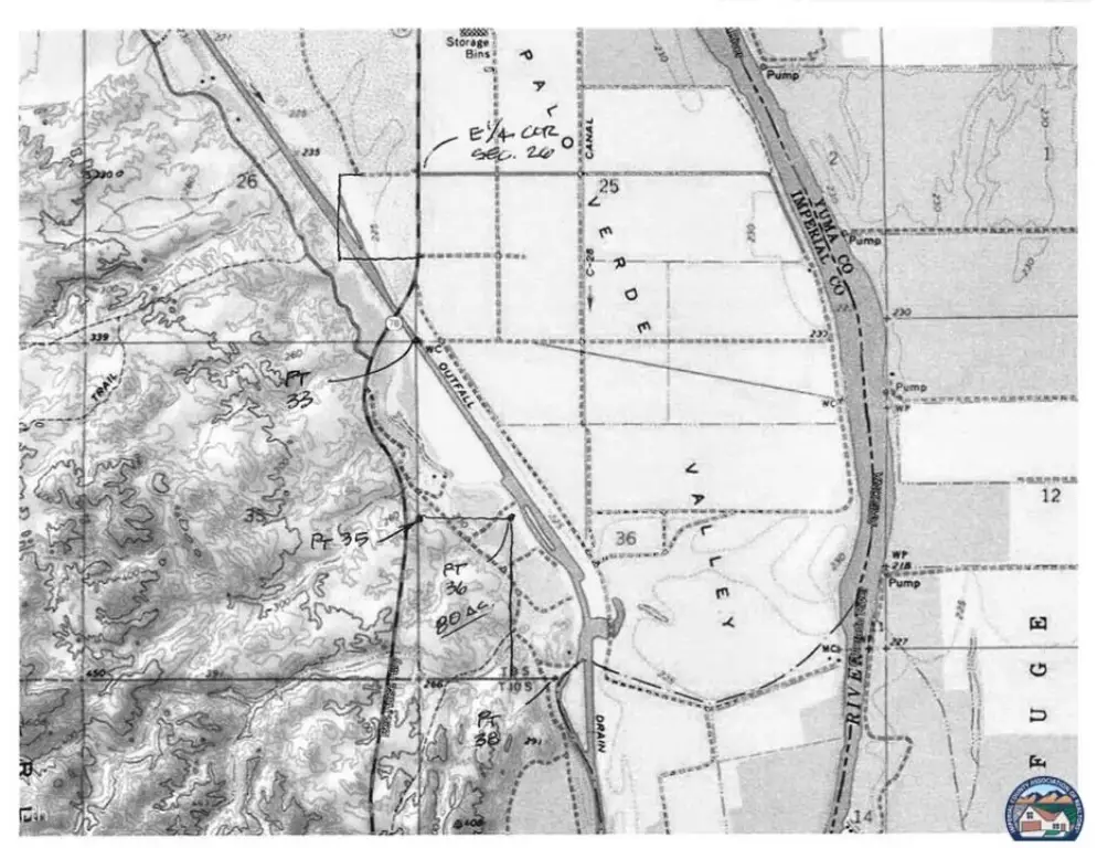
- APN 006‑150‑067; assessor map is not correct—refer to survey maps and photos
Overview
The property is described as being located off Highway 78 just before the town of Palo Verde. The listing also states the land is close to water and the Palo Verde Lagoon. The provided APN is 006-150-067.
This parcel may fit buyers looking for flexible, land-based operations within an S-1 zoning framework, whether for agricultural use, recreational clubs, habitation options such as an RV park or residence, or solar-related extraction. As emphasized in the remarks, prospective buyers should perform their own due diligence to confirm boundaries, details shown in maps, and the applicability of zoning descriptions for the intended use.
Current Use by Public Records
Map
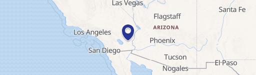
- City
- Palo Verde
- County
- Imperial
- State
- California
- Longitude
- -114.73166
- Latitude
- 33.429683