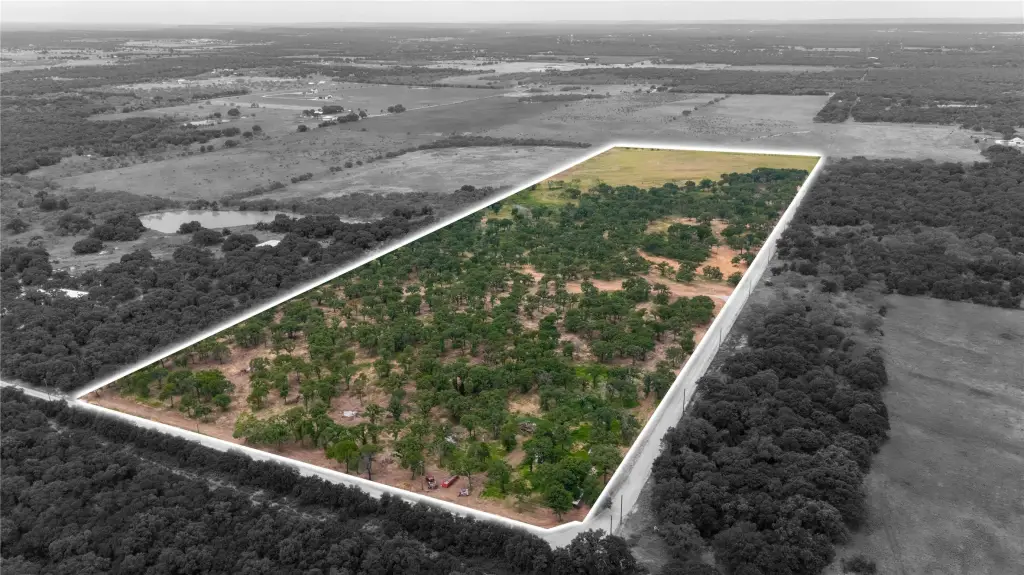
10-Acre Fenced Farmland

For Sale
$250,000
TBD- Tract 2 Quiet Oak Trail, Mineral Wells, TX 76067
LAND - Other - Mineral Wells, TX
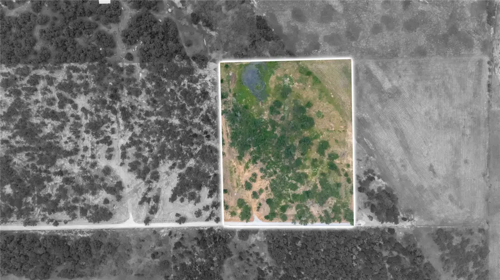
Lot Size10.00 Acres
Days on Market50
Property Features for TBD- Tract 2 Quiet Oak Trail
General Information
Property type
Land
Property subtype
Other
Zoning description
residential agriculture
Vegetation
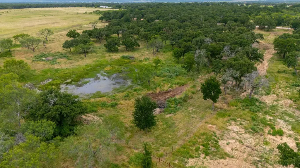
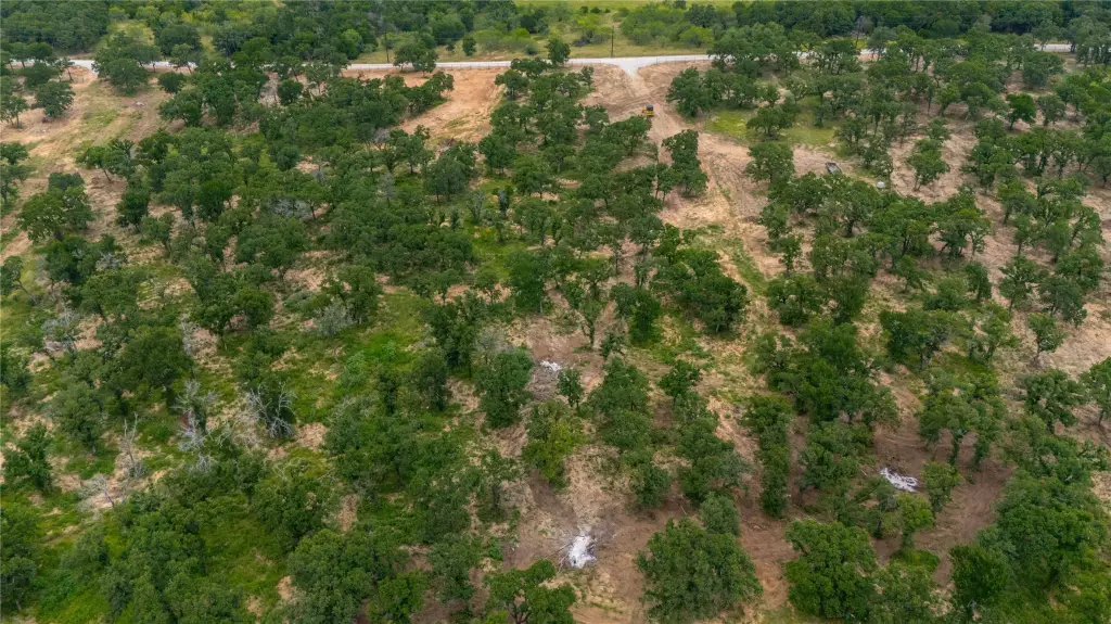
Grassed, Brush, Wooded, Cleared
Fencing
Fenced
Lot features
Acreage, Agricultural, Cleared, Hardwood Trees, Level, Pasture, Many Trees, Few Trees
Elementary school
Perrin
Middle school
Perrin
High school
Perrin
Elementary school district
Perrin-Whitt Cons ISD
Middle school district
Perrin-Whitt Cons ISD
High school district
Perrin-Whitt Cons ISD
Directions
from Weatherford take 180 towards mineral wells, take right on N 113, then take left on 1885. then left on Rock Creek Rd. at corner go straight property up on right ( gps to 1223 Rock Creek Rd Mineral Wells, Tx 76067 ) that is the start of Quiet Oak Trail go down this lot is the second entrance
Standard status
Active
APN
R000052960
Lot size
10.00 Acres
Building Details
Architectural style
Other
Listing Agency:
Real Broker, LLC
(855) 450-0442
Listed By:
Joy Townsend · License #0747195
(855) 450-0442
Added: Jun 13
Changed: Jul 31
Last Checked: Aug 1 at 9:06AM
MLS# 21300304
Copyright © 2026 North Texas Real Estate Information Systems, Inc. All rights reserved. All information provided by the listing agent/broker is deemed reliable but is not guaranteed and should be independently verified.
Investment Insights
Based on property information with market context.
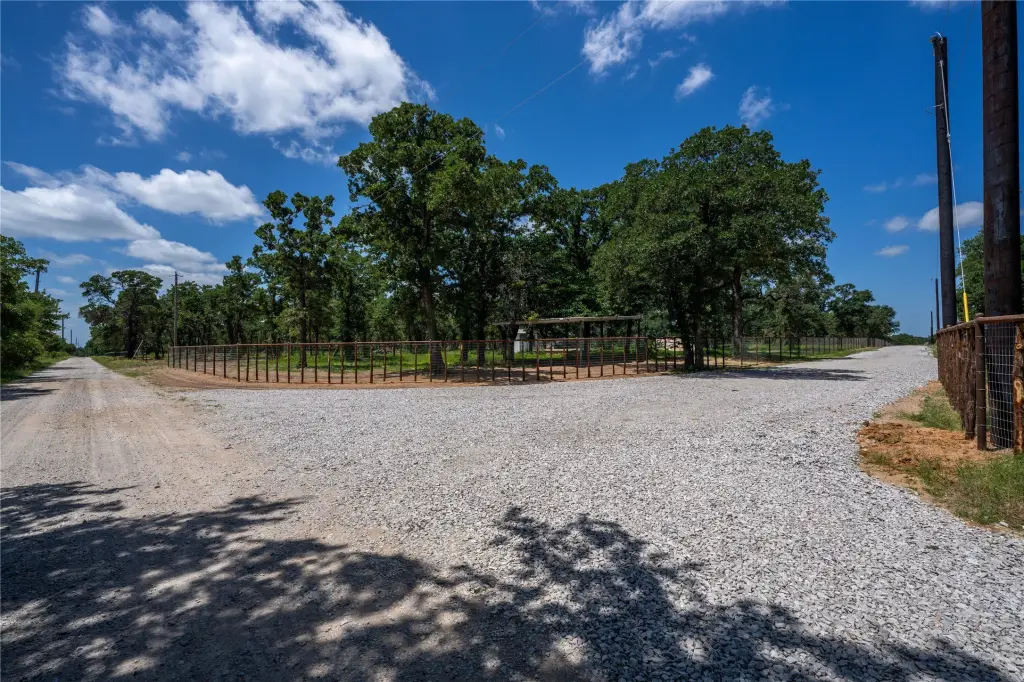
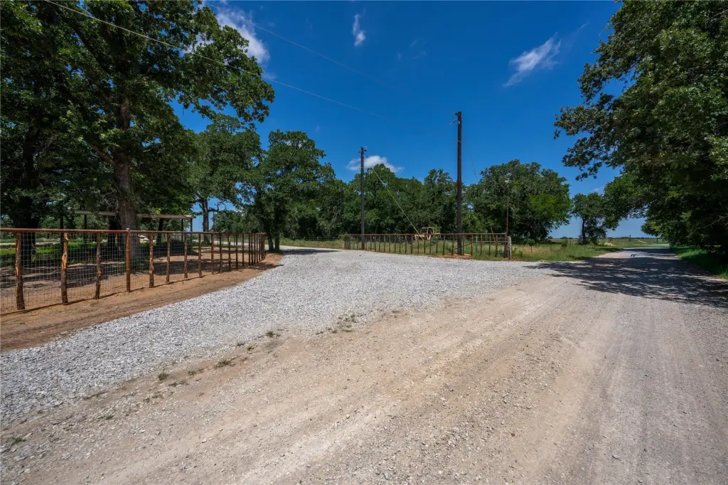
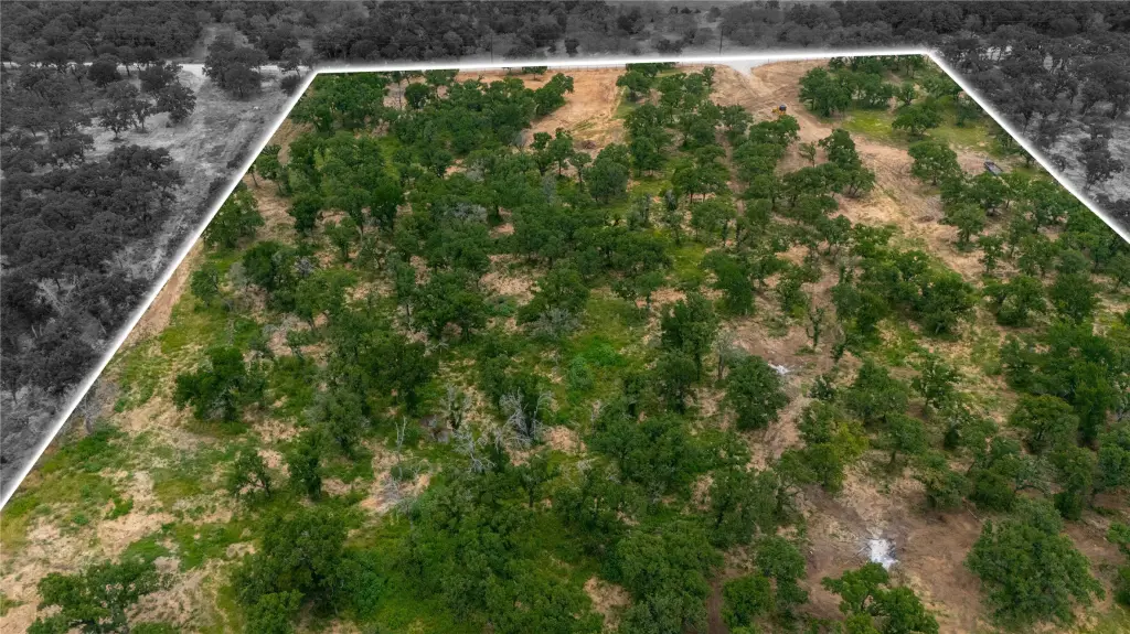
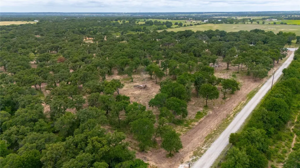
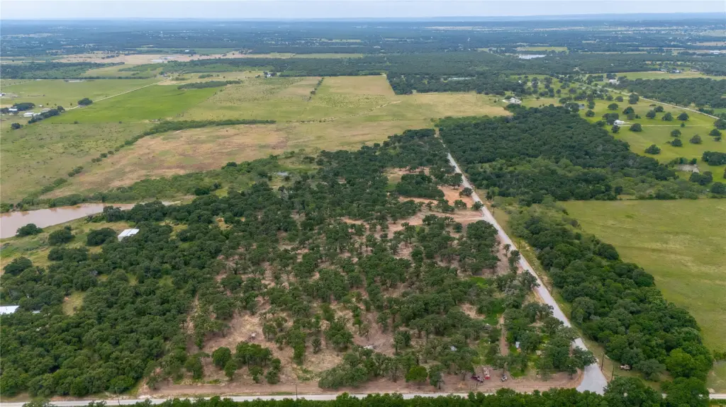
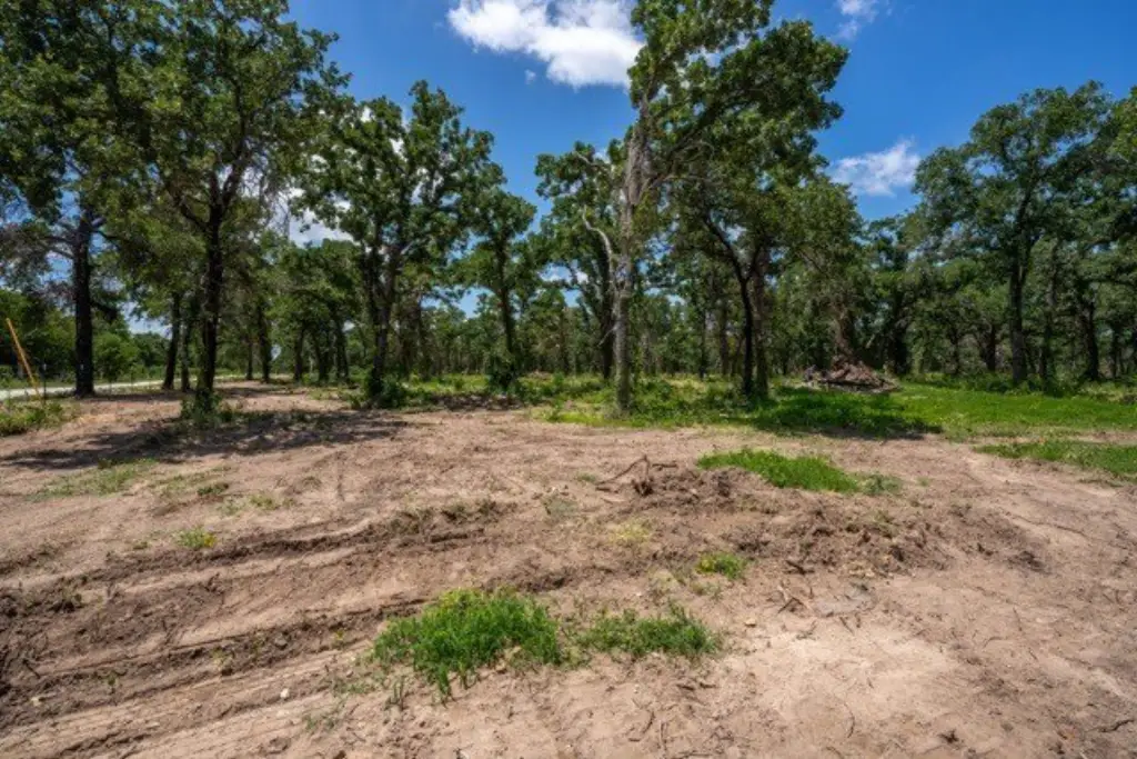
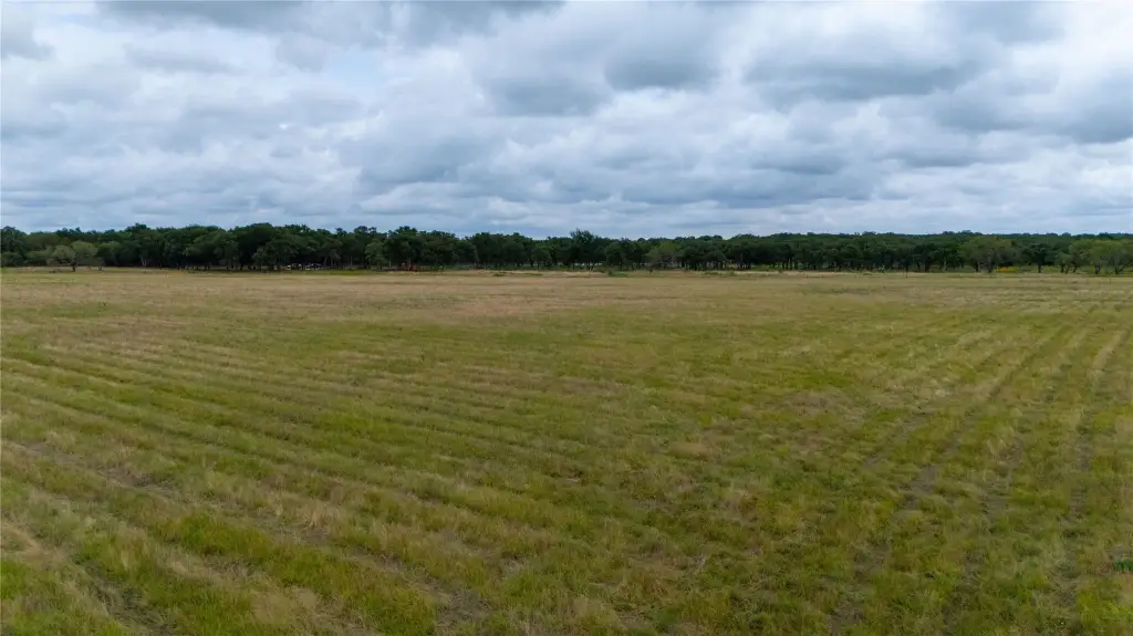
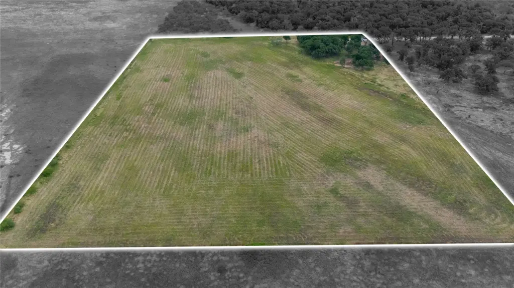
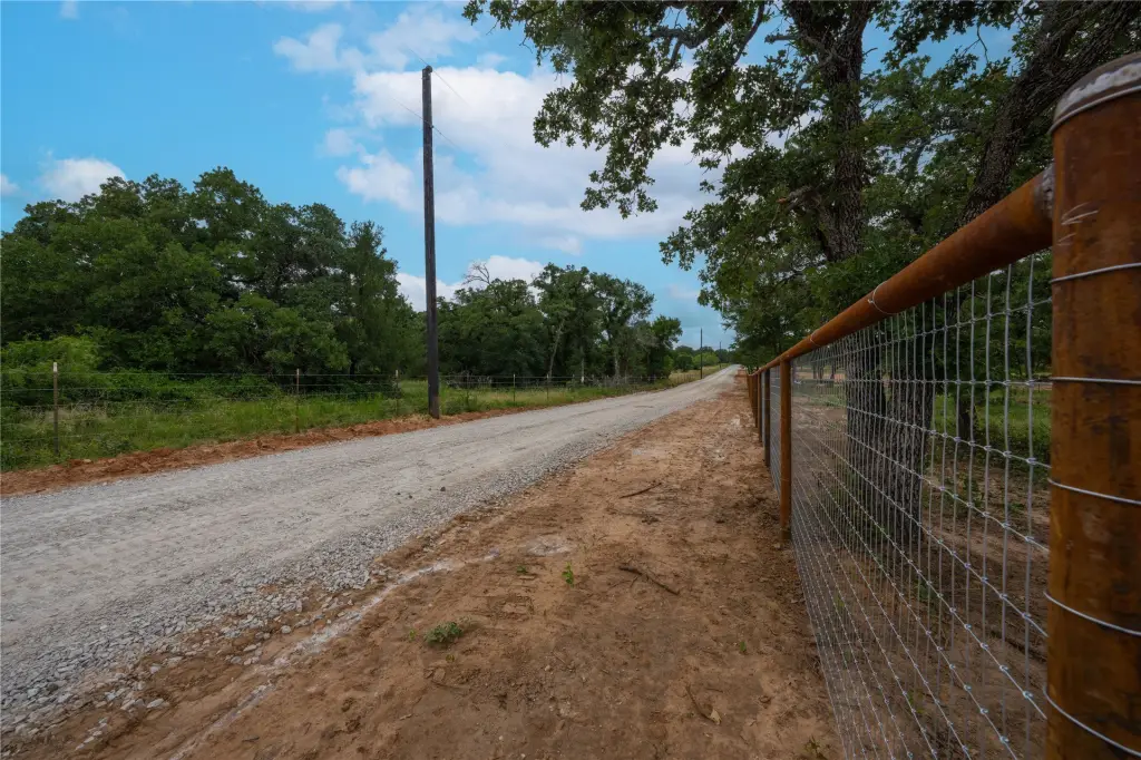
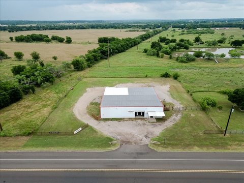
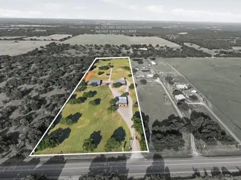
Agricultural land / farmland tract totaling 10 acres, presented with a perimeter fence and livestock-ready interior layout. Each 10-acre lot features a brand new professional five-foot, top-rail, 2x4 no-climb pipe fence with gate entry. Interior acreage is cross-fenced with secure five-strand smooth wire to help manage livestock safely.
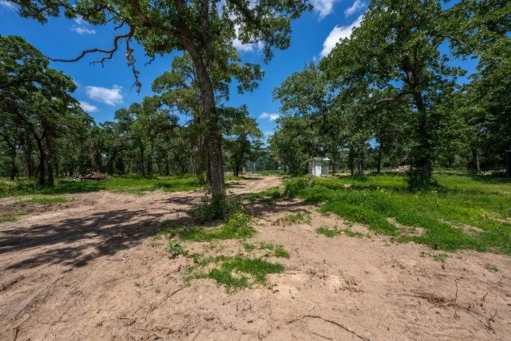
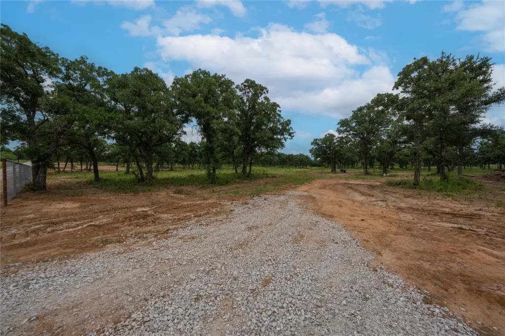
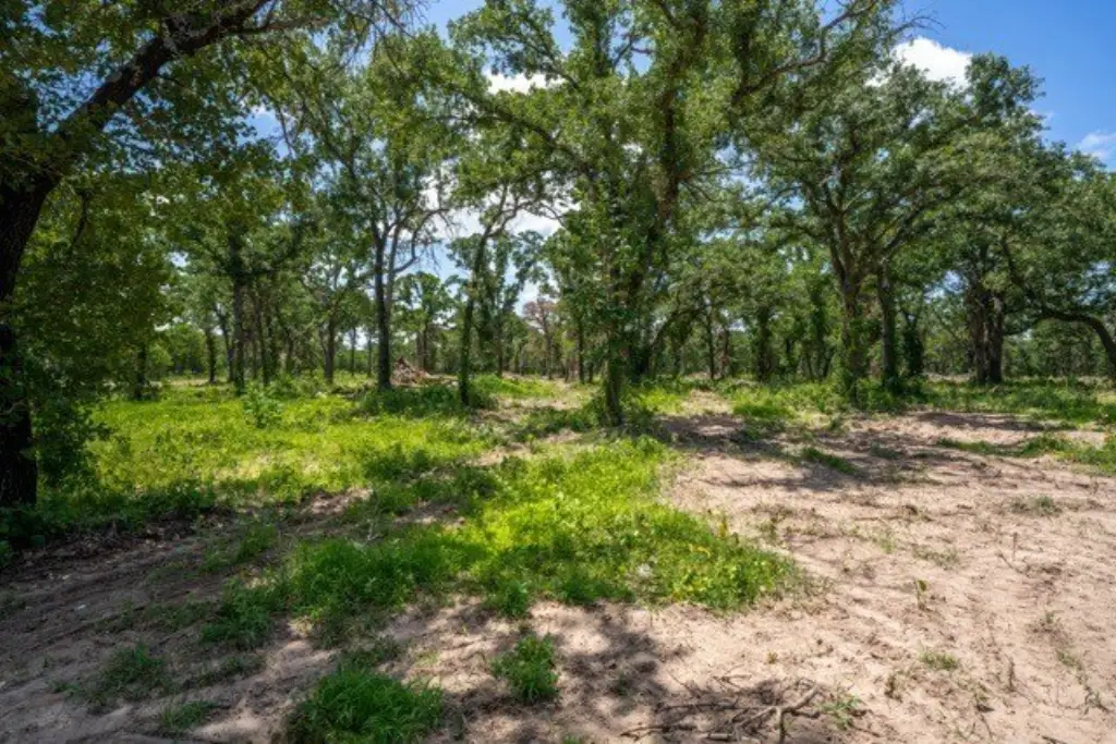
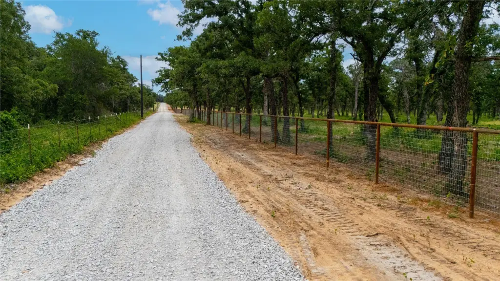
The property includes newly constructed all-weather 20-foot rock and gravel roads for access across the land. Mature, native oak trees are left strategically across the cleared/open terrain for natural shade and privacy. For immediate convenience, one select premium parcel is equipped with an established well and septic system in place.
Light deed restrictions are referenced to preserve natural integrity while maintaining building flexibility.
Key Highlights
- 10‑acre farmland tract
- New five‑foot, top‑rail, 2x4 no‑climb pipe fence with gate entry
- Interior cross‑fencing with secure five‑strand smooth wire
Property Analytics
Current Use
Lease Details
Yes
Fenced yard
Yes
Utilities to site
Location Intelligence
Trade Area within ½ mile
169
Businesses Nearby
Explore this area
Business Placement
Demographics for 76067, TX
20,473
Population
8,660
Households
2.4
Avg Household Size
39
Median Age
13%
College-Educated
84%
High-School Grad
197.6 sq mi
ZIP Area
104
Density / Sq Mi
$59,670
Median Household Income
$35,532
Median Earnings
$1,050
Median Rent
$156,000
Median Home Value

Questions? Ask Rey
Realmo’s AI knows this listing — price, zoning, demand, history. Ask anything.


Frequently Asked Questions
What type of property is this?
Agricultural land / Farmland - Fenced 10-acre farmland tract with new gated entry, cross-fencing for livestock management, and power to the site.
Where is this agricultural land / farmland located?
The property is located at TBD- Tract 2 Quiet Oak Trail Mineral Wells, TX.
What is the asking price?
The asking price for this property is $250,000.
What are key features of this property?
This property features: 10‑acre farmland tract; New five‑foot, top‑rail, 2x4 no‑climb pipe fence with gate entry; Interior cross‑fencing with secure five‑strand smooth wire


