Wooded Mountain Land
2 Back Basin Road, Angel Fire, NM 87710
For Sale


Contact for pricing
Land, Angel Fire, NM
Property SizeContact for details
Lot Size0.76 Acres
Days on Market701
Property Features for 2 Back Basin Road
General Information
Property type
Property subtype
Zoning description
Vegetation
Subdivision
Lot features
Elementary school
Middle school
High school
Directions
Standard status
Lot size
Taxes and HOA fees
Tax Description
Tax Annual Amount
Legal Description
Utilities
Utilities
Sewer type
Listing Agency:
Angel Fire Homes
Listed By:
Brian Lindsey · License NM REC20250634
(575) 595-0070
Added: Dec 10, 2024
Changed: Sep 13
Last Checked: Nov 10 at 7:06PM
MLS# 112670
Copyright © 2026 Enchanted Circle Association of REALTORS®. All rights reserved. All information provided by the listing agent/broker is deemed reliable but is not guaranteed and should be independently verified.

Ask AI about this property
Review the available facts, identify missing information and prepare questions for the agent.
Investment Insights
Based on property information with market context.
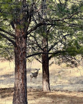
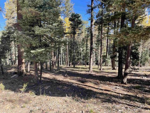
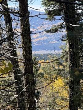
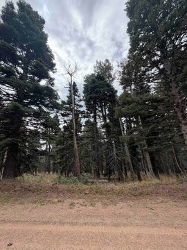
This 0.76-acre land parcel in Angel Fire features mature aspen and pine trees, along with numerous building sites across the property. The land sits on the back side of the ski mountain, less than 1/2 mile from the base of the Southwest Flyer. CS Ranch borders the parcel to the north, where a barbed-wire fence is located along the northern end. Propane is the listed utility. The property is identified in Colfax County, New Mexico, with an Angel Fire mailing address.
Key Highlights
- 0.76‑acre land parcel in Angel Fire
- Less than 1/2 mile from the base of the Southwest Flyer
- Mature aspen and pine trees
Property Analytics
Who owns this building?
See the owner, sales and loan history
Open Analytics
Location Intelligence
Trade Area within ½ mile
1
Businesses Nearby
Explore this area
Business Placement
Demographics for 87710, NM
1,616
Population
2,877
Households
0.6
Avg Household Size
57
Median Age
54%
College-Educated
98%
High-School Grad
144.3 sq mi
ZIP Area
11
Density / Sq Mi
$75,224
Median Household Income
$35,335
Median Earnings
$1,120
Median Rent
$436,200
Median Home Value
Check the figures for this property
Cap Rate, Value Estimation, Potential NOI and more
View Realmo Analytics
Market
Properties on Market for Land in Angel Fire





Frequently Asked Questions
What type of property is this?
Land - Aspen- and pine-covered land less than 1/2 mile from the Southwest Flyer base.
Where is this land located?
The property is located at 2 Back Basin Road Angel Fire, NM.
What are key features of this property?
This property features: 0.76‑acre land parcel in Angel Fire; Less than 1/2 mile from the base of the Southwest Flyer; Mature aspen and pine trees