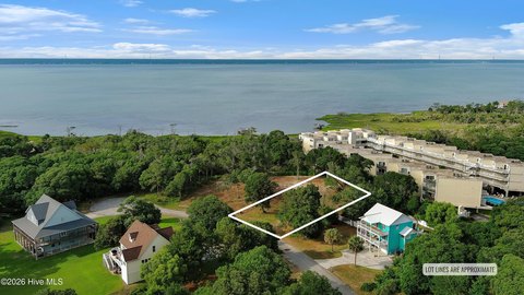
Waterfront Development Land

For Sale
$1,500,000
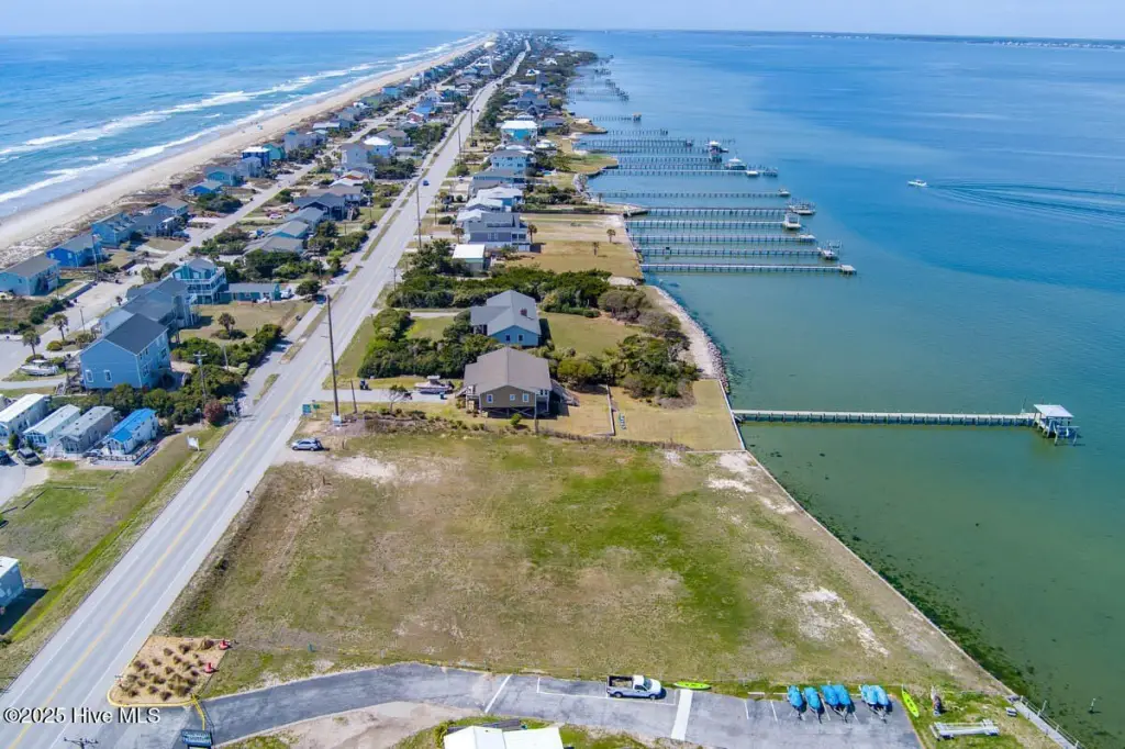
1980 Salter Path Road, Indian Beach, NC 28512
LAND - Indian Beach, NC
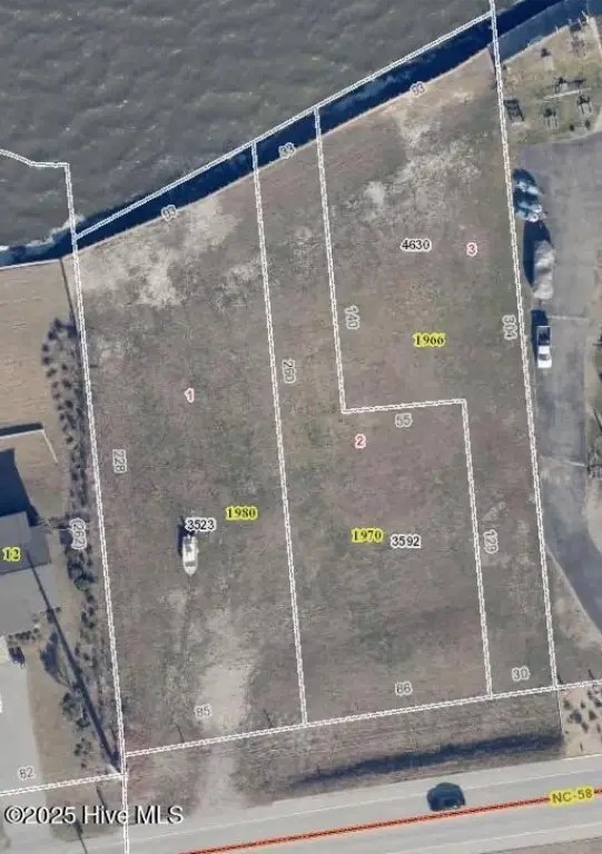
Lot Size1.22 Acres
Days on Market479
Property Features for 1980 Salter Path Road
General Information
Property type
Land
Property subtype
Other
Zoning
RR
Subdivision
Not In Subdivision
Lot features
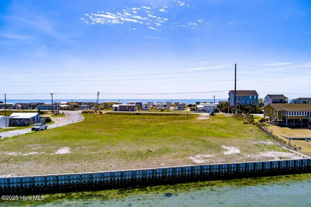
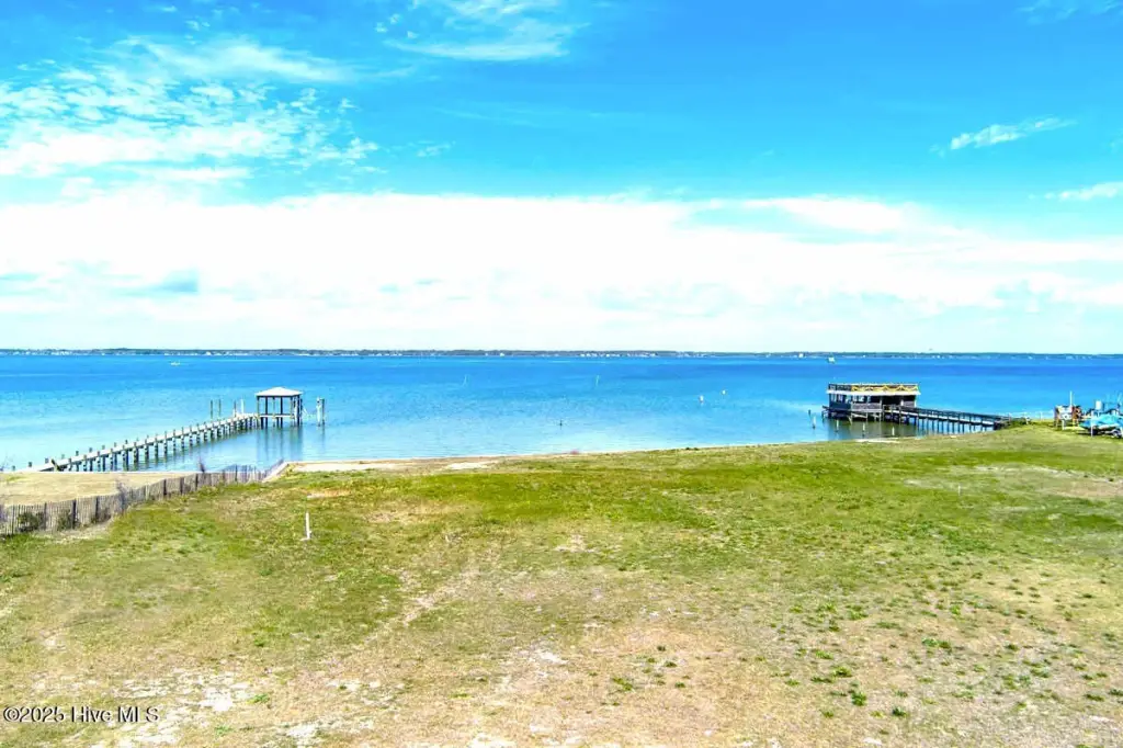
Open Lot, Deeded Water Rights, Bulkhead, Deeded Waterfront, Sound Side
View
Ocean, Water
Elementary school
White Oak Elementary
Middle school
Broad Creek
High school
Croatan
Directions
From Emerald Isle on Hwy 58 heading east, the property is soundfront,bordering the Emerald Isle -Indian Beach town line.
Standard status
Active
APN
632412863523000
Lot size
1.22 Acres
Taxes and HOA fees
Tax Year
2025
Tax Description
lots 1,2,3. Bufflehead
Legal Description
lots 1,2,3. Bufflehead
Utilities
Utilities
Electricity Available
Water front features
Waterfront
Water front
1
Listing Agency:
Bluewater Real Estate - EI
(252) 354-5921
Listed By:
Raymond E Riggs · License #288794
(252) 241-4354
Added: Apr 9, 2025
Changed: Jun 26
Last Checked: Jul 31 at 2:06AM
MLS# 100500026
Copyright © 2026 Hive MLS. All rights reserved. All information provided by the listing agent/broker is deemed reliable but is not guaranteed and should be independently verified.
Investment Insights
Based on property information with market context.
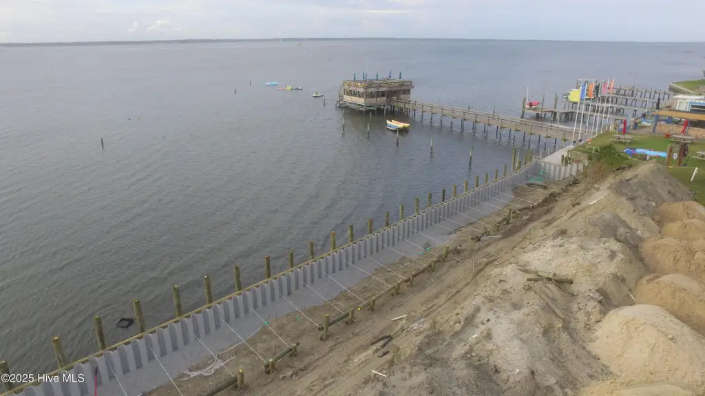
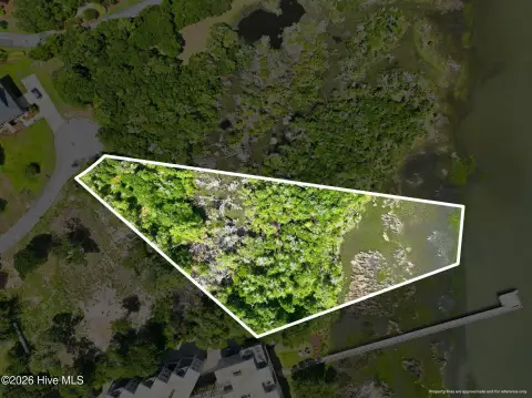
The property is a single-sale waterfront land parcel comprising three sound front lots. The land is cleared and ready for development, and it includes a brand-new engineered vinyl bulkhead installed in 2022. The building areas are identified as Flood Zone X, which is noted as not requiring flood insurance. The offering is being sold as one entity rather than separate lots.
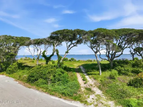
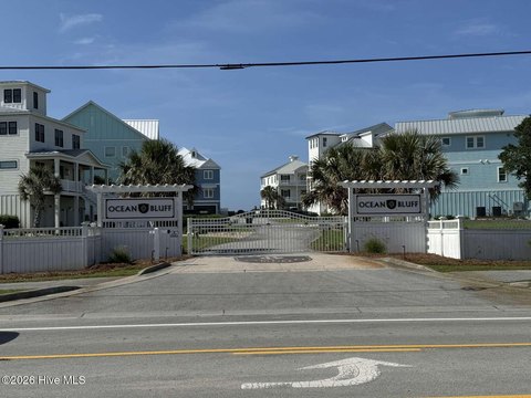
Situated in Indian Beach, the parcel provides direct access to Bogue Sound and is also described as second row to the ocean. A public beach access point is available a short walk away. The property is zoned RR (Residential Resort), and the listing indicates that development opportunities may vary based on use and approval requirements.
For buyers evaluating residential or vacation-oriented development, the cleared site and defined bulkhead provide a straightforward starting point for planning. The RR zoning supports residential resort-style concepts, while the seller notes that buyers interested in commercial development should confirm requirements with the Indian Beach and Carteret County planning departments. Prospective purchasers are encouraged to review the provided documents, including the plat map and zoning details, to understand the lot configuration and development parameters.
Key Highlights
- Three sound front lots offer breathtaking water views and direct access to Bogue Sound.
- Second row to the ocean, with a short walk to public beach access.
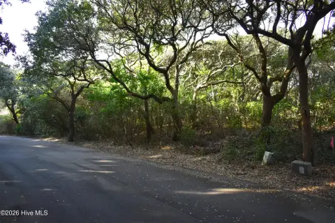
- Land is clear and ready for development.
Property Analytics
Property Profile
Current Use
Location Intelligence
Trade Area within ½ mile
20
Businesses Nearby
Explore this area
Business Placement
Demographics for 28512, NC
3,011
Population
8,944
Households
0.3
Avg Household Size
61
Median Age
56%
College-Educated
99%
High-School Grad
6.1 sq mi
ZIP Area
494
Density / Sq Mi
$80,375
Median Household Income
$45,075
Median Earnings
$1,008
Median Rent
$529,400
Median Home Value

Questions? Ask Rey
Realmo’s AI knows this listing — price, zoning, demand, history. Ask anything.

Frequently Asked Questions
What type of property is this?
Residential land & home lot - Three cleared lots with water views, direct Bogue Sound access, and a new 2022 bulkhead ready for development.
Where is this residential land & home lot located?
The property is located at 1980 Salter Path Road Indian Beach, NC.
What is the asking price?
The asking price for this property is $1,500,000.
What are key features of this property?
This property features: Three sound front lots offer breathtaking water views and direct access to Bogue Sound.; Second row to the ocean, with a short walk to public beach access.; Land is clear and ready for development.


