New
For Sale
$35,000
16434 NW 318TH STREET, Okeechobee, FL 34972
Residential land & home lots
Property SizeContact for details
Days on Market7
Property Features for 16434 NW 318TH STREET
General Information
Standard status
Active
Property subtype
Land
Amenities
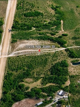
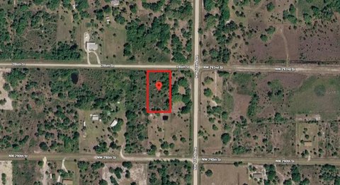
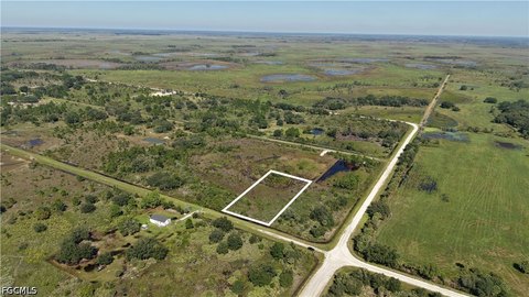
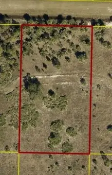
1.25 acres, Dimensions: 300 x 170, Buildable, Level, Rural
Additional parcels description:, Parcel Number: R1-11-34-33-0A00-00003-I000, Public Survey Range: 33, Public Survey Section: 11, Annual Amount: $427, Legal Description: LOT I OF TRACT 3 EAST 1/2 OF THE EAST 1/2 OF THE NORTH 1/2 OF THE SOUTH 1/2 OF TRACT 3, SECTION 11 AS TO THE SOUTHERN COLONIZATION COMPANY PLAT OF TOWNSHIP 34 SOUTH, RANGE 33 EAST, ACCORDING TO THE PLAT THEREOF RECORDED IN PLAT BOOK 4, PAGES 3-3E, IN CLUSIVE, PUBLIC RECORDS OF OKEECHOBEE COUNTY, FLORIDA., Year: 2025, Zoning: AG
Listing ID: MFRC7531977, Standard Status: Active, MLS Status: Active, On market as of 2026-10-13, Special Conditions: None
Living area units: Square Feet, Building faces North
Subdivision: SOUTHERN COLONIZATION CO, MLS Area (Major): 34972 - Okeechobee, County/Parish: Okeechobee
Electricity Available
Close Of Escrow
Frontage Type: Access Road, County Road, Road Surface: Dirt
Listing Agency:
LOKATION
(954) 545-5583
Listed By:
Lori Delin · License #3536731
(772) 666-4449
Source:
Miharaandassociates
Added: Oct 13
Changed: Oct 16
Last Checked: Oct 16 at 8:27AM
Displayed information is deemed reliable but is not guaranteed and should be independently verified. All listing content including descriptions, pricing, images are the copyrighted material of LOKATION

Ask AI about this property
Review the available facts, identify missing information and prepare questions for the agent.
Property Analytics
Unlock full access to Insights
Subscribe to Realmo Intelligence
Open Analytics
Current Use
Location Intelligence
Trade Area within ½ mile
1
Businesses Nearby
Explore this area
Business Placement
Demographics for 34972, FL
19,514
Population
7,004
Households
2.8
Avg Household Size
37
Median Age
15%
College-Educated
77%
High-School Grad
854.4 sq mi
ZIP Area
23
Density / Sq Mi
$53,902
Median Household Income
$33,612
Median Earnings
$994
Median Rent
$193,300
Median Home Value
Check the figures for this property
Cap Rate, Value Estimation, Potential NOI and more
View Realmo Analytics




Frequently Asked Questions
Where is this residential land & home lot located?
The property is located at 16434 NW 318TH STREET Okeechobee, FL.
What is the asking price?
The asking price for this property is $35,000.