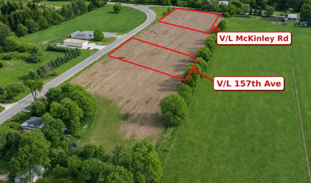
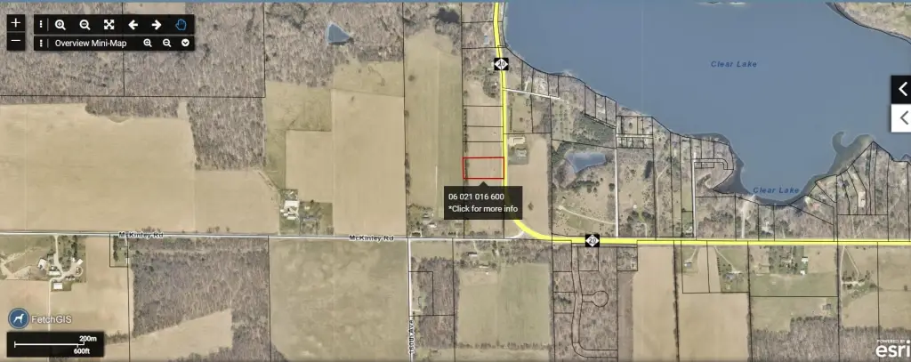
V/L 157th Ave, Big Rapids, MI 49307
- Added:
- May 22, 2026
- Days on Market:
- 41
- Last Refresh:
- Jul 1 at 6:06 pm
Property Features for V/L 157th Ave
General Information
- Property type
- Land
- Property subtype
- Other
- Standard status
- Active
- APN
- 06 021 016 600
- Lot size
- 1.62 Acres
Taxes and HOA fees
- Tax Year
- 2025
- Tax Description
- SEC 21 T15N R09W N 200 FT OF S 766 FT OF PARCEL DESC AS BEG 552.43 FT E OF S 8TH POST ON W SEC L TH N 1550 FT TH E 354 FT TO CENTER M-20 TH S TO A PT 358 FT E OF POB. TH W 358 FT TO POB.
- Tax Annual Amount
- 78
Utilities
- Utilities
- Cable Available
Listing agent Liberty K Gray (231) 679-0252
Listing office Keller Williams GR North 3237 Platinum St NE, Grand Rapids, MI (616) 447-9100
Listing date May 22, 2026
Copyright © 2026 Michigan Regional Information Center, LLC. All rights reserved. All information provided by the listing agent/broker is deemed reliable but is not guaranteed and should be independently verified.
HighLights
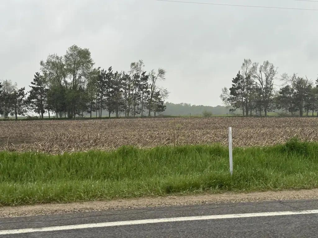
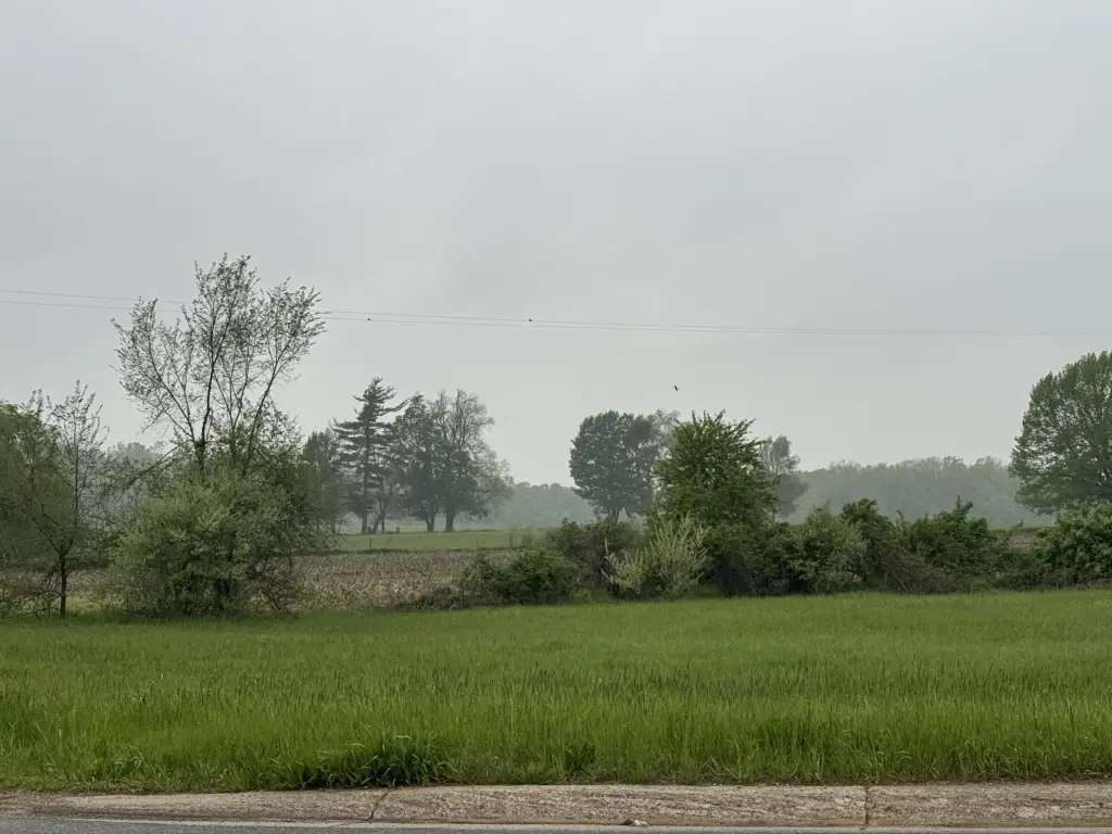
- 1.62‑acre agricultural‑zoned parcel with tillable and buildable land
- Located along 157th Avenue in a rural setting with open views
- Minutes from Big Rapids and M‑20
- Near Clear, Tri & Canadian Lakes and public lake access
- Cable available
- Property lines appear to have been surveyed on either side; buyer to verify driveway access, zoning, and intended use
Overview
The parcel is located in a peaceful rural setting near Clear, Tri, and Canadian Lakes, with public lake access noted as nearby. The remarks also indicate the property is minutes from Big Rapids and M-20. Because driveway access and utilities are not detailed, the seller recommends buyers verify driveway access, utilities, and intended use. A neighboring pole barn is referenced as having obtained a driveway permit from MDOT, but all requirements should be confirmed for this site.
For tenants, buyers, or operators seeking land to support extra storage, agricultural activities, or personal rural projects, this parcel’s agricultural zoning and tillable/buildable description are central. Buyers planning a residence or other structures should confirm zoning and permitting, including driveway, utilities, and any required boundary documentation, as the remarks note surveying appears to exist but a boundary survey or recertification is recommended.
Current Use by Public Records
Map
- City
- Big Rapids
- County
- Mecosta
- State
- Michigan
- Longitude
- -85.400269
- Latitude
- 43.686096