150 Durnwald Road, Clyde, OH 43410
- Added:
- Jun 17, 2026
- Days on Market:
- 2
- Last Refresh:
- Jun 18 at 1:06 am
Property Features for 150 Durnwald Road
General Information
- Property type
- Commercial Sale
- Property subtype
- Other
- Standard status
- Active
- APN
- 326000015900
- Lot size
- 25.14 Acres

Listing agent Steve Lehmann License #2010003176 (419) 680-6390
Listing office Truth First Realty 101 W Water St., OH (419) 680-6390
Listing date Jun 17, 2026
Copyright © 2026 Firelands MLS. All rights reserved. All information provided by the listing agent/broker is deemed reliable but is not guaranteed and should be independently verified.
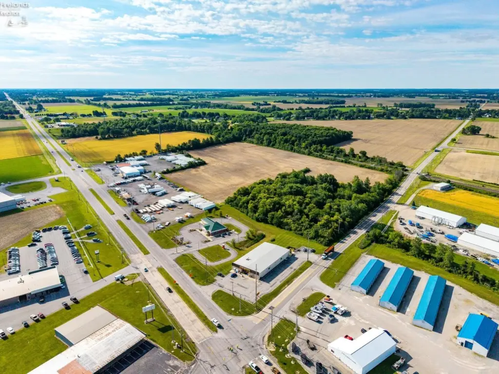
HighLights
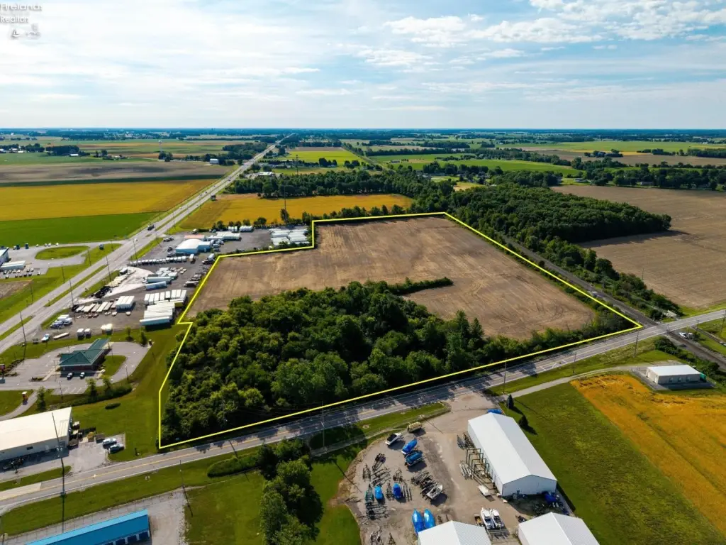
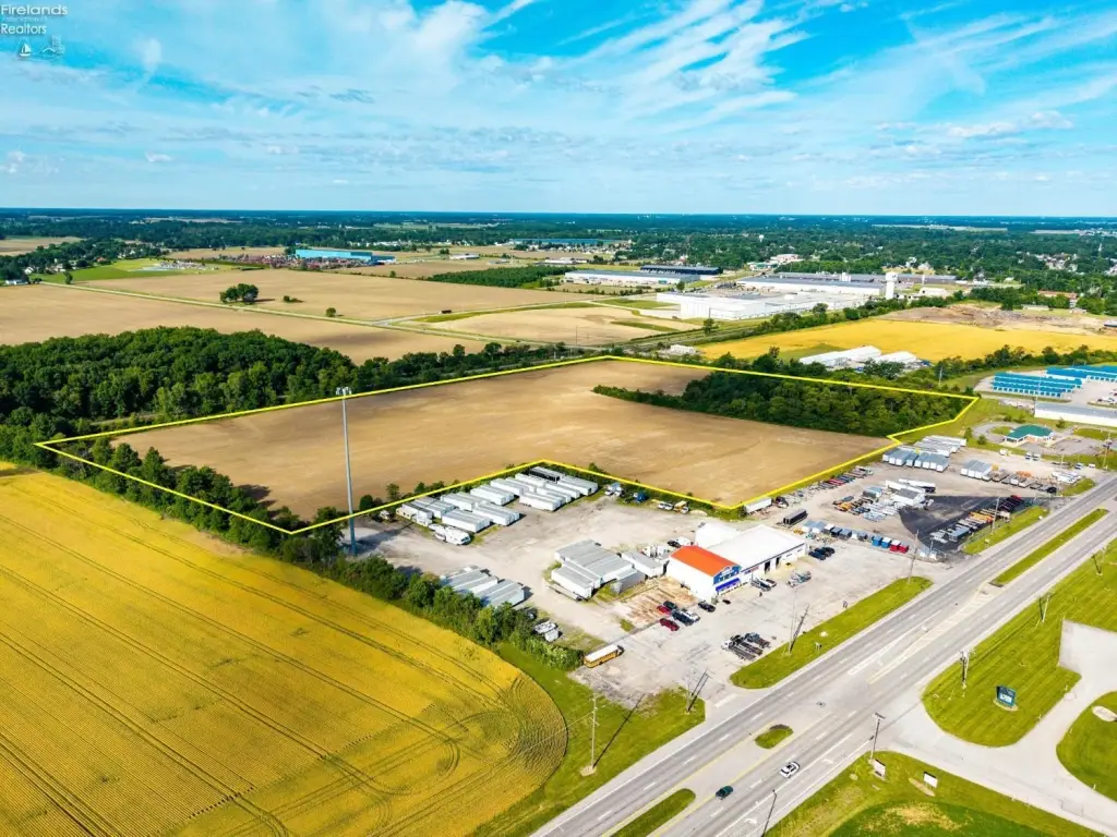
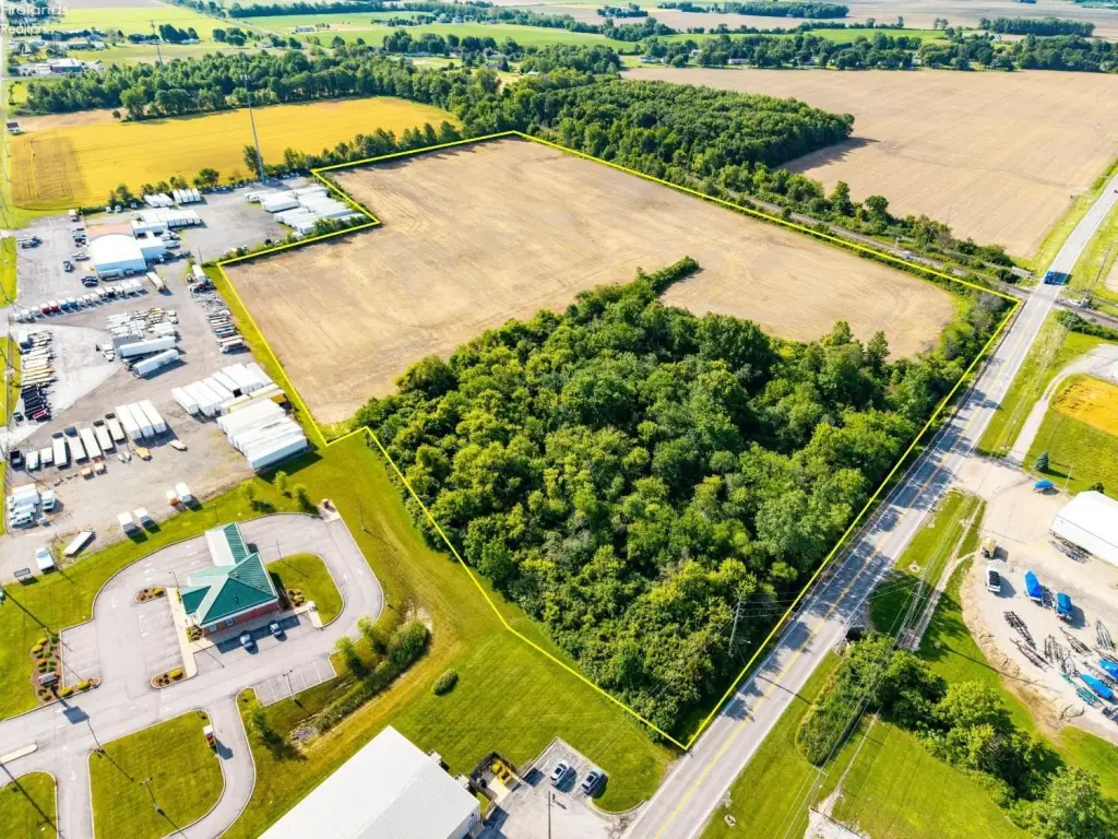
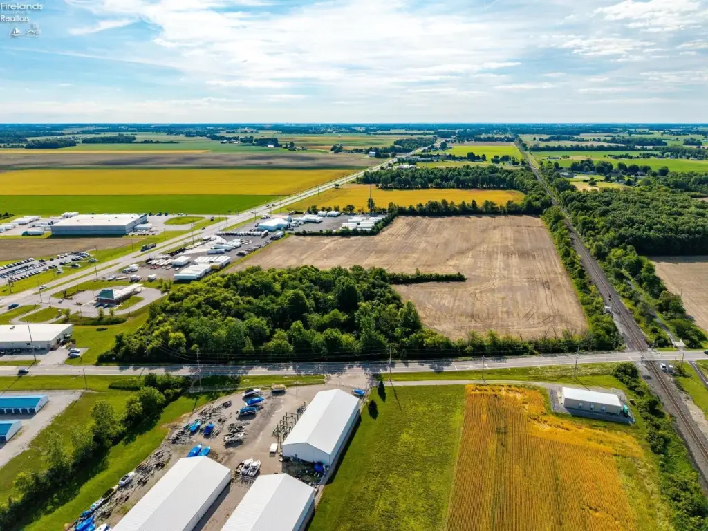
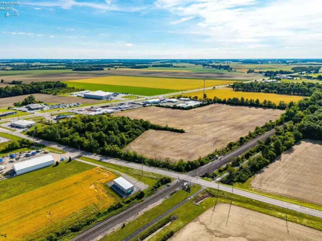
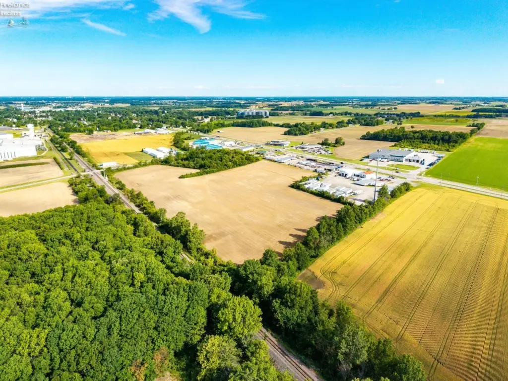
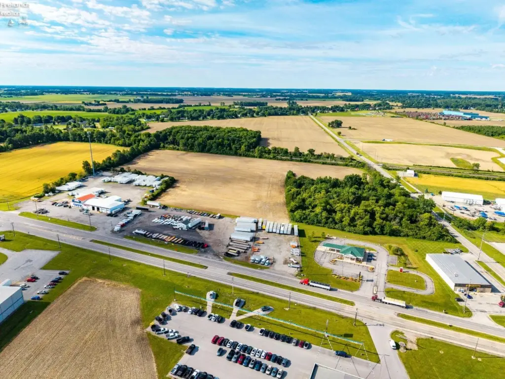
- Approximately 25 acres of C‑2 general commercial land along the US Route 20 corridor
- Zoned C‑2 general commercial, allowing multiple commercial uses including retail, office, service, hospitality, storage, and automotive
- Frontage on Durnwald Road (CR 260) plus a 30‑foot easement providing access to US Route 20 through a neighboring property
- About 21 acres currently used for agriculture, with remaining acreage consisting of wooded land
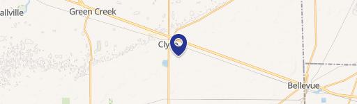
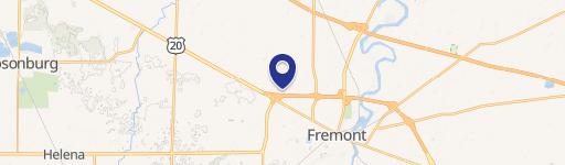
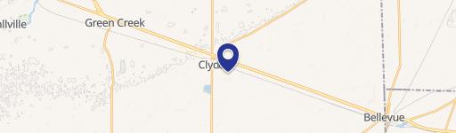
- Located between Clyde and Bellevue, Ohio, within a commercial and industrial area
Overview
The land features frontage along Durnwald Road (CR 260). Access to US Route 20 is provided through a neighboring Fremont Federal Credit Union property via a 30-foot easement. The parcel sits within an active commercial and industrial corridor and is surrounded by a mix of businesses, including Fremont Federal Credit Union, Dollar General, Steinle Chevrolet Buick, NOMS Healthcare, Rush Repairs & Recovery, Burroughs Marine, Spader Freight Services, and Evergreen Plastics.
For buyers seeking development-ready acreage with established zoning, this parcel offers flexibility under C-2 General Commercial, including uses such as retail, office, service, hospitality, storage, automotive, and other commercial applications. With a portion already in agricultural use and additional wooded acreage for buffering, the site may be workable for phased planning or future expansion while maintaining options aligned to the zoning and corridor access to US Route 20.
Current Use by Public Records
Map
- City
- Clyde
- County
- Sandusky
- State
- Ohio
- Longitude
- -82.954286
- Latitude
- 41.302007