Productive Farmland
For Sale
Contact for pricing
465th St Parcels 1 2 3, Fairfax, MN 55332
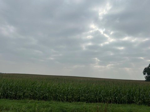
Three parcels offer substantial tillable acreage with CPI ratings ranging from 89.2 to 92.1.
Property Size212 SF
Lot Size212.42 Acres
Price / SF$50.58
Days on Market52
Property Features for 465th St Parcels 1 2 3
General Information
Standard status
Active
Size
212 SF
Lot size
212.42 Acres
Property subtype
Land
Additional Details
Road Access
Yes
Listing Agency:
National Land Realty, Minneapolis, MN
Listed By:
Terri Jensen
(507) 382-0908
Source:
Nationalland
Added: Jul 16
Changed: Aug 26
Last Checked: Sep 5 at 3:33AM
Displayed information is deemed reliable but is not guaranteed and should be independently verified. All listing content including descriptions, pricing, images are the copyrighted material of National Land Realty, Minneapolis, MN
Investment Insights
Based on property information with market context.
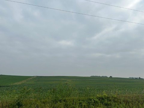
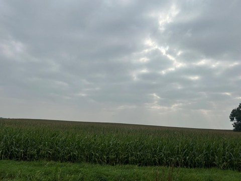
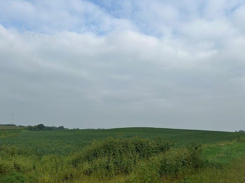
This offering consists of three separate farmland parcels totaling 212 acres in Fairfax, Minnesota, with productivity supported by stated CPI figures. Parcel 1 includes 40 acres on the east side of 465th St, comprised of 37.84 tillable acres (CPI 92.1), with the remainder in road and a small wooded area at the southwest corner. Parcel 2 totals 63.62 acres and includes approximately 60.38 tillable acres (CPI 90.4), with stated grassed waterways and an old landing strip that could also be tillable; the 10.66-acre building site at 63093 465th Street is excluded from the sale. Parcel 3 provides 108.80 acres with 99.57 tillable acres (CPI 89.2), split between two tax parcels, with 465th Street bordering the east side and County Ditch 141 forming the southerly line.
Field access is described for each parcel, and topography is generally level to gently rolling, with lower ground adjacent to the ditch on Parcel 3. PID numbers are listed for each parcel (07.00980.00, 07.01000.00, 07.01020.00, and 07.01030.00). The seller notes 2025 taxes reflect land and the separate excluded building site, and upcoming taxes will reflect land and the separate parcel ID and taxes for the building site.
Field access is described for each parcel, and topography is generally level to gently rolling, with lower ground adjacent to the ditch on Parcel 3. PID numbers are listed for each parcel (07.00980.00, 07.01000.00, 07.01020.00, and 07.01030.00). The seller notes 2025 taxes reflect land and the separate excluded building site, and upcoming taxes will reflect land and the separate parcel ID and taxes for the building site.
Key Highlights
- Parcel 1: 40 acres on the east side of 465th St in Fairfax, MN, including 37.84 tillable acres with CPI of 92.1
- Parcel 2: 63.62 acres with approximately 60.38 tillable acres and CPI of 90.4; includes road along the east and south lines
- Parcel 3: 108.80 acres with 99.57 tillable acres and CPI of 89.2, made up of two tax parcels (74.55 acres and 34.25 acres)
Property Analytics
Current Use
Lease Details
Yes
Paved road access
Location Intelligence
Trade Area within ½ mile
124
Businesses Nearby
Explore this area
Business Placement
Demographics for 55332, MN
1,838
Population
773
Households
2.4
Avg Household Size
45
Median Age
12%
College-Educated
86%
High-School Grad
114.3 sq mi
ZIP Area
16
Density / Sq Mi
$58,177
Median Household Income
$34,943
Median Earnings
$447
Median Rent
$135,800
Median Home Value

Questions? Ask Rey
Realmo’s AI knows this listing — price, zoning, demand, history. Ask anything.




Frequently Asked Questions
What type of property is this?
Agricultural land / Farmland - Three parcels offer substantial tillable acreage with CPI ratings ranging from 89.2 to 92.1.
Where is this agricultural land / farmland located?
The property is located at 465th St Parcels 1 2 3 Fairfax, MN.
What are key features of this property?
This property features: Parcel 1: 40 acres on the east side of 465th St in Fairfax, MN, including 37.84 tillable acres with CPI of 92.1; Parcel 2: 63.62 acres with approximately 60.38 tillable acres and CPI of 90.4; includes road along the east and south lines; Parcel 3: 108.80 acres with 99.57 tillable acres and CPI of 89.2, made up of two tax parcels (74.55 acres and 34.25 acres)



