Ranch Land with Premium
12403 FM 1975 Gilmer, TX 75644
12403 FM 1975, Gilmer, TX, 75644
$206,000
For Sale
$206,000
LAND - Gilmer, TX
Lot Size20.60 Acres
Days on Market335
Property Features for 12403 FM 1975
General Information
- Property type
- Land
- Property subtype
- Other
- Vegetation
- Grassed, Wooded, Cleared
- Fencing
- Fenced
- Standard status
- Active
- APN
- 000000046871
- Lot size
- 20.60 Acres
Taxes and HOA fees
- Tax Description
- ABS A204 HARRISON COUNTY SCHOOL LAND,TRACT 1
Listing Agency
Michael Wells Realty
(682) 225-2649
Keller, TX
Listed by
Michael Wells · License #0557595
(817) 581-0321
Added: Aug 19, 2025 Checked: Jul 19 at 9:06 pm
MLS# 21034694
Listing URL
Copyright © 2026 North Texas Real Estate Information Systems, Inc. All rights reserved. All information provided by the listing agent/broker is deemed reliable but is not guaranteed and should be independently verified.
Investment Insights
Based on property information with market context.
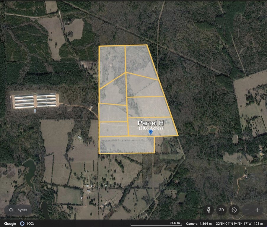
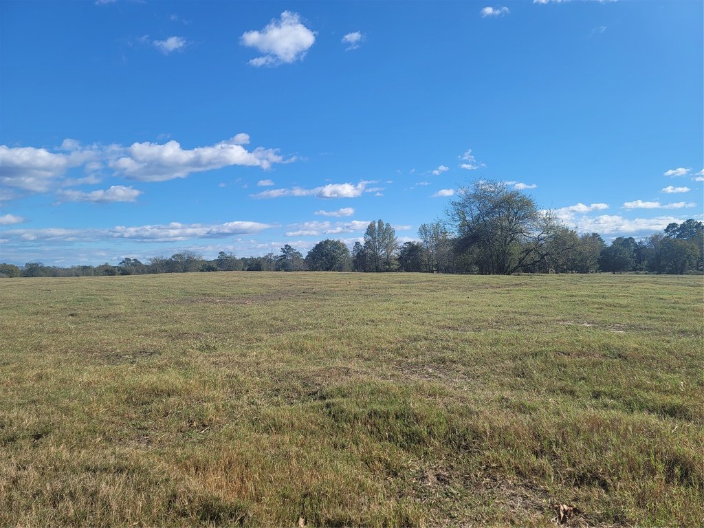
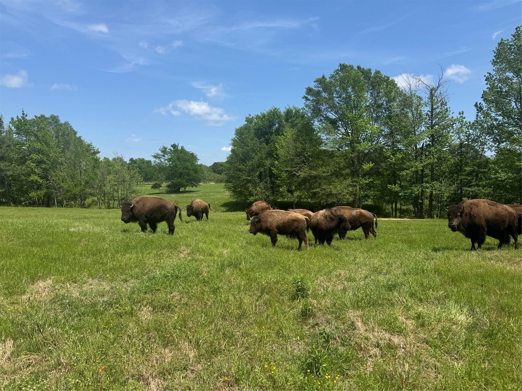
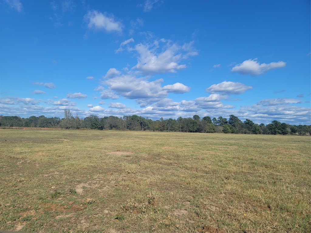
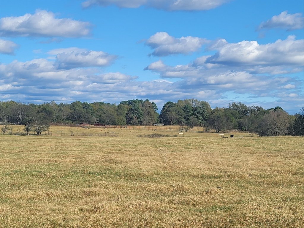
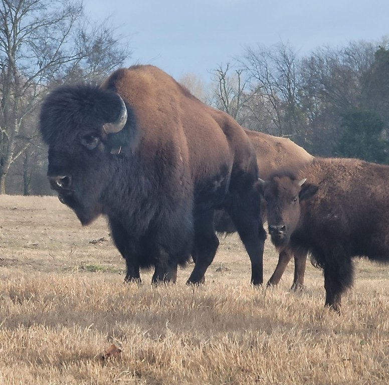
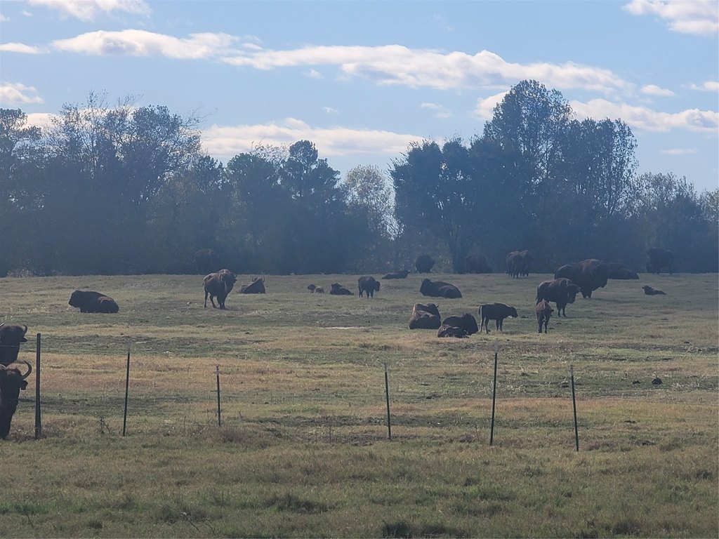
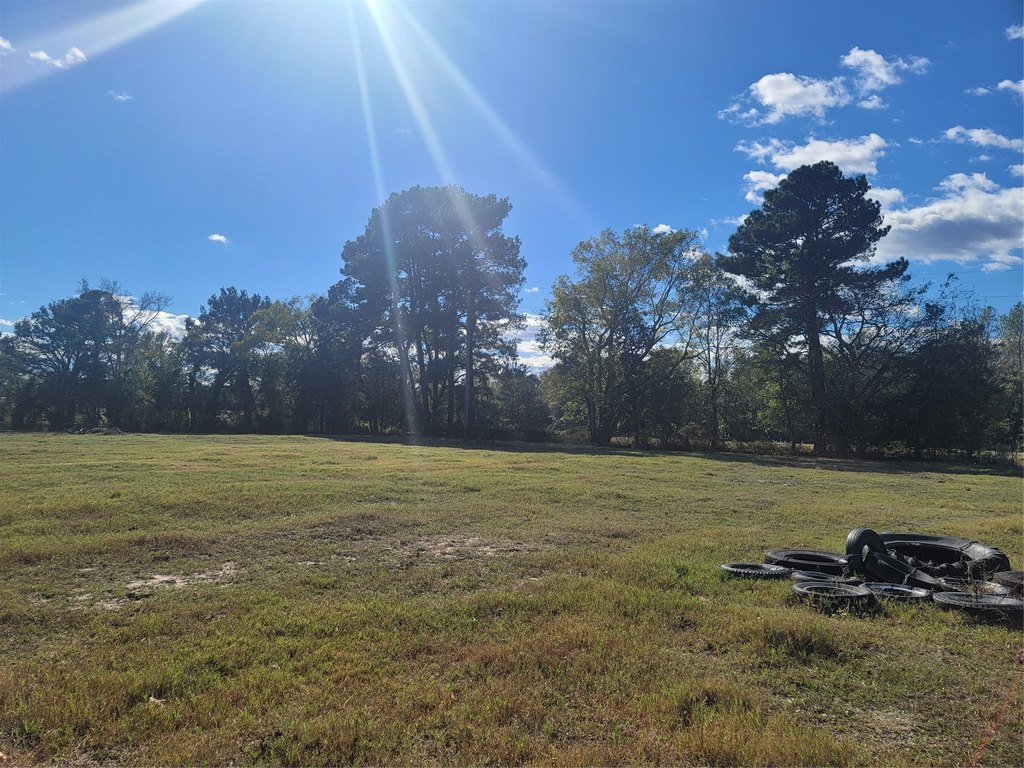
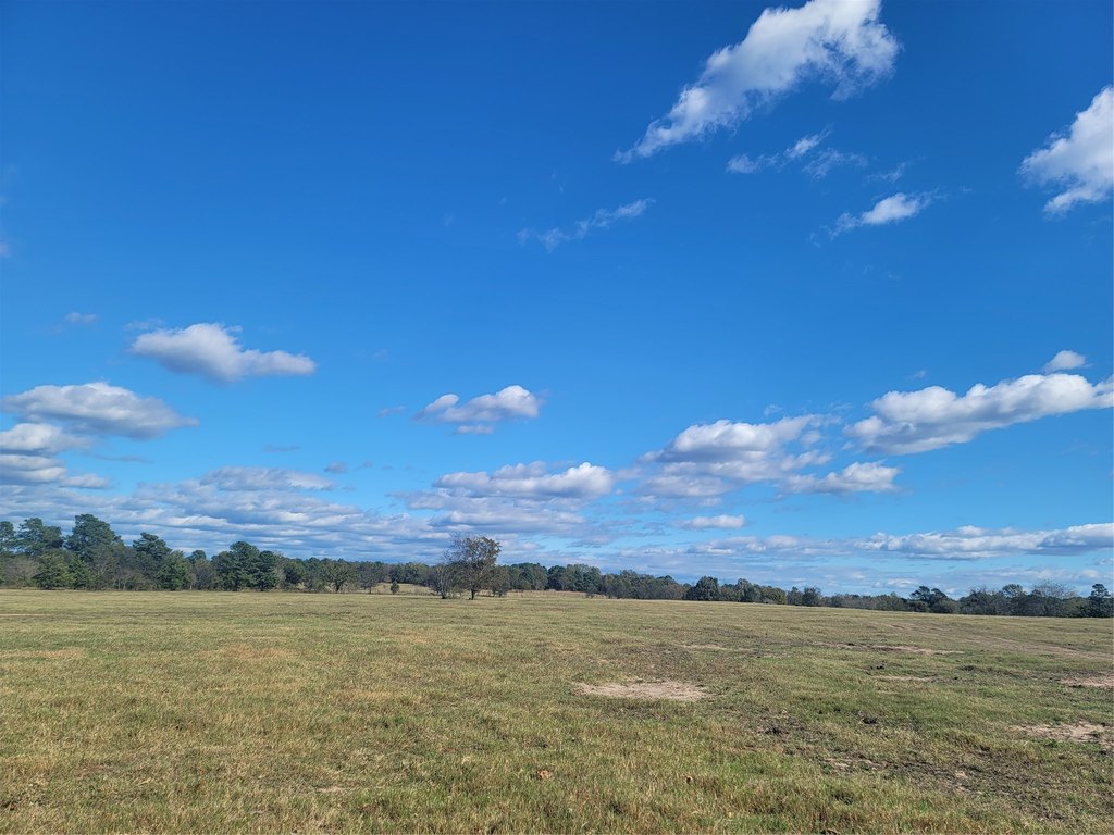
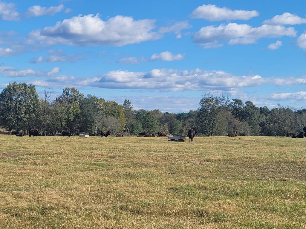
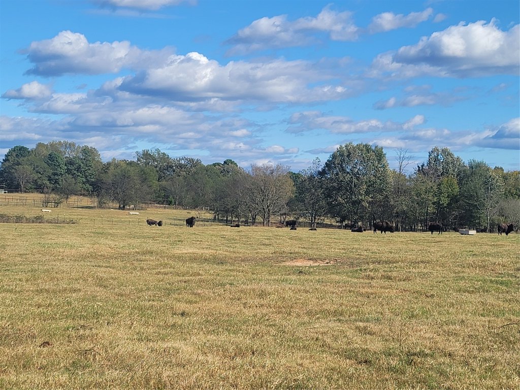
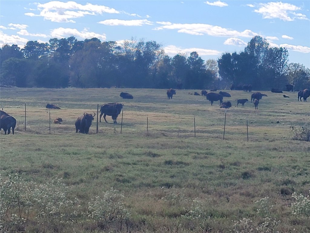
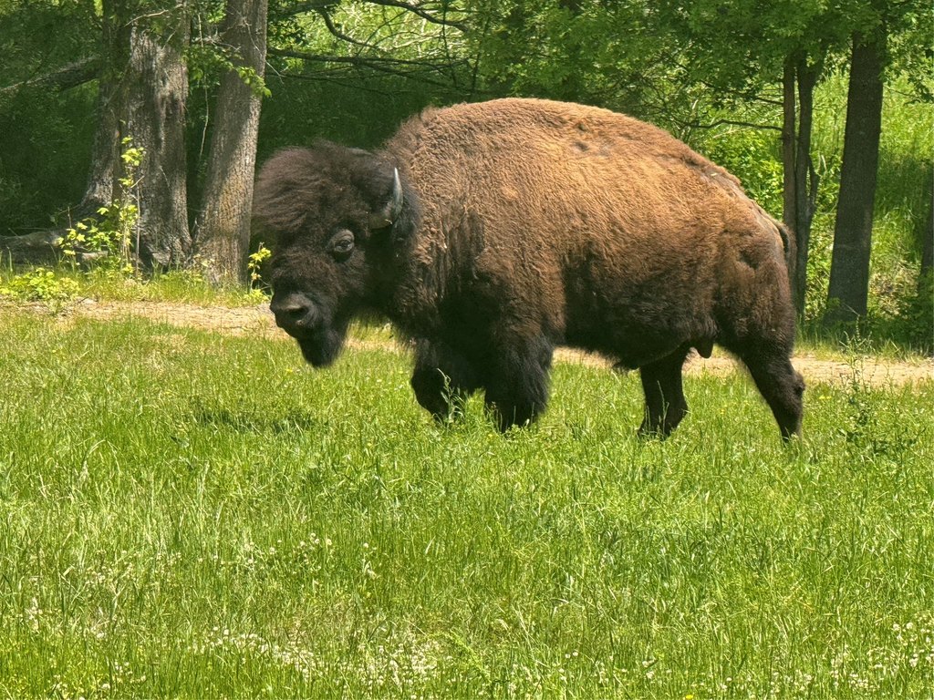
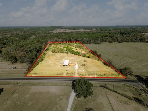
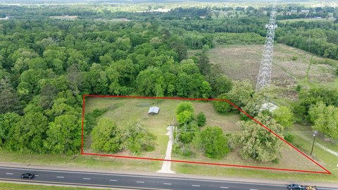
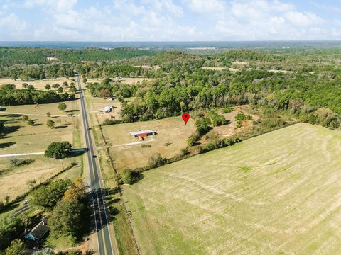
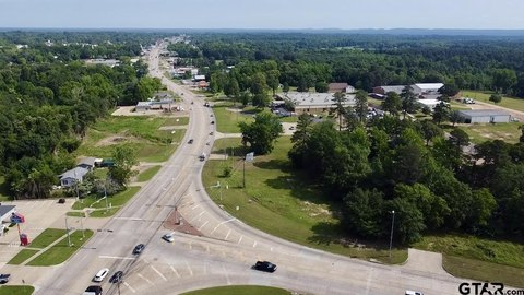
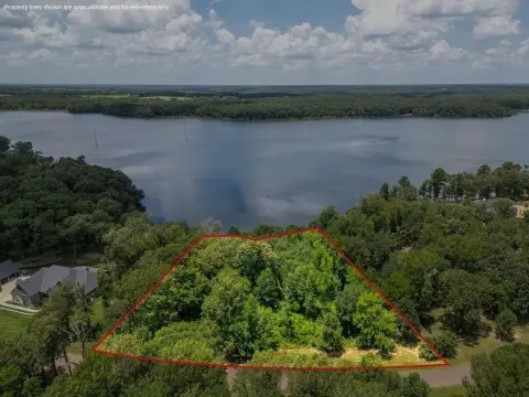
Parcel H is approximately 20.6 acres of East Texas ranch land featuring rolling terrain with a mix of wooded areas and pasture. The property is currently used as the ranch home for a livestock operation raising bison and cattle, supported by substantial fencing in place throughout the boundary and between pastures.
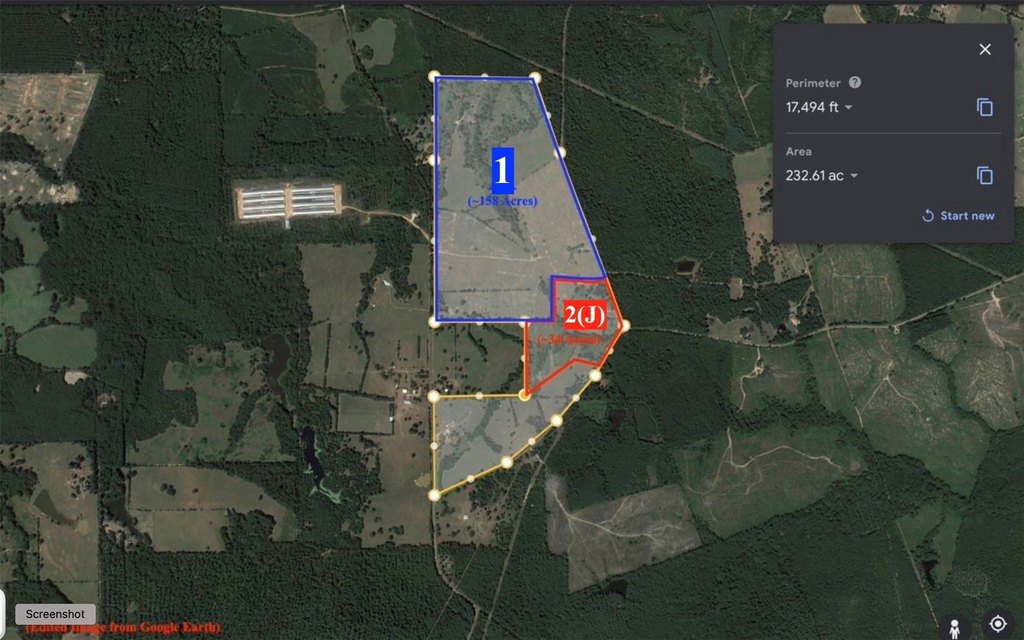
The parcel is positioned along the northeast side of the overall tract and forms part of a 232-acre plat, from which approximately 192 acres will be divided at closing. The offering allows buyers to purchase parcels as displayed, or to combine designated parcels to create a larger tract. Road access varies by parcel within the plat, with Parcels A and B having road access at a corner, while Parcels C through I include some road frontage. The depicted parcel boundaries are approximated from Google Earth, and the resulting parcel will be re-platted for closing.
This configuration is well suited for buyers seeking grazing land and livestock-ready acreage, including operations that value perimeter control and internal pasture separation. It also offers flexibility for investors or landowners looking to assemble a larger ranch footprint from the available parcels, subject to re-platting and negotiated boundary design within the overall acreage.
Key Highlights
- Listing includes Parcel H, approximately 20.6 acres on the northeast side of the overall property
- Rolling land mix with wooded area and pasture acreage currently used for a bison and cattle livestock operation
- 6 ft high premium perimeter fencing with 6‑strand wire along the external boundary
Property Analytics
Property Profile
Location Intelligence
Current Use by Public Records
Ranches
Similar For Sale Nearby
FAQs
What type of property is this?
Ranch - Rolling pasture and wooded areas offer a turnkey setting for livestock operations with premium, high-capacity boundary fencing.
Where is this ranch located?
The property is located at 12403 FM 1975 Gilmer, TX.
What is the asking price?
The asking price for this property is $206,000.
What are key features of this property?
This property features: Listing includes Parcel H, approximately 20.6 acres on the northeast side of the overall property; Rolling land mix with wooded area and pasture acreage currently used for a bison and cattle livestock operation; 6 ft high premium perimeter fencing with 6‑strand wire along the external boundary


