Lower-Density Residential Development
1100 N Cumberland Road Indianapolis, IN 46229
For Sale
$924,900
LAND - Indianapolis, IN
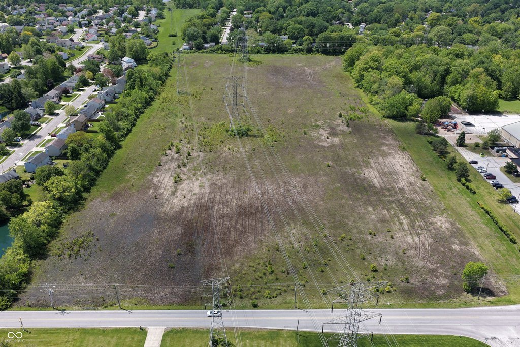
Lot Size20.80 Acres
Days on Market82
Property Features for 1100 N Cumberland Road
General Information
Property type
Land
Property subtype
Other
Zoning
D-A
Standard status
Active
APN
490834114001000700
Lot size
20.80 Acres
Taxes and HOA fees
Tax Year
2024
Tax Description
Nw1/4 Se1/4 S34 T16 R5 Beg 657.7Ft S Of Ne Cors660ft W 1324.7Ft N 660Ft E 1324.7Ft To Beg 20Ac
Utilities
Sewer type
Public Sewer
Listing Agency:
Keller Williams Indy Metro NE
(317) 564-7100
Listed By:
Sharon Stamper Thompson · License #RB14044406
(317) 564-7100
Added: May 7
Changed: Jun 16
Last Checked: Jul 27 at 1:06PM
MLS# 22088590
Copyright © 2026 MIBOR Service Corporation. All rights reserved. All information provided by the listing agent/broker is deemed reliable but is not guaranteed and should be independently verified.
Investment Insights
Based on property information with market context.
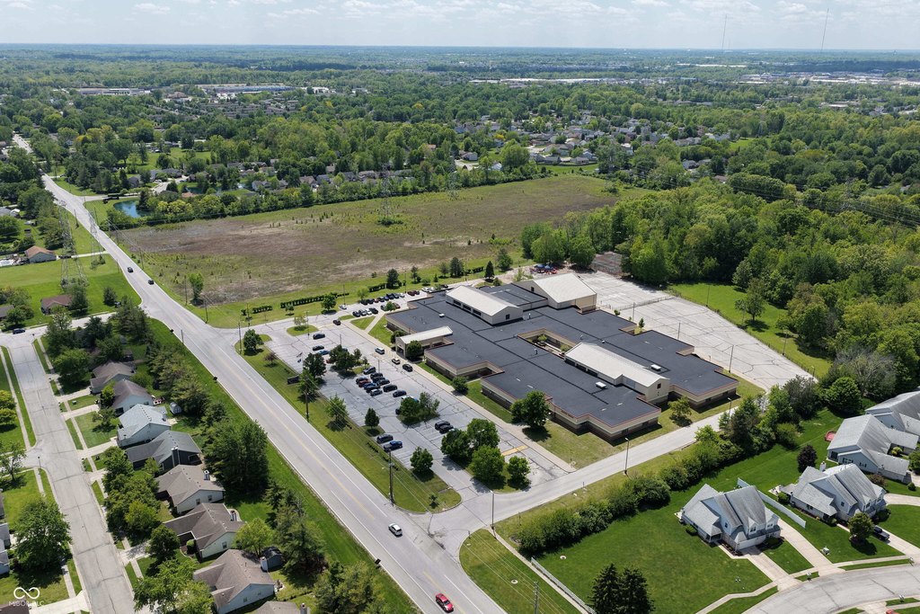
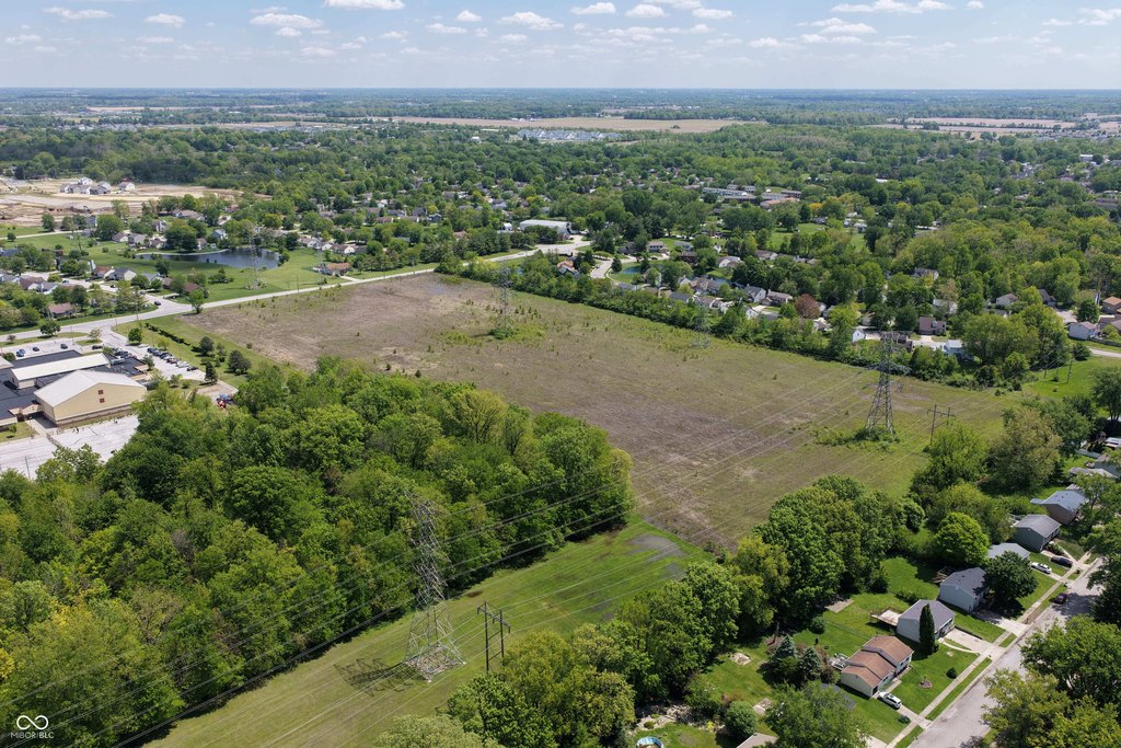
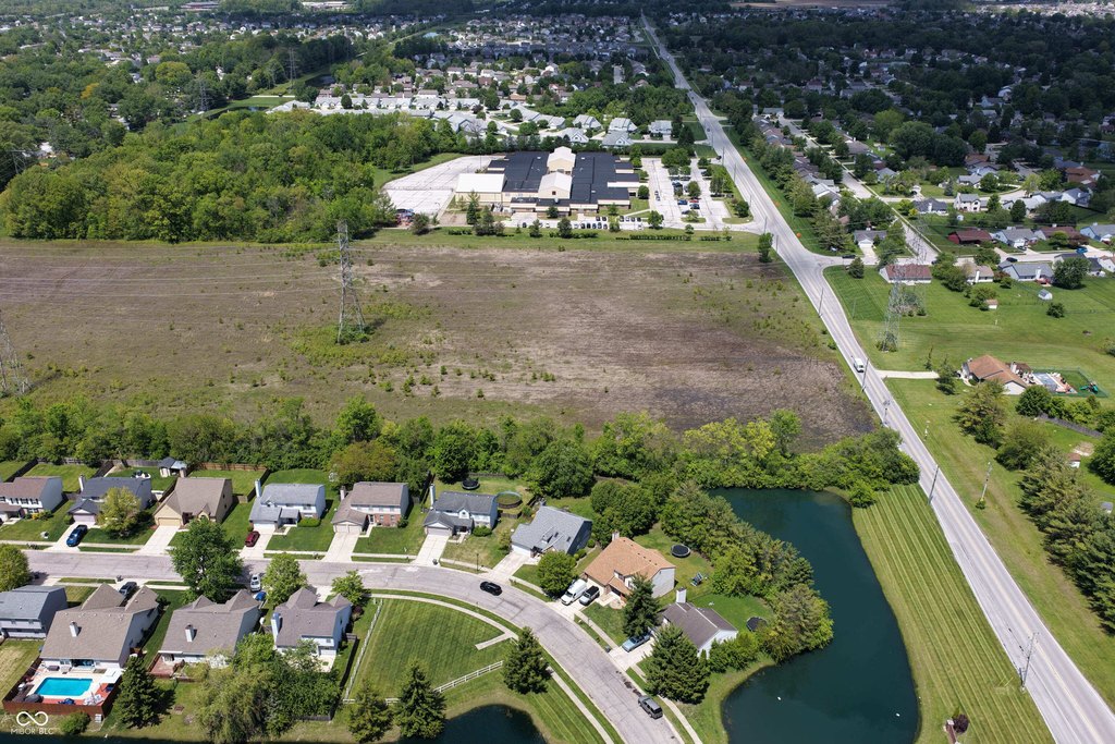
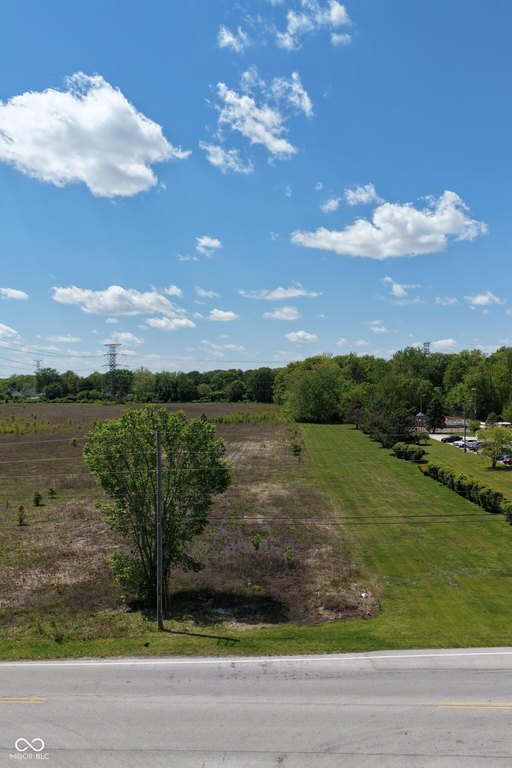
This property offers 20.8 acres of level land intended for residential development. The site is zoned D-A and has a Comprehensive Plan recommendation of Suburban Neighborhood, which supports lower-density residential development including single-family detached housing. The plan indicates densities of 1 to 5 dwelling units per acre. Multiple easements are present and will restrict portions of the land use and future development approvals. Utilities are described as being nearby, and more than 10 acres is identified as potentially available for development now.
The property is adjacent to Brookview Elementary School and is located near established residential neighborhoods. It is described as being within Warren Township Schools. The listing also notes proximity “just minutes” from Greenfield’s Amazon Warehouse complex and the Indianapolis Regional Airport.
For developers or land buyers seeking a lower-density, single-family residential project, the combination of D-A zoning, suburban neighborhood planning guidance, and a largely level site may support feasibility for a residential subdivision concept. Prospective buyers should plan for the impact of the existing easements, which may limit buildable areas and development approvals, along with confirmation of utility tie-ins during due diligence.
Key Highlights
- Over 20 acres of land for residential development adjacent to Brookview Elementary School
- Zoned D‑A with Comprehensive Plan recommendation of Suburban Neighborhood for lower‑density residential use
- Suburban Neighborhood density range supports 1 to 5 dwelling units per acre
Property Analytics
Property Profile
Location Intelligence
Current Use


Frequently Asked Questions
What type of property is this?
Residential land & home lot - Over 20 acres zoned D-A with a suburban neighborhood plan recommendation for lower-density single-family development.
Where is this residential land & home lot located?
The property is located at 1100 N Cumberland Road Indianapolis, IN.
What is the asking price?
The asking price for this property is $924,900.
What are key features of this property?
This property features: Over 20 acres of land for residential development adjacent to Brookview Elementary School; Zoned D‑A with Comprehensive Plan recommendation of Suburban Neighborhood for lower‑density residential use; Suburban Neighborhood density range supports 1 to 5 dwelling units per acre