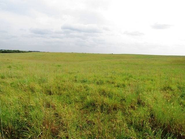
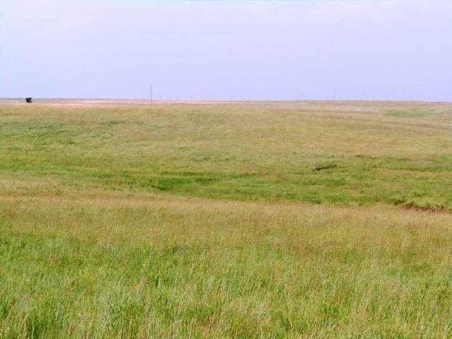
Agricultural Land with Pond
For Sale
$153,000
01 N 4020 Rd, Bartlesville, OK 74006
LAND - Bartlesville, OK
Property SizeContact for details
Lot Size36.00 Acres
Days on Market698
Property Features for 01 N 4020 Rd
General Information
Property type
Land
Property subtype
Other
Zoning description
Agricultural
Directions
Request Maps
Standard status
Active
Lot size
36.00 Acres
Listing Agency:
Cross Timbers Land LLC
(918) 287-1996
Listed By:
Jeff Henry
(918) 287-1996
Added: Sep 24, 2024
Changed: Jul 2
Last Checked: Aug 22 at 8:06PM
MLS# 11381341
Copyright © 2026 My State MLS. All rights reserved. All information provided by the listing agent/broker is deemed reliable but is not guaranteed and should be independently verified.
Investment Insights
Based on property information with market context.
This offering consists of individually surveyed agricultural tracts that are part of the Tyler Brent Ranch area just northeast of Bartlesville. The land features multiple draws and rolling terrain that create varied building sites, along with pond opportunities; an existing 1-acre pond is noted on the overall property. The tracts are currently unfenced and have legal access routes in place, including easements connecting tract access where applicable. Existing electricity is onsite, and a 2-inch rural water line is located a short distance to the west. The property is also described as having inactive oil wells on the full 160 acres and includes current road access into the tracts.
Location is on the north side of E 1800 Road. The tracts are described as minutes from town and approximately 0.70 miles north of the Tuxedo and CR 4020 intersection, with county road frontage varying by tract (about 1,000 feet for Tract B and about 1,735 feet for Tract C, as noted). All tracts are stated to be zoned Agricultural.
A strong fit for buyers seeking a ranchette near Bartlesville is the combination of agricultural zoning, seclusion created by draws, and documented water features. Tracts also appear practical for development plans given the marked acreages, onsite electricity, and multiple locations identified for building and pond improvements.
Location is on the north side of E 1800 Road. The tracts are described as minutes from town and approximately 0.70 miles north of the Tuxedo and CR 4020 intersection, with county road frontage varying by tract (about 1,000 feet for Tract B and about 1,735 feet for Tract C, as noted). All tracts are stated to be zoned Agricultural.
A strong fit for buyers seeking a ranchette near Bartlesville is the combination of agricultural zoning, seclusion created by draws, and documented water features. Tracts also appear practical for development plans given the marked acreages, onsite electricity, and multiple locations identified for building and pond improvements.
Key Highlights
- 160‑acre Agricultural‑zoned property just northeast of Bartlesville, minutes from town
- Four inactive oil wells on the 160 acres and existing road access into the tracts
- Multiple pond opportunities: includes existing 1‑acre pond plus multiple locations for a larger dam and smaller ponds
Property Analytics
Property Profile
Current Use
Lease Details
Yes
Paved road access
Location Intelligence
Demographics for 74006, OK
27,795
Population
11,820
Households
2.4
Avg Household Size
41
Median Age
40%
College-Educated
95%
High-School Grad
91.4 sq mi
ZIP Area
304
Density / Sq Mi
$74,139
Median Household Income
$40,031
Median Earnings
$960
Median Rent
$184,800
Median Home Value

Questions? Ask Rey
Realmo’s AI knows this listing — price, zoning, demand, history. Ask anything.




Frequently Asked Questions
What type of property is this?
Ranch - Zoned agricultural land with multiple draws, existing pond, and county road frontage for ranchette-style development.
Where is this ranch located?
The property is located at 01 N 4020 Rd Bartlesville, OK.
What is the asking price?
The asking price for this property is $153,000.
What are key features of this property?
This property features: 160‑acre Agricultural‑zoned property just northeast of Bartlesville, minutes from town; Four inactive oil wells on the 160 acres and existing road access into the tracts; Multiple pond opportunities: includes existing 1‑acre pond plus multiple locations for a larger dam and smaller ponds


