Waterfront Recreational Land
For Sale
$119,500
000 Moores Bend Rd, Cedarcreek, MO 65627
Wooded land with lake views and paved road access, providing a private setting for outdoor recreation or a future home site.
Days on Market79
Property Features for 000 Moores Bend Rd
General Information
Standard status
Active
Property subtype
Land
Additional Details
Road Access
Yes
Listing Agency:
Whitetail Properties Real Estate
(417) 351-8989
Listed By:
Darin Jenkins · License #2020003722
(417) 351-8989
Source:
Exprealty
Added: May 15
Changed: Jul 6
Last Checked: Jul 31 at 1:41PM
Displayed information is deemed reliable but is not guaranteed and should be independently verified. All listing content including descriptions, pricing, images are the copyrighted material of Whitetail Properties Real Estate
Investment Insights
Based on property information with market context.
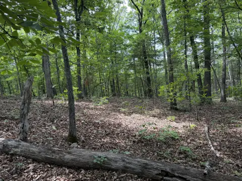
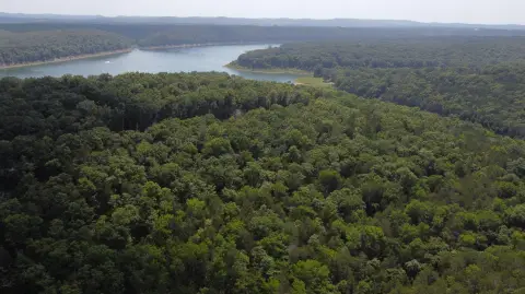
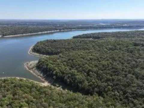
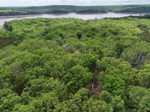
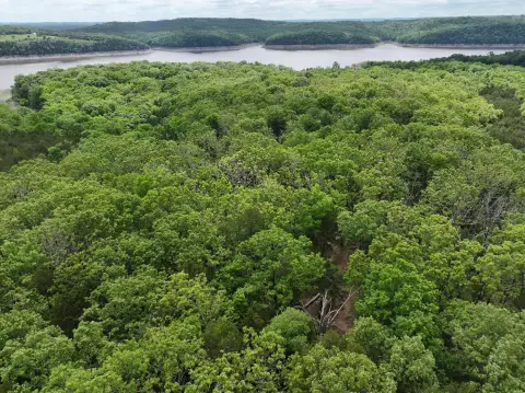
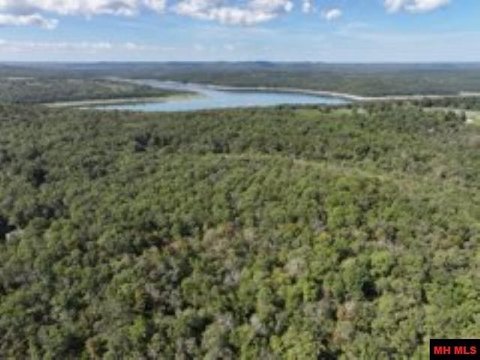
This wooded recreational land property overlooks Bull Shoals Lake and adjoins U.S. Army Corps of Engineers land, creating a secluded backdrop with natural privacy. The site offers diverse terrain, abundant wildlife habitat, and interior trails for exploring the property. With clearing and pruning, the land may be opened to develop multiple secluded build areas designed to showcase lake views. Electricity is available from the road, and there are also existing lines running through the property.
The property is accessed via paved road. It is located approximately 3 miles from public boat ramps, supporting recreational activities tied to the lake. The setting includes an established mix of cover and sightlines toward the water, with surrounding public land offering additional distance from neighboring development.
For buyers seeking a private lake-oriented retreat, this parcel offers a practical mix of access, on-site trails, and the ability to preserve privacy while selecting view-oriented build locations. It may also appeal to buyers looking for a recreational property where wildlife habitat and outdoor use are part of the day-to-day experience, with the option to develop future improvements using available electricity and potential cleared building sites.
Key Highlights
- Wooded land overlooking Bull Shoals Lake with potential for lake‑view building sites
- Adjoins U.S. Army Corps of Engineers land
- Paved road access with electricity available from the road and existing lines running through the property
Property Analytics
Current Use
Lease Details
Yes
Paved road access
Location Intelligence
Trade Area within ½ mile
1
Businesses Nearby
Explore this area
Business Placement
Demographics for 65627, MO
503
Population
422
Households
1.2
Avg Household Size
54
Median Age
30%
College-Educated
83%
High-School Grad
47.6 sq mi
ZIP Area
11
Density / Sq Mi
$58,813
Median Household Income
$36,681
Median Earnings
$127,900
Median Home Value

Questions? Ask Rey
Realmo’s AI knows this listing — price, zoning, demand, history. Ask anything.


Frequently Asked Questions
What type of property is this?
Waterfront Land - Wooded land with lake views and paved road access, providing a private setting for outdoor recreation or a future home site.
Where is this waterfront land located?
The property is located at 000 Moores Bend Rd Cedarcreek, MO.
What is the asking price?
The asking price for this property is $119,500.
What are key features of this property?
This property features: Wooded land overlooking Bull Shoals Lake with potential for lake‑view building sites; Adjoins U.S. Army Corps of Engineers land; Paved road access with electricity available from the road and existing lines running through the property


