00 County Road 5615 Bunker, MO 63629
New
- Added:
- May 6, 2026
- Days on Market:
- 2
- Last Refresh:
- May 7 at 1:06 am
Property Features for 00 County Road 5615
General Information
- Property type
- Land
- Property subtype
- Other
- Zoning
- Agricultural
- Standard status
- Pending
- APN
- 21-4.0-20-0-00-002.000
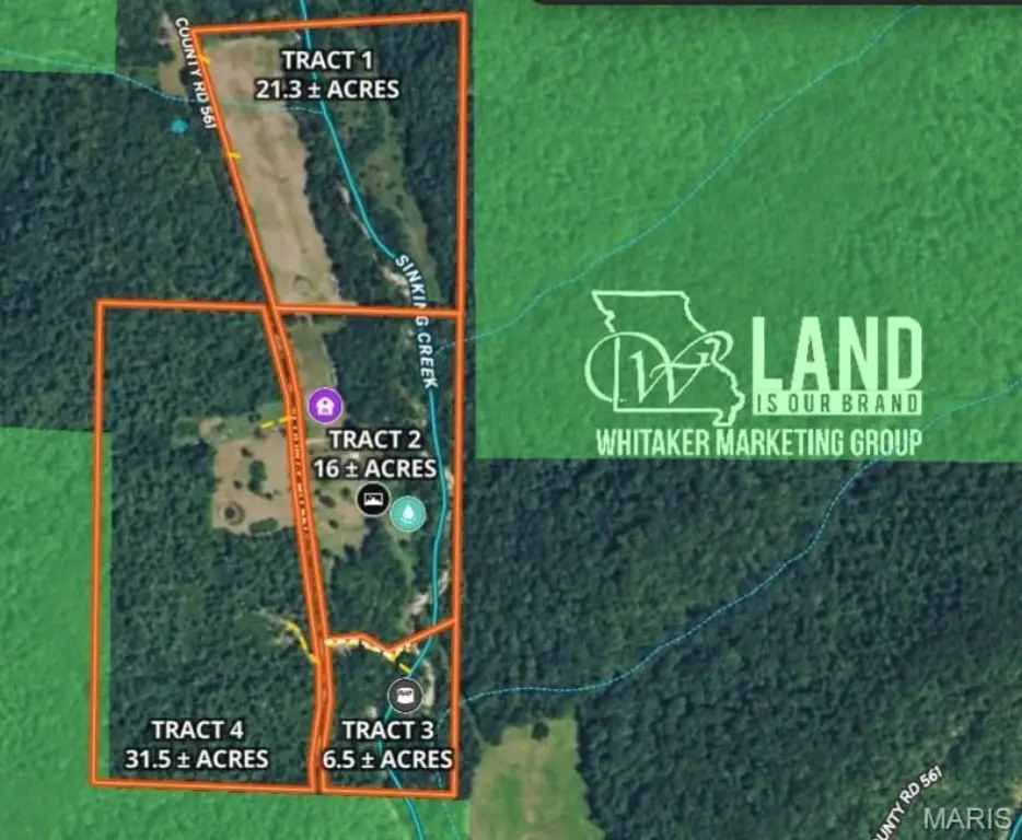
- Lot size
- 6.50 Acres
Taxes and HOA fees
- Tax Year
- 2025
- Tax Annual Amount
- 130
Utilities
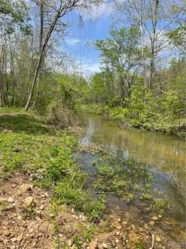
- Water front features
- Creek
Building Details
- Architectural style
- Other

Listing agent Kelly Johnston License #2013027356 (314) 412-2288
Listing office Whitaker Marketing Group 101 US Hwy 69, Ames, MO (515) 996-5263
Listing date May 6, 2026
MLS# 26025293
Listing URL
Copyright © 2026 Mid America Regional Information Systems, Inc. All rights reserved. All information provided by the listing agent/broker is deemed reliable but is not guaranteed and should be independently verified.
HighLights
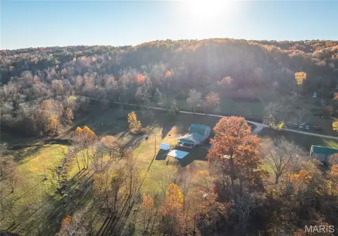
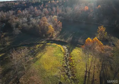
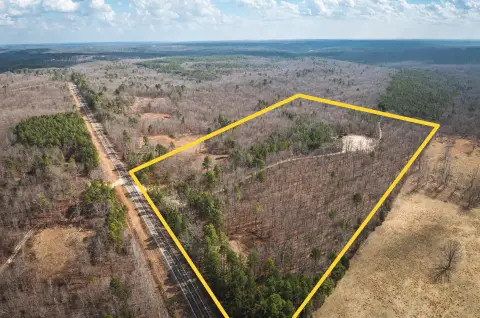
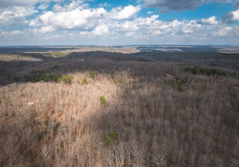
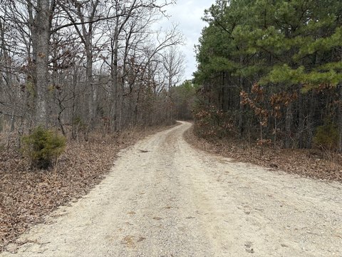
- 6.5 Acre Tract with Cleared Area on Sinking Creek
- Borders Mark Twain National Forest for Hunting and Recreation
- Creekside Location
- Potential for Cabin or Camper Site
- Live Water (Creek)
- Privacy
Overview
6.5 Acres Creekside Getaway Land
This 6.5-acre tract features a cleared area along Sinking Creek, suitable for a camper, cabin, or weekend getaway. The property borders Mark Twain National Forest, providing access to public land for hunting and recreation. Located in Bunker, MO, this land offers potential for various uses, given its agricultural zoning.
Property Profile
Insight Report
Location Intelligence
Current Use by Public Records
Recreation land
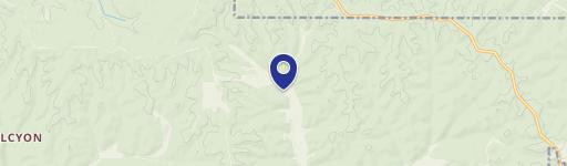
Map
- City
- Bunker
- County
- Reynolds
- State
- Missouri
- Longitude
- -91.298755
- Latitude
- 37.487284
Nearby Similar for Sale


FAQs
What type of property is this?
Recreation land - 6.5-acre parcel with creek access and bordering national forest.
Where is this recreation land located?
The property is located at 00 County Road 5615 Bunker, MO.
What is the asking price?
The asking price for this property is Off market.
What are key features of this property?
This property features: 6.5 Acre Tract with Cleared Area on Sinking Creek; Borders Mark Twain National Forest for Hunting and Recreation; Creekside Location


