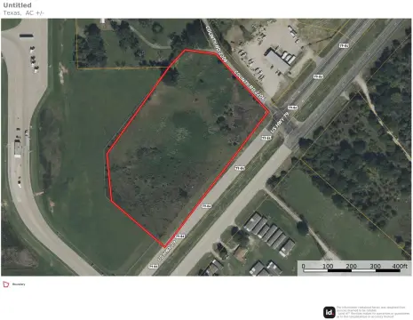
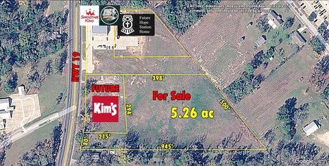
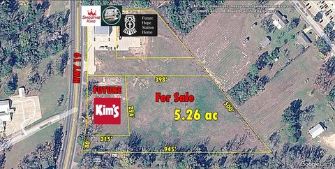
Corner Commercial Land
US HWY 79 Palestine, TX 75803
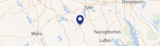
US HWY 79, Palestine, TX, 75803
$470,000
Pending
For Sale
$470,000
Pending
LAND - Palestine, TX
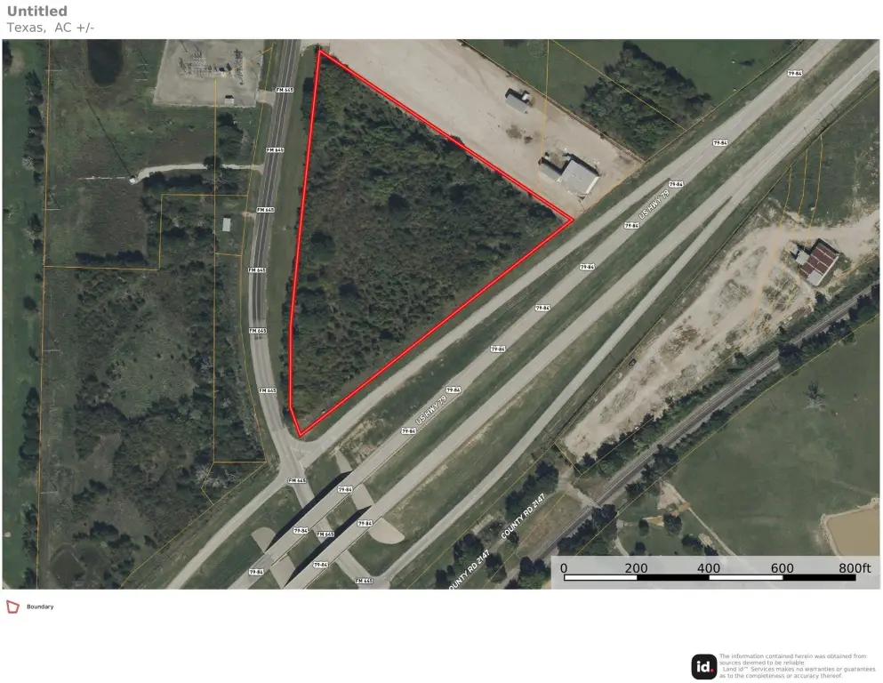
Lot Size8.45 Acres
Days on Market14
Property Features for US HWY 79
General Information
- Property type
- Land
- Property subtype
- Other
- Standard status
- Pending
- APN
- R66949
- Lot size
- 8.45 Acres
Taxes and HOA fees
- Tax Description
- A0052 PARKER, DANIEL JR BLOCK 1677 TRACT 4B
- Tax Annual Amount
- 1472
Building Details
- Floors in Building
- 1
- Number of units
- 1
Listing Agency
Staples Commercial Group, LLC
(903) 266-2900
Frankston, TX
Listed by
Dana Staples · License #0546841
(903) 876-1051
Added: Jul 6 Checked: Jul 19 at 8:06 pm
MLS# 21111024
Copyright © 2026 North Texas Real Estate Information Systems, Inc. All rights reserved. All information provided by the listing agent/broker is deemed reliable but is not guaranteed and should be independently verified.
Investment Insights
Based on property information with market context.
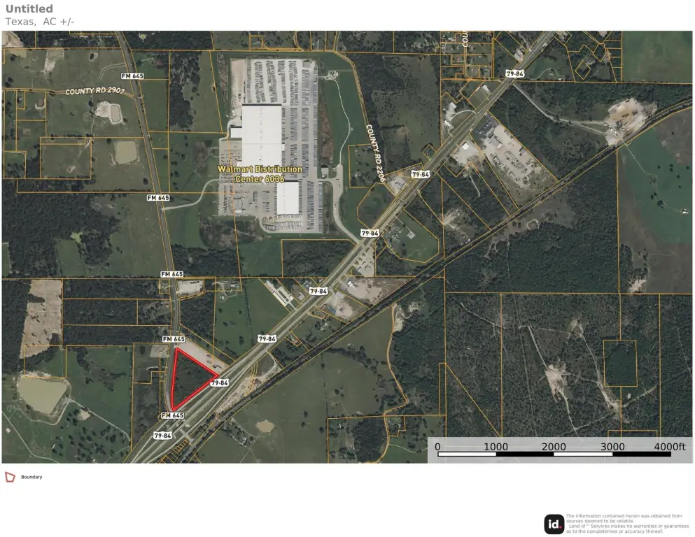
This 8.45-acre commercial corner tract is level and undeveloped, offering a clean site for a range of development concepts. The property is positioned along a high-visibility corridor on US Hwy 79 and features corner-lot access designed to support commercial exposure.
Located just south of Palestine, Texas city limits in Anderson County, the tract provides convenient access to major routes and nearby local amenities. Utilities are available nearby, supporting site readiness for future improvements.
The frontage and visibility along US Hwy 79 make the property well-suited for retail, service businesses, restaurants, storage facilities, distribution, or light industrial development. Its location just outside the city limits may offer development flexibility and potential tax advantages.
Key Highlights
- 8.45‑acre level, undeveloped commercial corner tract located just south of the Palestine, TX city limits
- Corner lot along US Hwy 79 with high‑traffic visibility
- Utilities are available nearby
Property Analytics
Property Profile
Location Intelligence
Current Use by Public Records
Commercial land
Similar For Sale Nearby

FAQs
What type of property is this?
Commercial land - 8.45-acre undeveloped, level corner tract along US Hwy 79 just south of Palestine city limits.
Where is this commercial land located?
The property is located at US HWY 79 Palestine, TX.
What is the asking price?
The asking price for this property is $470,000.
What are key features of this property?
This property features: 8.45‑acre level, undeveloped commercial corner tract located just south of the Palestine, TX city limits; Corner lot along US Hwy 79 with high‑traffic visibility; Utilities are available nearby