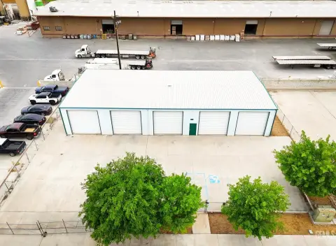
Industrial Land with Rezoning
Taft Hwy 119 Bakersfield, CA 93311
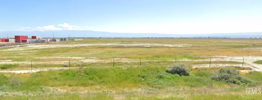
Taft Hwy 119, Bakersfield, CA, 93311
$2,500,000
For Sale
$2,500,000
LAND - Bakersfield, CA
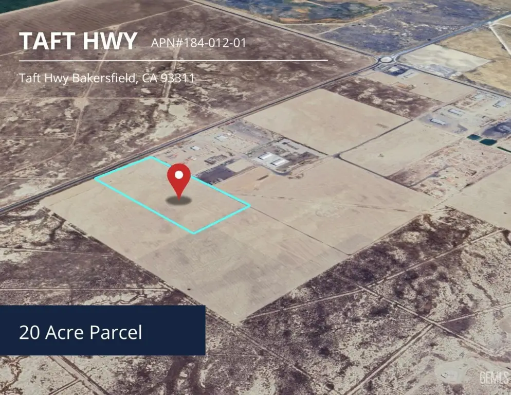
Lot Size20.00 Acres
Days on Market95
Property Features for Taft Hwy 119
General Information
- Property type
- Land
- Property subtype
- Other
- Standard status
- Active
- APN
- 00000001
- Lot size
- 20.00 Acres
Listing agency
Miramar Realty
(661) 381-6500
Listed by
Litashi Litashi
(661) 751-8016
Added: Apr 20 Updated: Jun 2 at 3:40PM Checked: Jul 23 at 8:06AM
MLS# 202604260
Copyright © 2026 Bakersfield Association of Realtors. All rights reserved. All information provided by the listing agent/broker is deemed reliable but is not guaranteed and should be independently verified.
Investment Insights
Based on property information with market context.
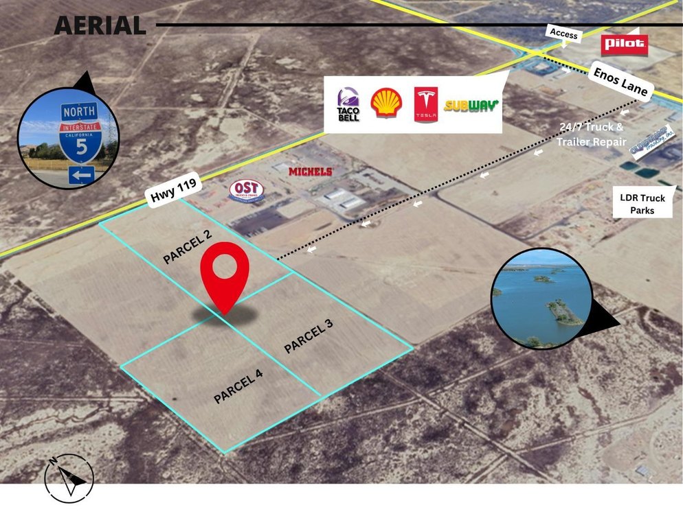
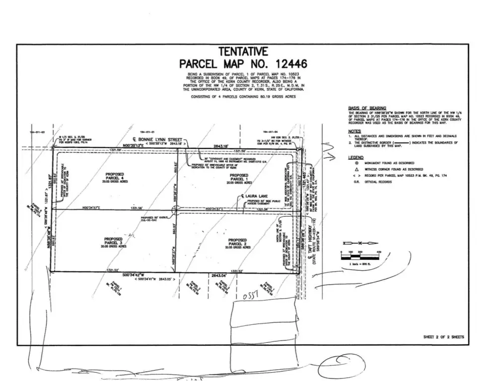
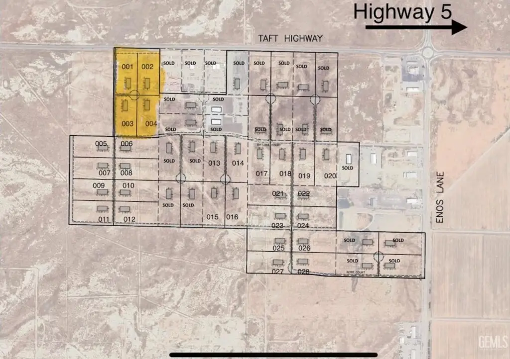
This offering presents a 20-acre parcel of industrial land positioned for investment and development. The property’s existing land use is Agricultural (AG), and a zoning change application has been submitted and paid, currently pending approval to rezone to M-2 Industrial. The ownership plan also contemplates subdividing the existing APN into four parcels, creating flexibility for phased development, multiple end users, or resale strategies. Documentation is available upon request, providing visibility into the rezoning effort and the proposed subdivision concept.
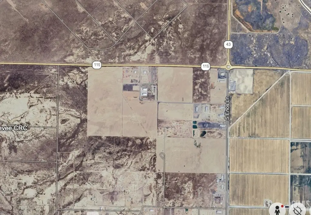
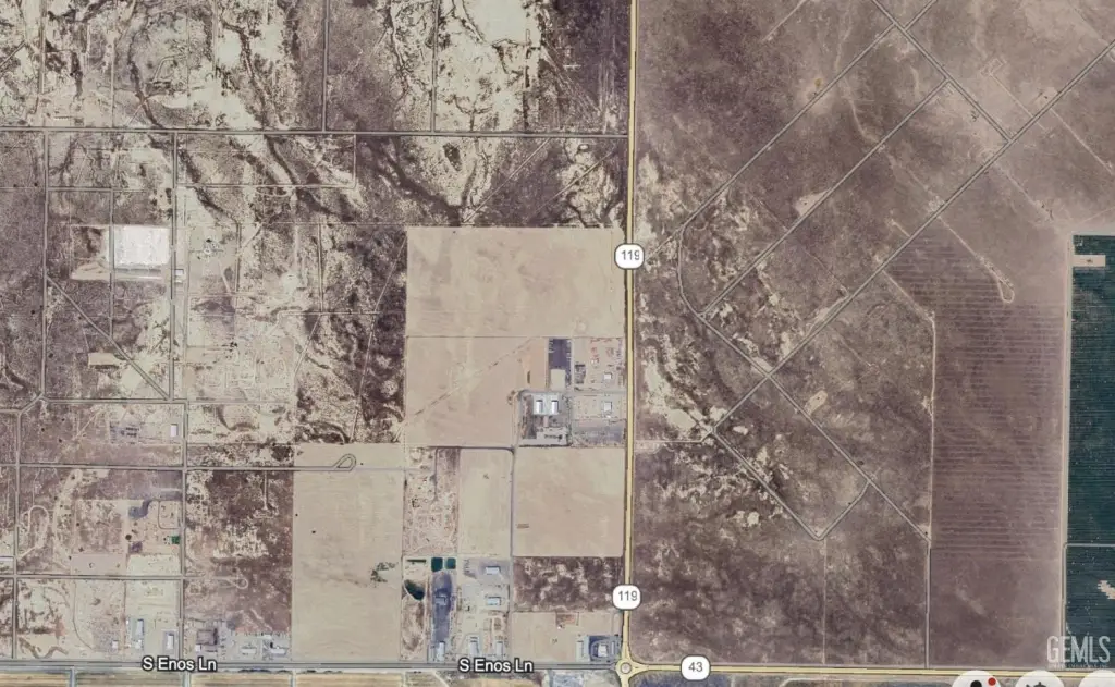
The site is located in Bakersfield’s growing industrial corridor and is described as being near Interstate 5, supporting regional transportation, freight, and distribution access. The surrounding area is experiencing ongoing industrial and commercial expansion, which is relevant for long-term demand and future growth expectations. Connectivity to a major interstate is a practical consideration for logistics-oriented projects and manufacturing users.
For investors, this land is well-suited to a development strategy that can benefit from the potential shift to M-2 Industrial and the ability to structure the project across four parcels. For industrial operators, the property offers an opportunity to secure a large footprint with subdivision flexibility should operational needs evolve over time. As the rezoning is pending, interested parties may want to review the submitted documentation to understand the application status and next steps.
Key Highlights
- Large 20‑acre parcel ideal for industrial, logistics, or manufacturing use.
- Strategic location near Interstate 5, providing strong regional connectivity.
- Pending zoning change to M‑2 Industrial, enhancing development potential.
Property Analytics
Property Profile
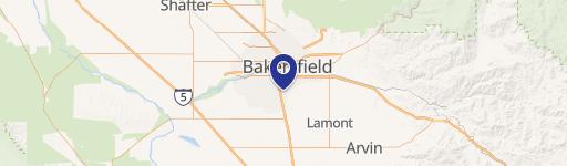
Location Intelligence
Current Use by Public Records
Industrial land
Similar For Sale Nearby


FAQs
What type of property is this?
Industrial land - Large 20-acre parcel with pending rezoning to M-2, designed for phased industrial, logistics, or manufacturing development.
Where is this industrial land located?
The property is located at Taft Hwy 119 Bakersfield, CA.
What is the asking price?
The asking price for this property is $2,500,000.
What are key features of this property?
This property features: Large 20‑acre parcel ideal for industrial, logistics, or manufacturing use.; Strategic location near Interstate 5, providing strong regional connectivity.; Pending zoning change to M‑2 Industrial, enhancing development potential.


