Commercial Land near
VL 8.59 AC S Old 27 Highway Gaylord, MI 49735
VL 8.59 AC S Old 27 Highway, Gaylord, MI, 49735
$519,000
For Sale
$519,000
LAND - Gaylord, MI
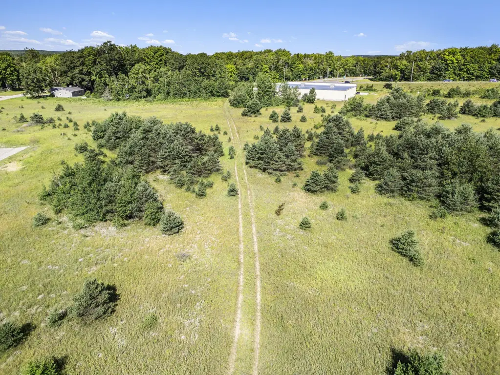
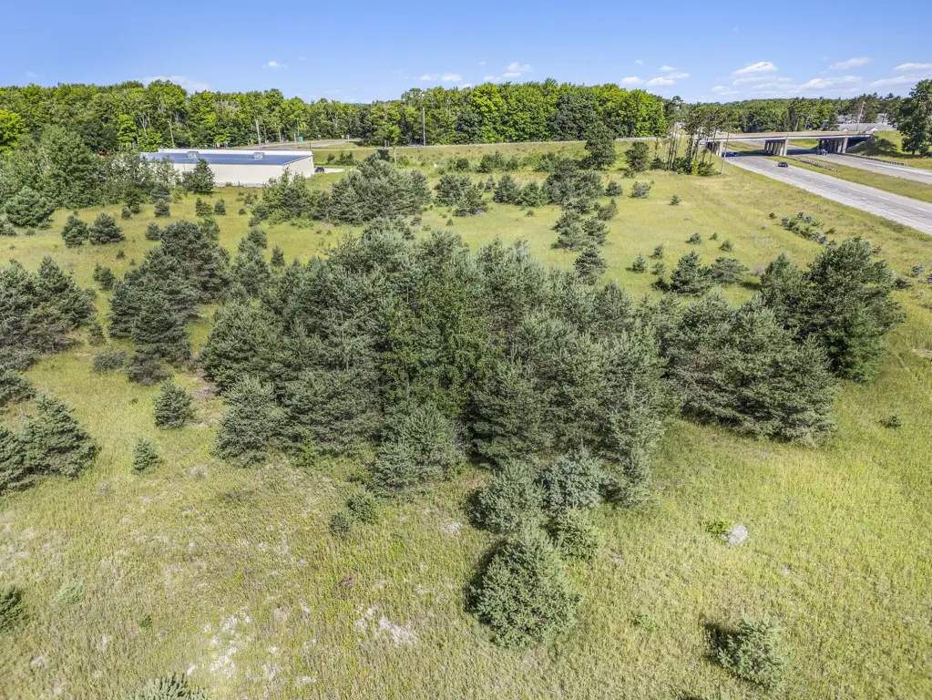
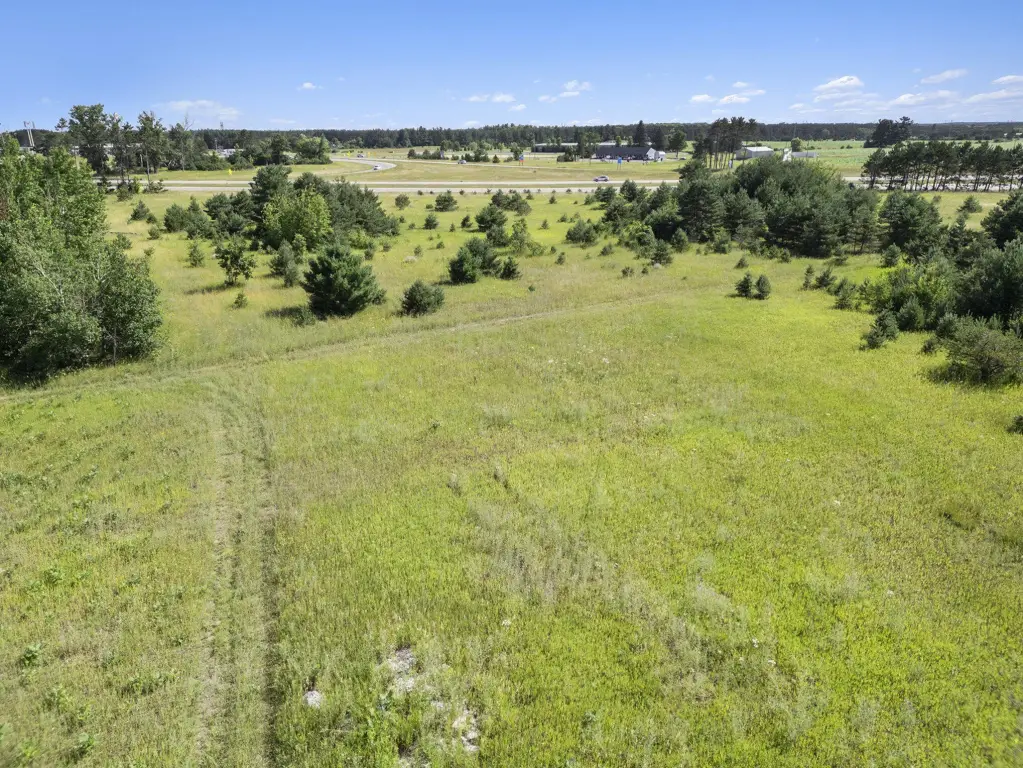
Lot Size8.59 Acres
Days on Market92
Property Features for VL 8.59 AC S Old 27 Highway
General Information
- Property type
- Land
- Property subtype
- Other
- Zoning
- B-2
- Standard status
- Active
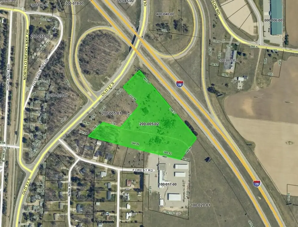
- APN
- 010-021-200-005-02
- Lot size
- 8.59 Acres
Taxes and HOA fees
- Tax Description
- COMM @ N 1/4 COR, TH S1 degrees 4'E 462.2' FOR POB, TH S41 degrees 47'48''E 403.64', TH 356.37' ALG CURVE TO RIGHT, RAD 5614.58', LC S39 degrees 58'43''E 356.31', TH S37 degrees 30'19''W 249.64', TH N75 degrees 34'43''W 369.82', TH N75 degrees 34'55''W 544.89', TH N44 degrees 55'54''E 186.59', TH S71 degrees 42'14''E 174
Listing Agency
The TEAM Real Estate Group
(989) 732-6500
2680 M-32, Gaylord, MI
Listed by
Brian Wallace · License #6501403871
(989) 858-5426
Added: Apr 16 Checked: Jul 16 at 11:06 pm
MLS# 201839476
Listing URL
Copyright © 2026 Water Wonderland Board of Realtors®. All rights reserved. All information provided by the listing agent/broker is deemed reliable but is not guaranteed and should be independently verified.
Investment Insights
Based on property information with market context.
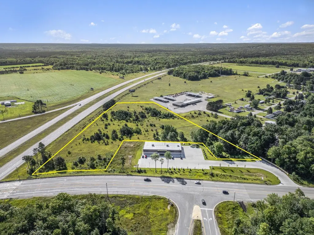
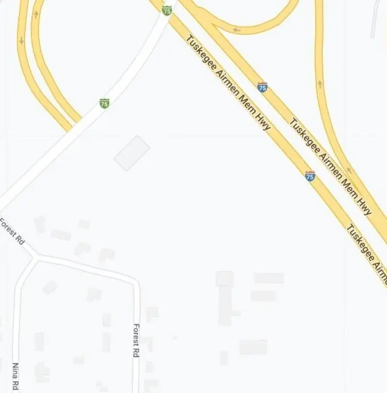
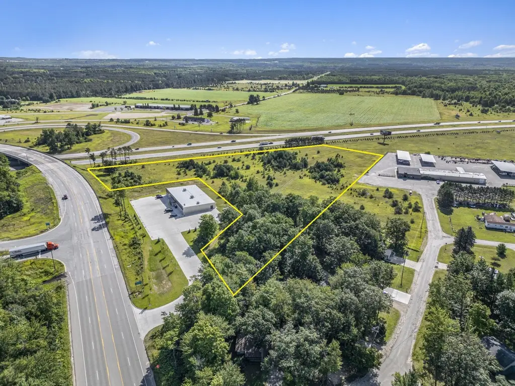
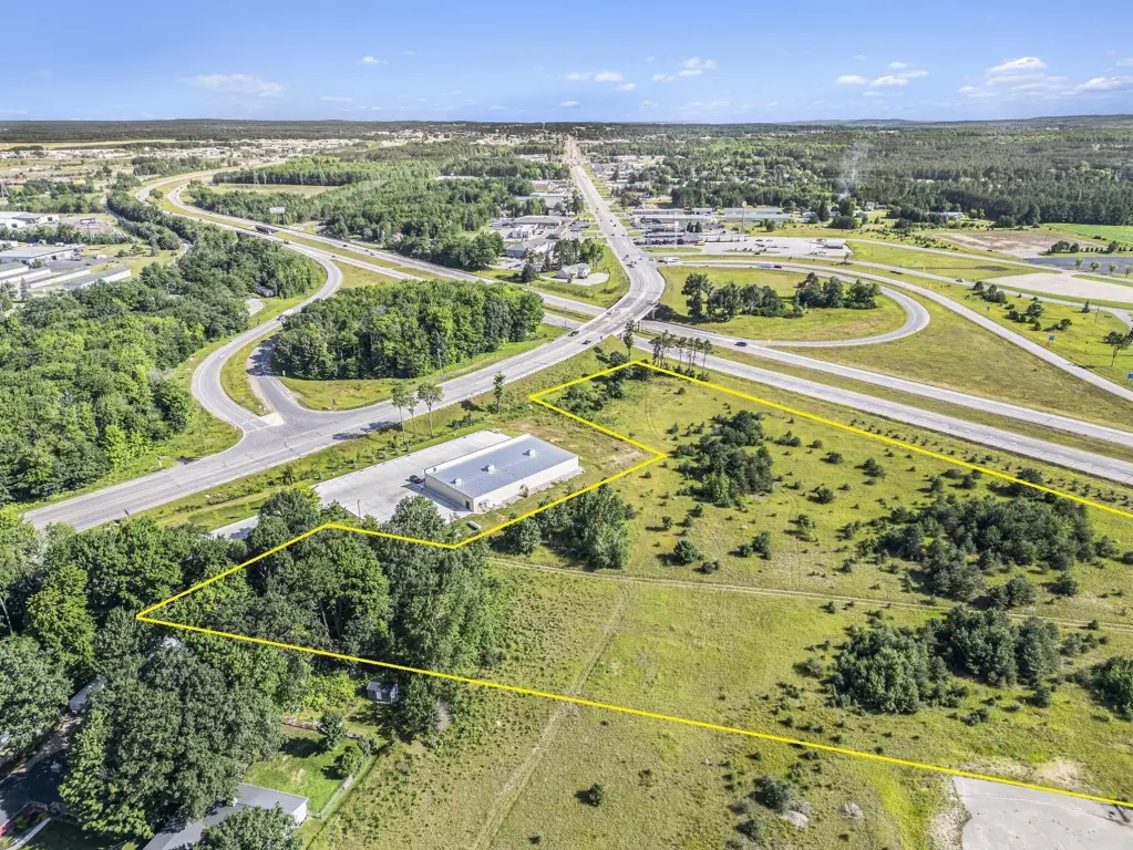
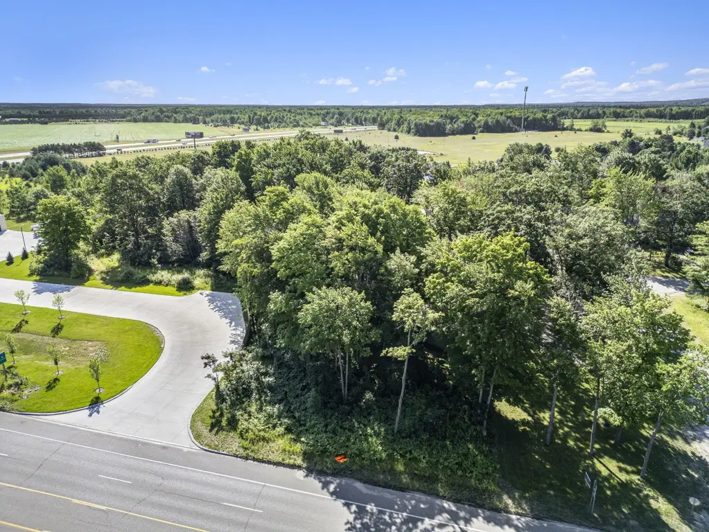
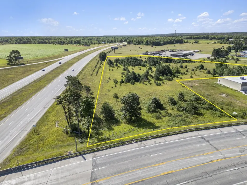
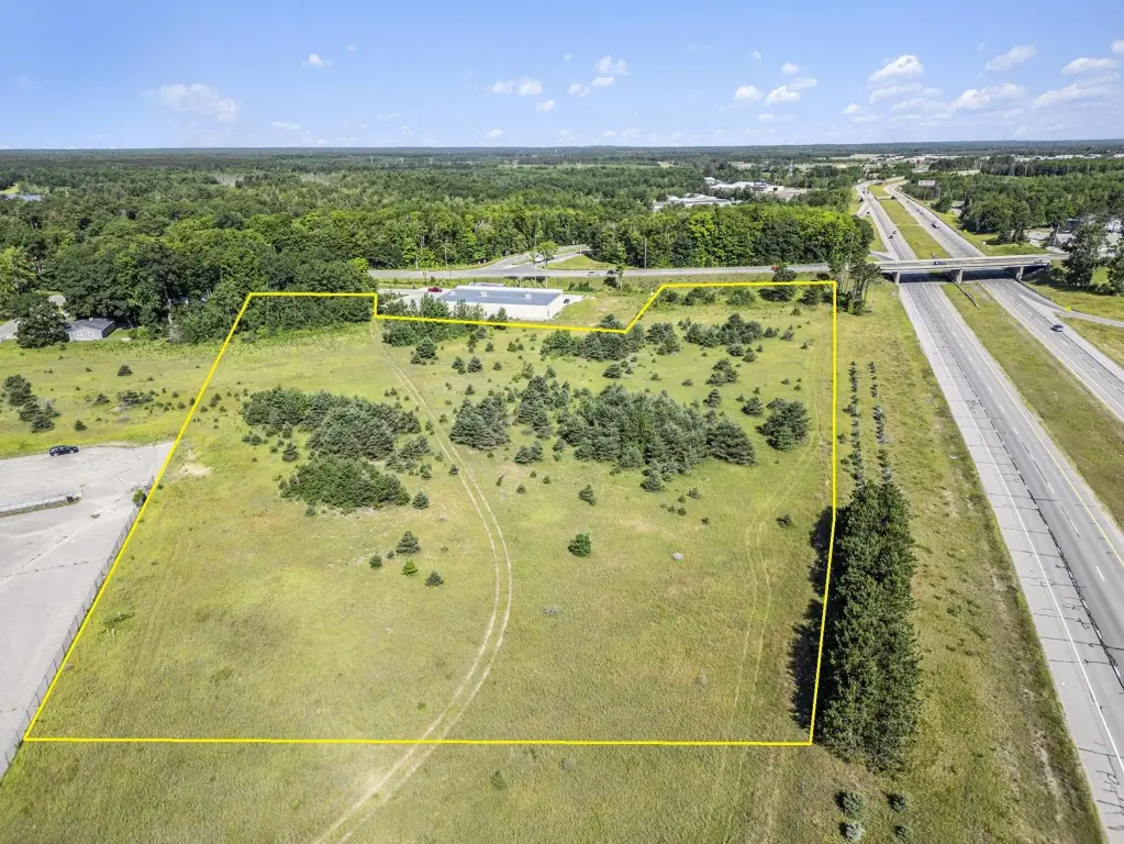
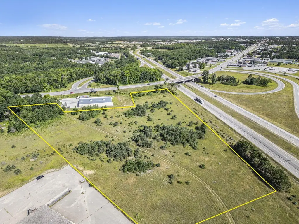
This 8.59-acre commercial land parcel features 830 feet of frontage along I-75. The property is located just south of the south Gaylord exit (exit 279) and neighbors the new Dollar General. Zoned B-2, the site is located in Gaylord, MI.
Key Highlights
- Expansive 8.59‑acre commercial parcel.
- High visibility with 830 feet of frontage on I‑75.
- Prime location just south of Gaylord exit (exit 279).
Property Analytics
Property Profile
Location Intelligence
Current Use by Public Records
Commercial land
Similar For Sale Nearby
FAQs
What type of property is this?
Commercial land - 8.59-acre commercial land with I-75 frontage in Gaylord, MI.
Where is this commercial land located?
The property is located at VL 8.59 AC S Old 27 Highway Gaylord, MI.
What is the asking price?
The asking price for this property is $519,000.
What are key features of this property?
This property features: Expansive 8.59‑acre commercial parcel.; High visibility with 830 feet of frontage on I‑75.; Prime location just south of Gaylord exit (exit 279).