Corner Recreation Land
Oak Tree Lane Fountain, FL 32438
For Sale
$67,000
LAND - Fountain, FL
Lot Size16.10 Acres
Days on Market305
Property Features for Oak Tree Lane
General Information
- Property type
- Land
- Property subtype
- Other
- Standard status
- Active
- APN
- 03170-060-000
- Lot size
- 16.10 Acres
Taxes and HOA fees
- Tax Year
- 2024
- Tax Description
- 27 2N 12W 193 COM AT NE COR TH W 1599.63' SELY 455.42' FOR POB TH SELY 145.64' SWLY 259.38' W 1414.45 TO CENTER OF STREAM TH NLY 304 TH E 1486.21' TO POB ***AND** COM AT NE COR TH W 2776.06' TO CENTER OF CREEK FOR POB TH W 633.48' SELY 641.72' E 439. 27' TO CENTER OF CREEK TH NLY 730.8' TO POB LESS & EXCEPT COM AT NE COR TH W 1599.63' FOR POB TH SELY 455.42' W 1486.21'
- Tax Annual Amount
- 514
Utilities
- Sewer type
- Septic Needed
Listing Agency:
World Impact Real Estate
(850) 225-7000
Listed By:
Danielle Britton · License #3412821
(850) 596-4944
Added: Sep 24, 2025
Changed: Jun 5
Last Checked: Jul 25 at 9:06AM
MLS# 779508
Copyright © 2026 Central Panhandle Association of REALTORS. All rights reserved. All information provided by the listing agent/broker is deemed reliable but is not guaranteed and should be independently verified.
Investment Insights
Based on property information with market context.
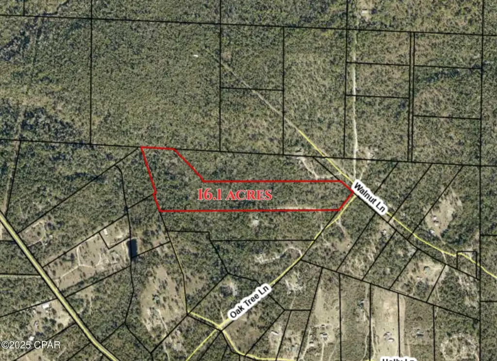
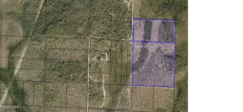
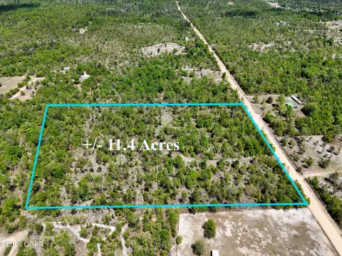
This listing offers a 16.1-acre corner land parcel in Fountain, suitable for recreation-oriented use and residential lot concepts. The site includes a reported split between approximately 9 acres outside the flood zone and about 7 acres in Flood Zone A, supporting different planning approaches across the property. The terrain is described as having a distinctive natural outline, which may appeal to owners looking for character and open space.
The property is positioned as a corner at Oak Tree and Walnut, giving it a layout defined by two sides. A key planning consideration reflected in the remarks is the portion of land outside the flood zone versus the portion within Flood Zone A, which can affect how future site improvements are arranged.
For buyers and operators evaluating development or personal-use land, the flood-zone delineation is the primary practical factor highlighted here. The area outside the flood zone is positioned for development planning, while the Flood Zone A acreage is presented as more suitable for open space, recreation, or landscaping ideas. Those looking for a larger, distinctive corner parcel with a clear flood-zone breakdown may find this property worth reviewing in person.
Key Highlights
- 16.1‑acre corner lot at the intersection of Oak Tree and Walnut in Fountain
- Approx. 9 acres are outside the flood zone
- Approx. 7 acres are in Flood Zone A
Property Analytics
Property Profile
Location Intelligence
Current Use by Public Records
Recreation land


FAQs
What type of property is this?
Recreation land - A 16.1-acre corner parcel with flood-zone split, offering flexible space for outdoor recreation and development planning.
Where is this recreation land located?
The property is located at Oak Tree Lane Fountain, FL.
What is the asking price?
The asking price for this property is $67,000.
What are key features of this property?
This property features: 16.1‑acre corner lot at the intersection of Oak Tree and Walnut in Fountain; Approx. 9 acres are outside the flood zone; Approx. 7 acres are in Flood Zone A