Corner Commercial Land


For Sale
$750,000
N State Route 89, Ash Fork, AZ 86320
Land, Ash Fork, AZ
Property SizeContact for details
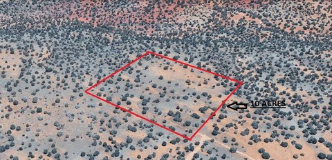
Lot Size26.33 Acres
Days on Market295
Property Features for N State Route 89
General Information
Property type
Land
Property subtype
Other
Zoning
R1-175
Fencing
Perimeter, Barbed Wire
View
City
Directions
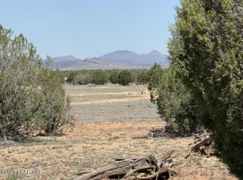
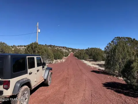
Property is located on the southwest corner of state route 89 and I40. There is dirt road access to the property, I suggest a high clearance vehicle. Please call listing agent for those directions.
Standard status
Active
Lot size
26.33 Acres
Taxes and HOA fees
Tax Year
2025
Tax Description
IRREG PCL LYING WEST OF U S HWY 89 NORTH OF EAST-WEST MID-SECTION LINE AND SOUTH OF PROPERTY DEEDED TO STATE AND DESC IN 1361 48 S EC 11 21 2W CONT 26.33 AC 1510 865
Tax Annual Amount
5
Legal Description
IRREG PCL LYING WEST OF U S HWY 89 NORTH OF EAST-WEST MID-SECTION LINE AND SOUTH OF PROPERTY DEEDED TO STATE AND DESC IN 1361 48 S EC 11 21 2W CONT 26.33 AC 1510 865
Listing Agency:
Realty Executives Arizona Territory
(928) 777-0077
Listed By:
Rachelle Fernow · License #SA698555000
(928) 533-6334
Added: Nov 19, 2025
Changed: Sep 10
Last Checked: Sep 10 at 1:06AM
MLS# 1078276
Copyright © 2026 Prescott Area Association of Realtors®. All rights reserved. All information provided by the listing agent/broker is deemed reliable but is not guaranteed and should be independently verified.
Investment Insights
Based on property information with market context.
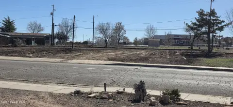
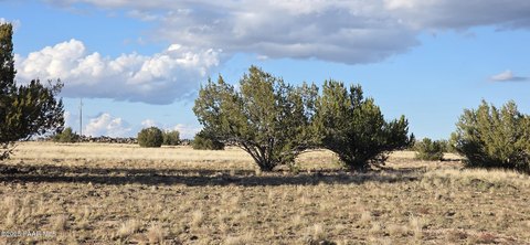
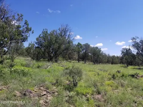
This 26.33-acre commercial land parcel occupies the southwest corner of State Route 89 and Interstate 40 in Ash Fork. The property is currently zoned R1-175 for low-density residential use and is used for cattle grazing. Perimeter barbed-wire fencing encloses the open land, while electrical service and municipal water are available to the parcel.
An estimated 20,000 vehicles pass the intersection each day. The property is 18 miles from Williams, 45 minutes from Flagstaff, one hour from Prescott, and 87 miles from the Grand Canyon. Its position along State Route 89 and Interstate 40 provides direct regional roadway access within North Central Arizona.
An estimated 20,000 vehicles pass the intersection each day. The property is 18 miles from Williams, 45 minutes from Flagstaff, one hour from Prescott, and 87 miles from the Grand Canyon. Its position along State Route 89 and Interstate 40 provides direct regional roadway access within North Central Arizona.
Key Highlights
- 26.33 acres at the southwest corner of State Route 89 and Interstate 40
- R1‑175 zoning for low‑density residential use
- Estimated traffic volume of 20,000 vehicles per day
Property Analytics
Current Use
Lease Details
20,000 VPD
Traffic count
Yes
Highway access
Yes
Paved road access
Location Intelligence
Trade Area within ½ mile
36
Businesses Nearby
Explore this area
Business Placement
Demographics for 86320, AZ
2,111
Population
1,349
Households
1.6
Avg Household Size
55
Median Age
13%
College-Educated
82%
High-School Grad
806.8 sq mi
ZIP Area
3
Density / Sq Mi
$43,553
Median Household Income
$41,131
Median Earnings
$1,063
Median Rent
$186,600
Median Home Value

Questions? Ask Rey
Realmo’s AI knows this listing — price, zoning, demand, history. Ask anything.

Frequently Asked Questions
What type of property is this?
Commercial land - The parcel has R1-175 zoning, perimeter fencing, and access to electrical service and municipal water.
Where is this commercial land located?
The property is located at N State Route 89 Ash Fork, AZ.
What is the asking price?
The asking price for this property is $750,000.
What are key features of this property?
This property features: 26.33 acres at the southwest corner of State Route 89 and Interstate 40; R1‑175 zoning for low‑density residential use; Estimated traffic volume of 20,000 vehicles per day