City-Limits Development
Millsap Road Tontitown, AR 72762
Millsap Road, Tontitown, AR, 72762
$4,200,000
For Sale
$4,200,000
LAND - Tontitown, AR
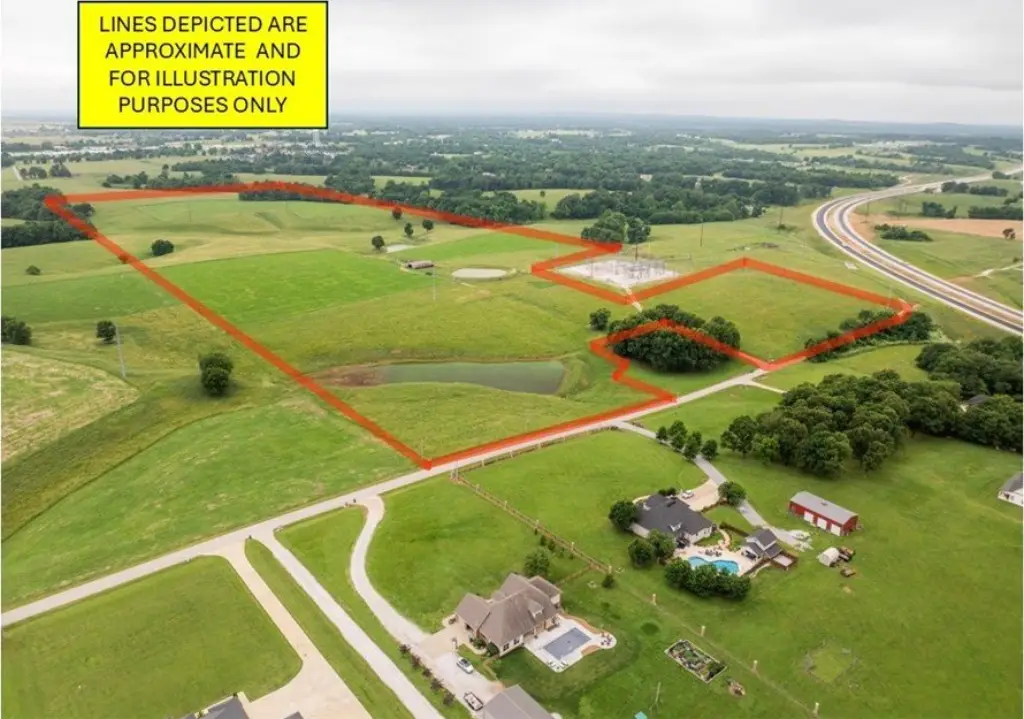
Lot Size71.39 Acres
Days on Market59
Property Features for Millsap Road
General Information
- Property type
- Land
- Property subtype
- Other
- Fencing
- Fenced
- Standard status
- Active
- APN
- 830-37987-000
- Lot size
- 71.39 Acres
Taxes and HOA fees
- Tax Description
- See attachment for full legal description.
- Tax Annual Amount
- 109
Utilities
- Sewer type
- Public Sewer
- Water source
- Public
- Water front features
- Pond
Listing Agency
The Griffin Company Commercial Division-Springdale
(479) 756-1003
5100 S Thompson, Springdale, AR
Listed by
Sarah Brothers · License #EB53350-D01
(479) 871-6678
Added: May 21 Checked: Jul 18 at 4:06 am
MLS# 1348115
Listing URL
Copyright © 2026 ArkansasONE MLS. All rights reserved. All information provided by the listing agent/broker is deemed reliable but is not guaranteed and should be independently verified.
Investment Insights
Based on property information with market context.
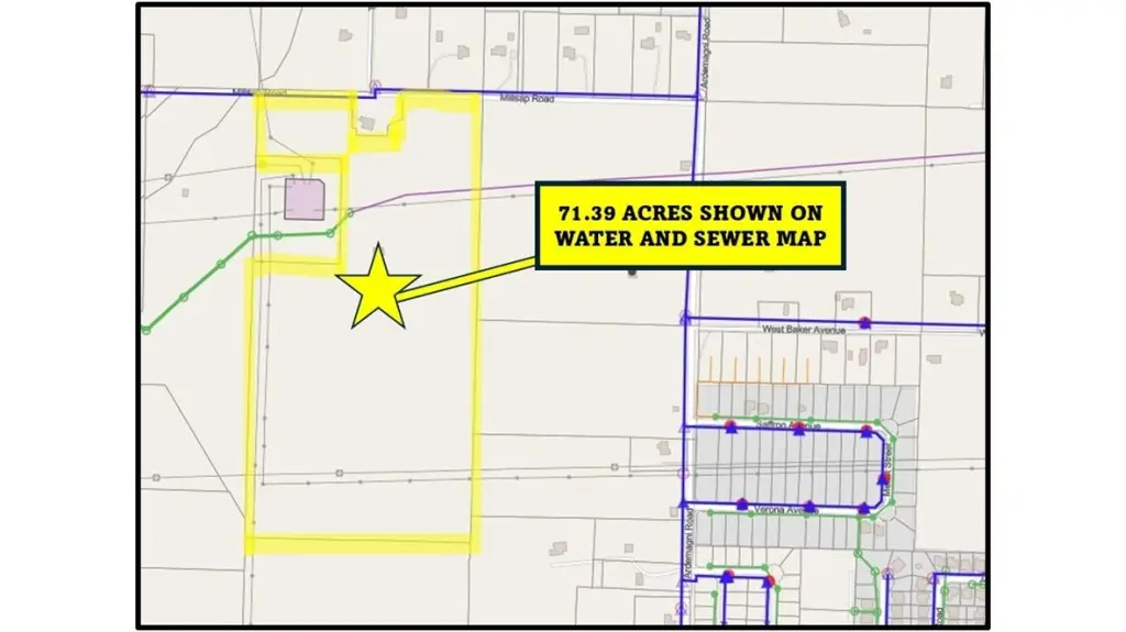
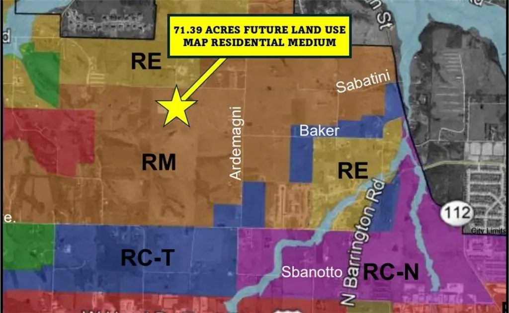
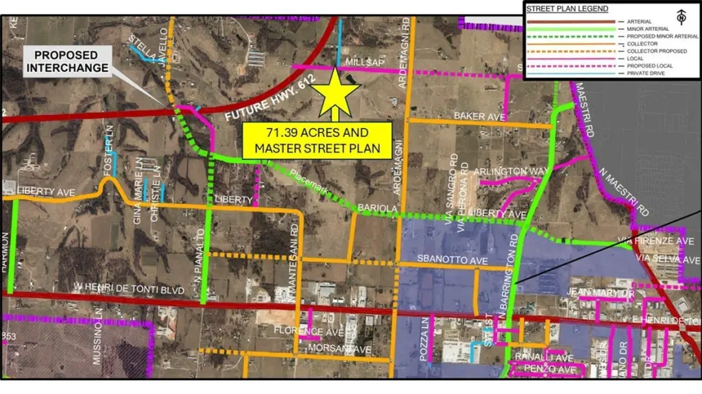
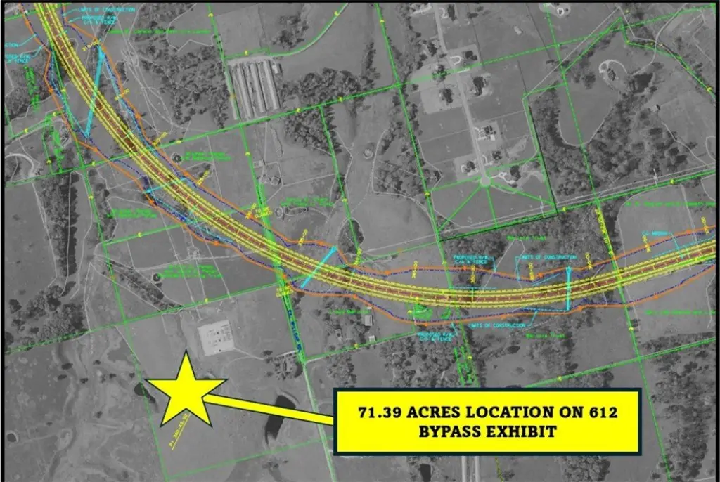
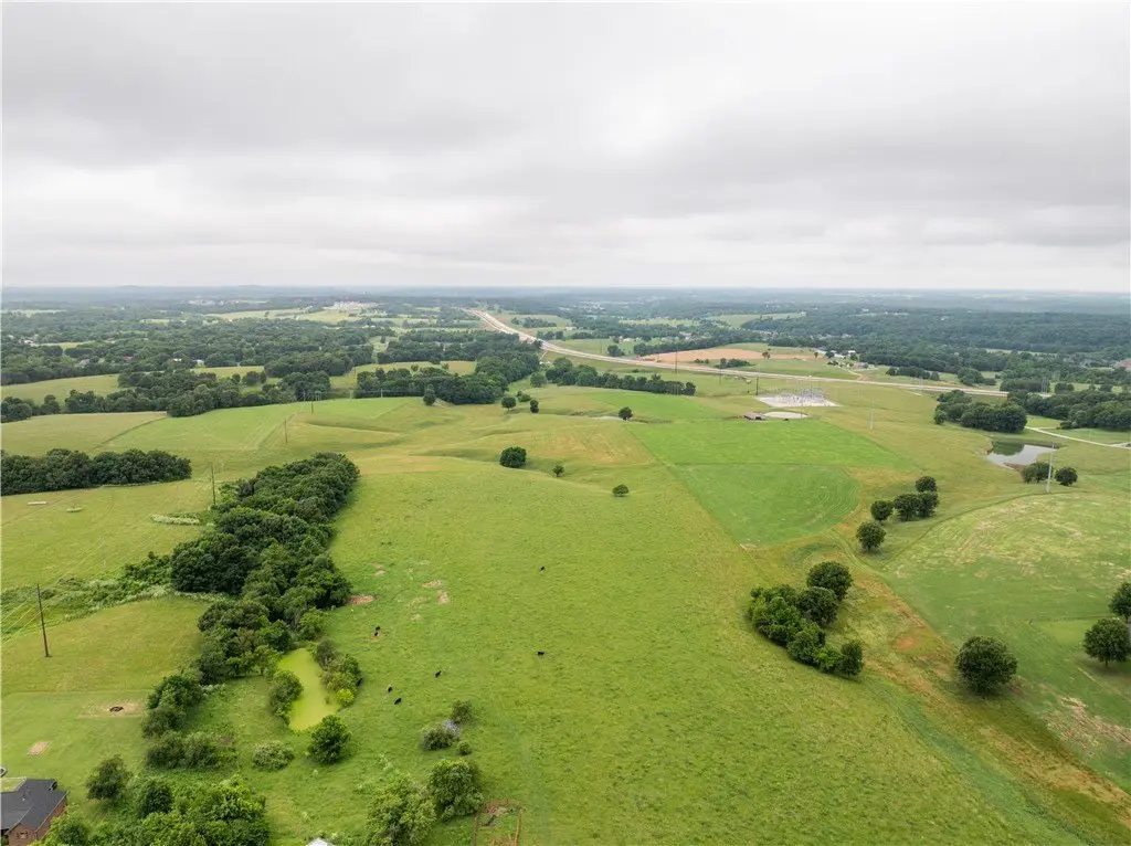
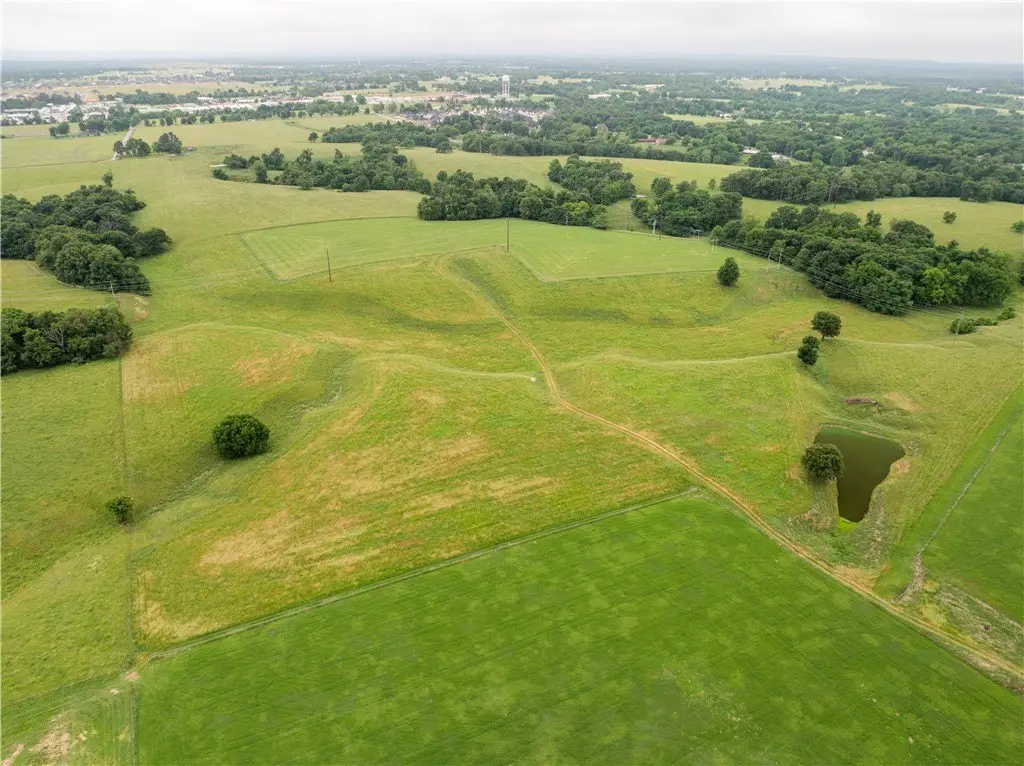
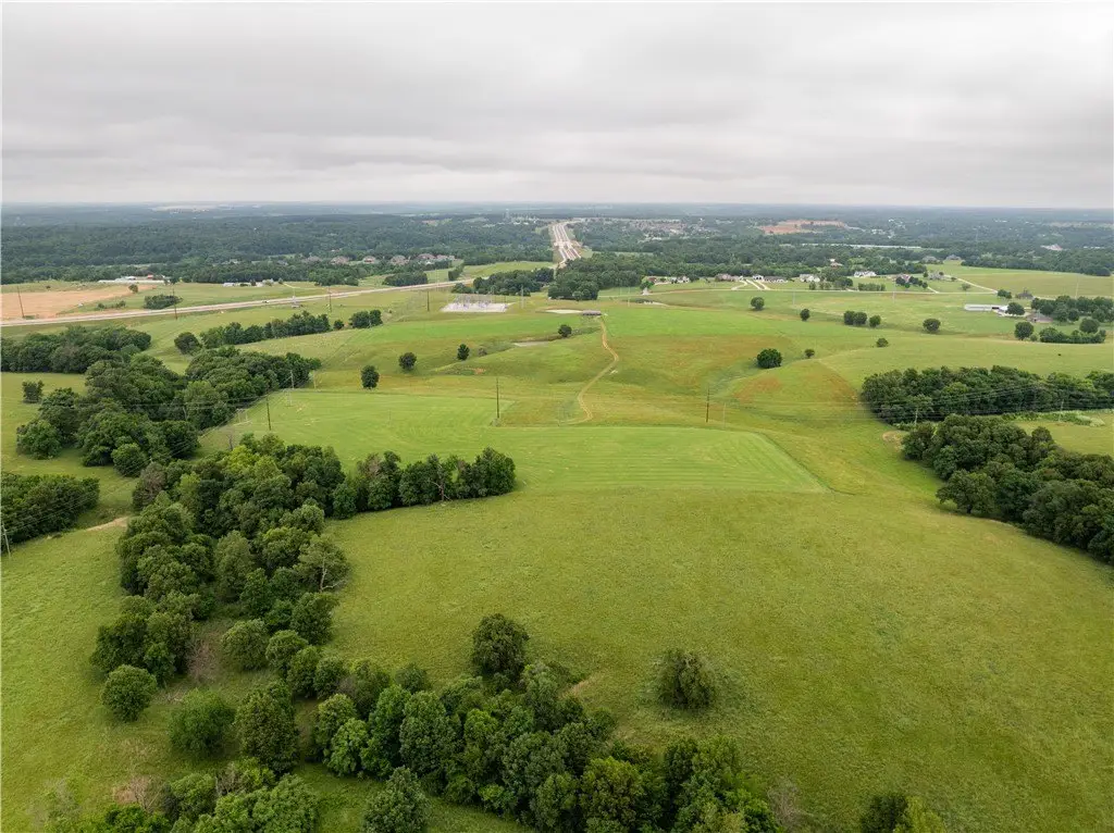
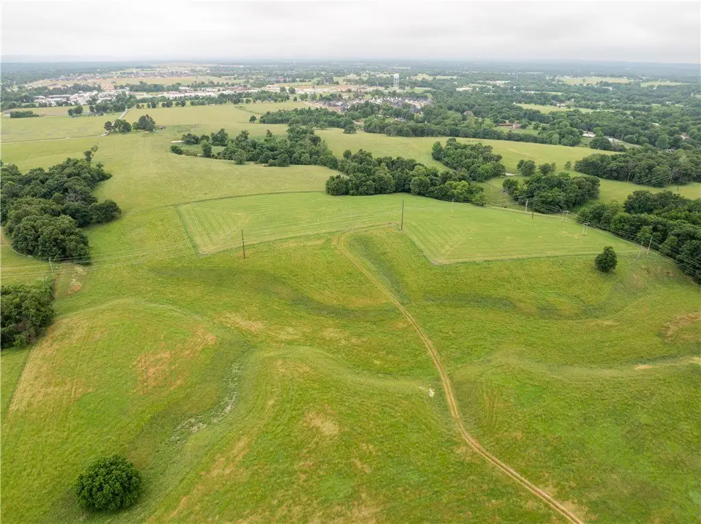
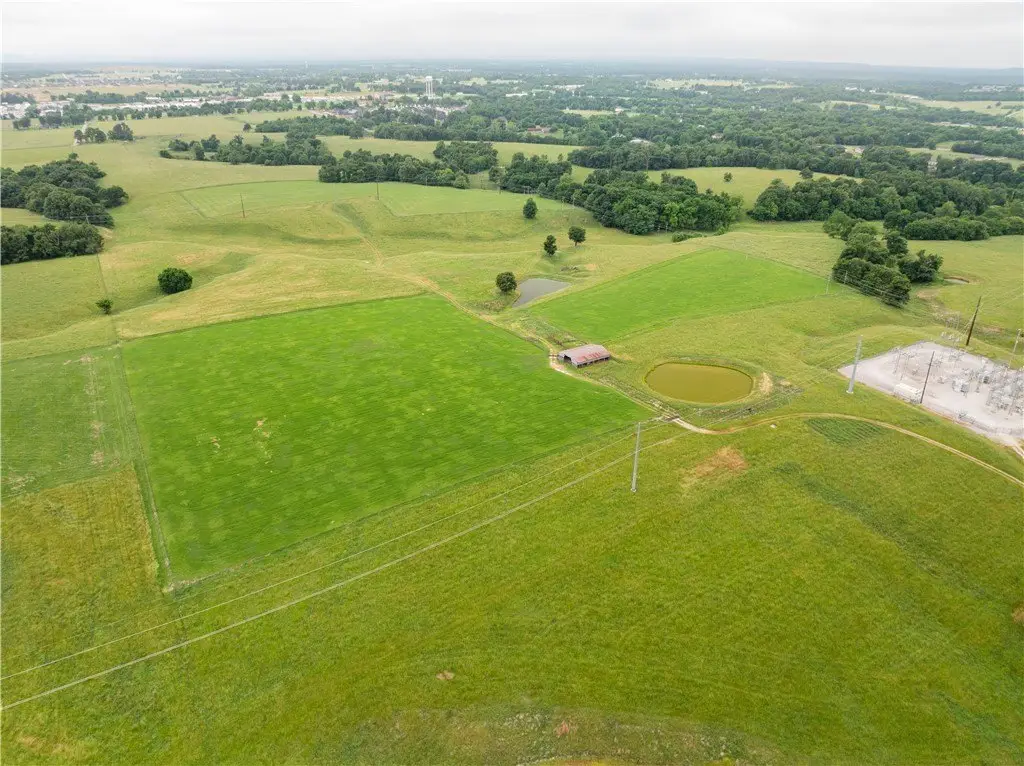
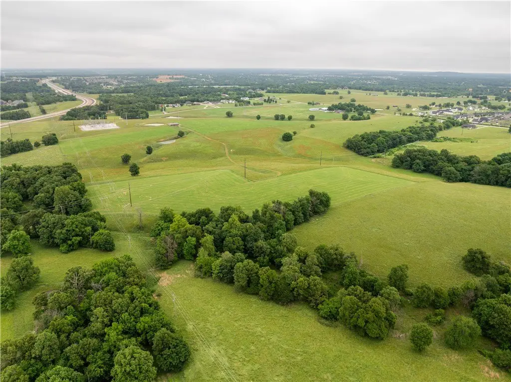
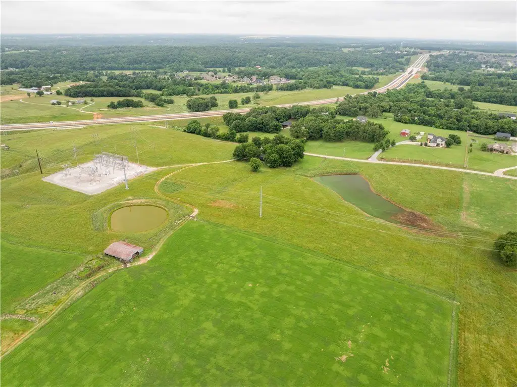
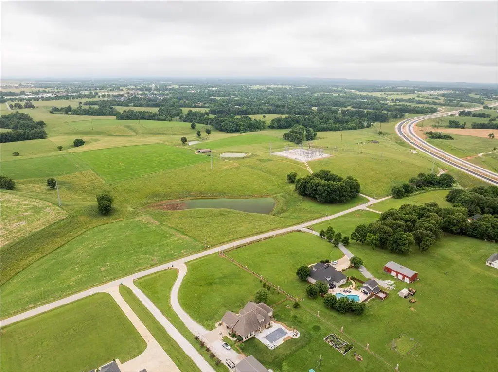
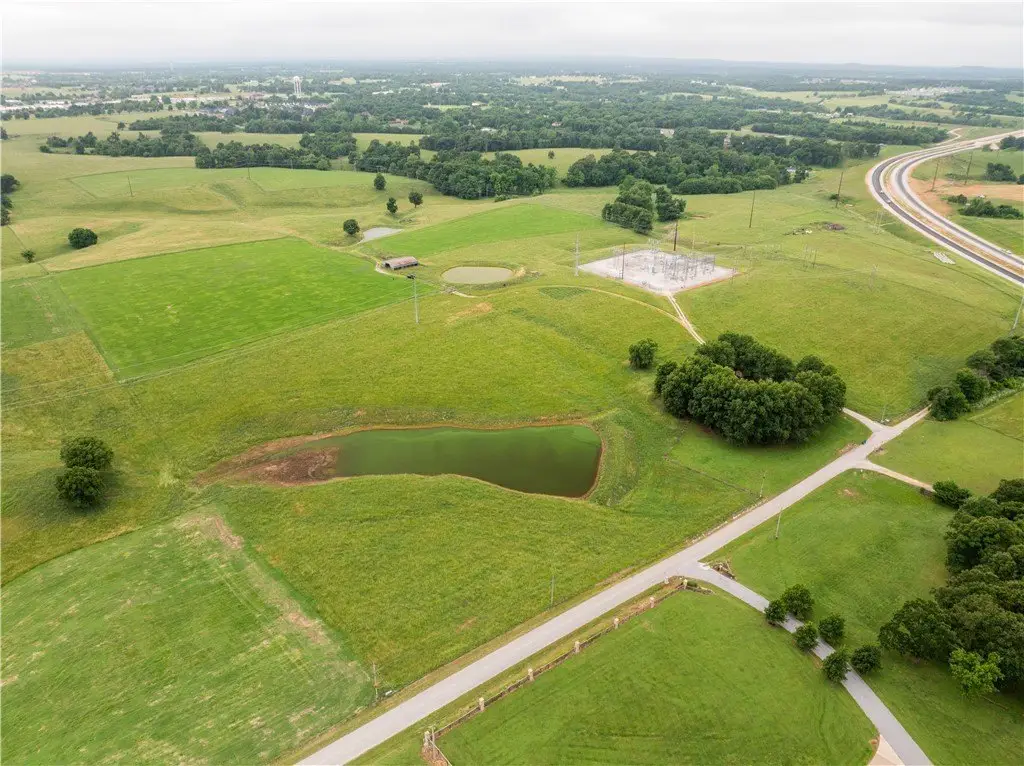
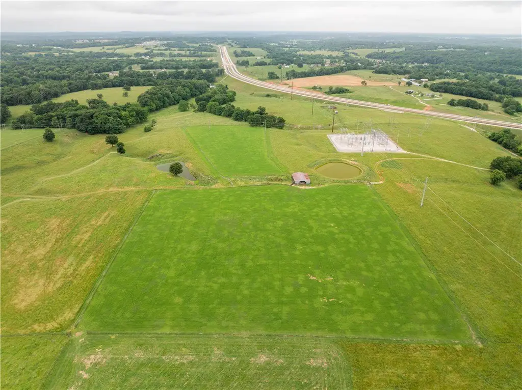
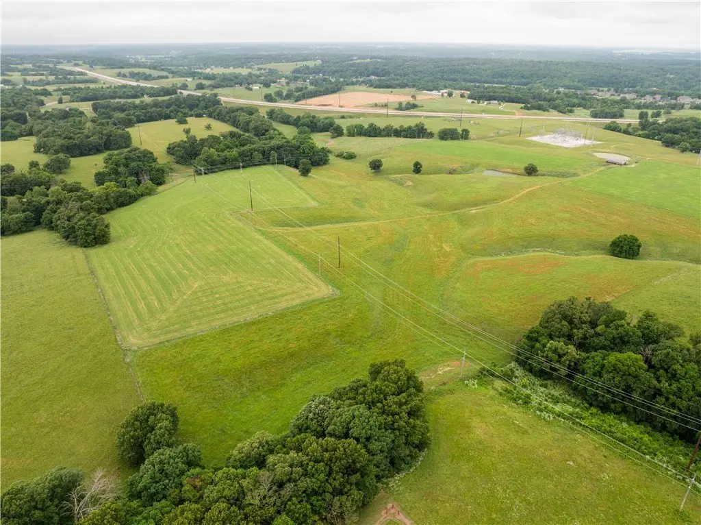
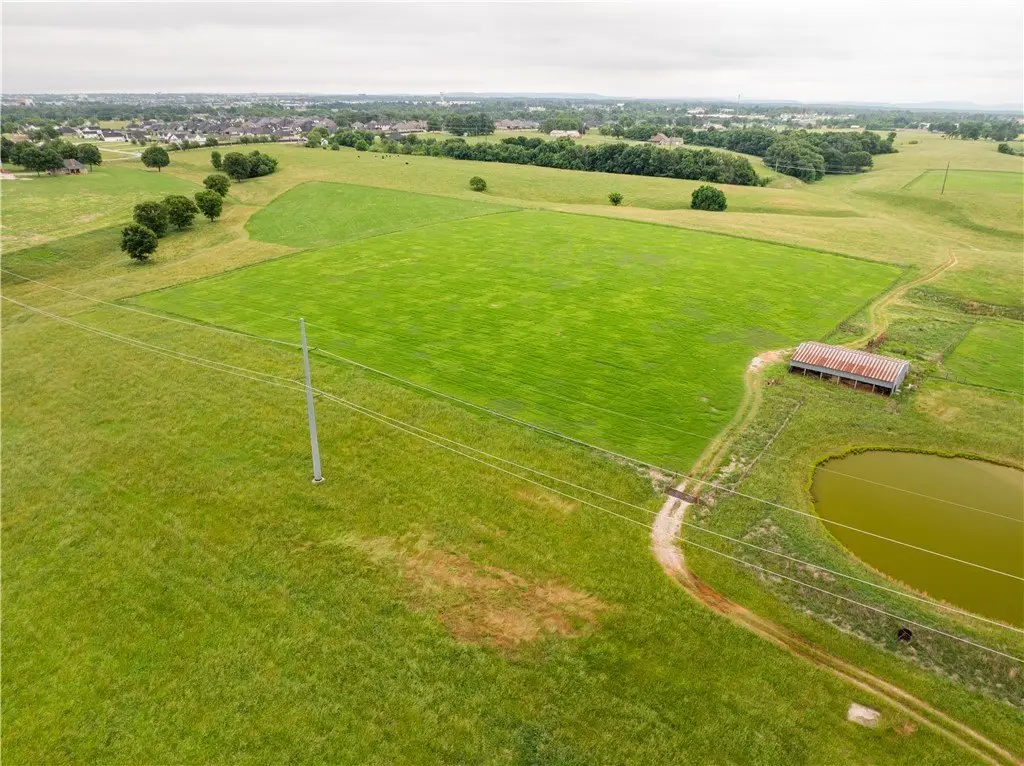
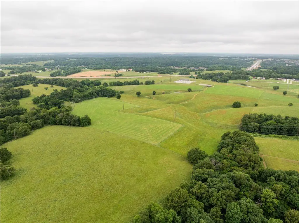
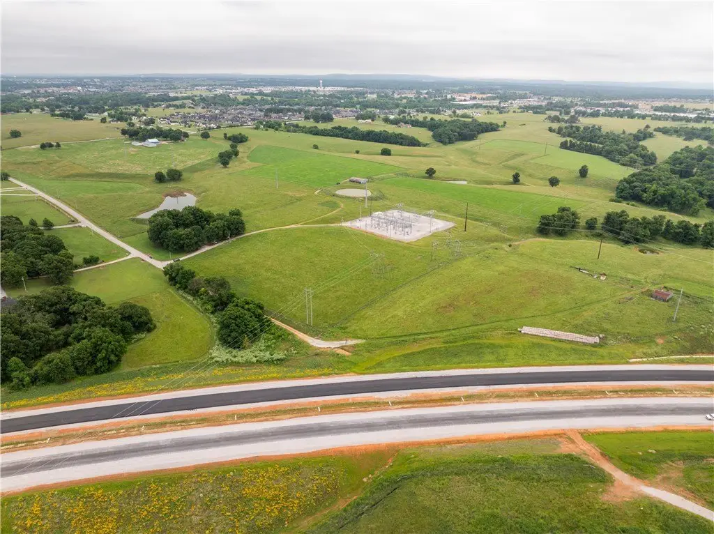
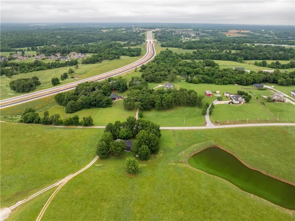
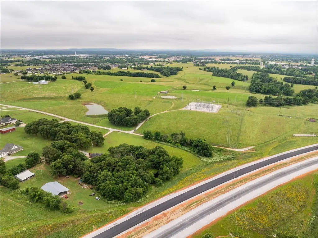
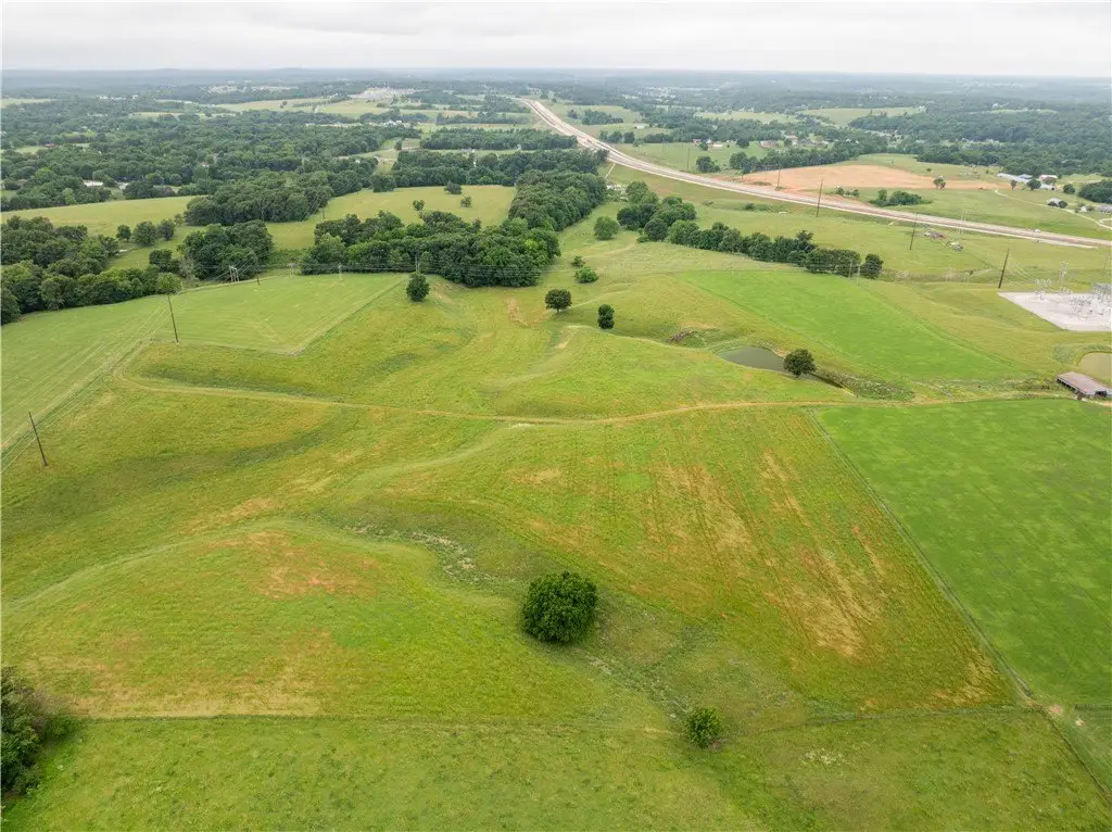
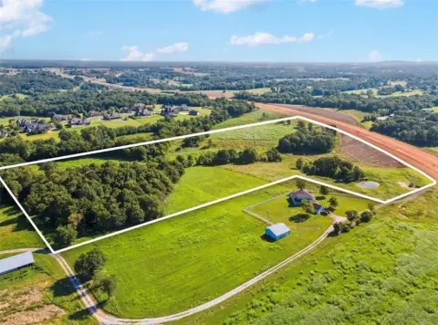
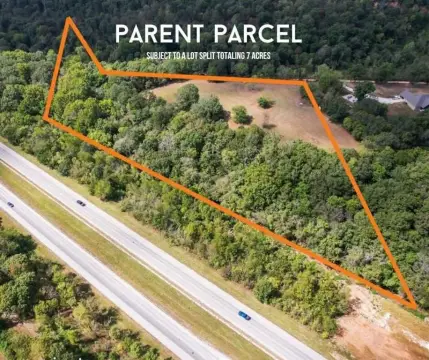
Rare opportunity to own 71.39 acres within the Tontitown city limits with utility access and paved road frontage. The property includes a mix of level, gently rolling, and sloping terrain, plus three ponds and open landscape. Zoning is agricultural, and the City of Tontitown Future Land Use Map indicates Residential Medium. According to the City’s utilities information, sewer is on-site while water is available at the street, with electric and gas also located at the street per utility companies.
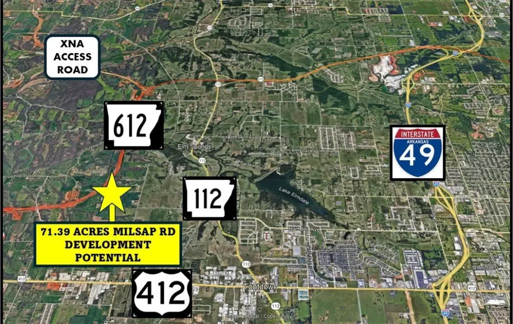
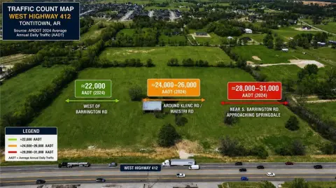
Conveniently positioned in the Springdale Public Schools district, the site sits just 1.5 miles from Hwy 112 and approximately 2 miles from Hwy 412W, supporting straightforward access throughout Northwest Arkansas. With large tracts inside city limits and utilities available, the overall development opportunity is increasingly uncommon.
This parcel offers a practical foundation for operators and buyers looking to plan residential estate lots, a multi-phase residential concept, or other investment uses consistent with the property’s residential future land use designation. The combination of city access, on-site sewer, and varied topography with water features supports a range of layout approaches, from lower-density development to pond-adjacent design concepts.
Key Highlights
- 71.39 acres within the Tontitown city limits with public utilities available
- Zoned agriculture; City of Tontitown Future Land Use Map shows Residential Medium
- Utility access: sewer on‑site and water at the street; electric and gas at the street
Property Analytics
Property Profile
Location Intelligence
Current Use by Public Records
Residential land & home ...
Similar For Sale Nearby

FAQs
What type of property is this?
Residential land & home lot - Utilities, paved road frontage, and mixed terrain make this large tract well-suited for residential and investment projects.
Where is this residential land & home lot located?
The property is located at Millsap Road Tontitown, AR.
What is the asking price?
The asking price for this property is $4,200,000.
What are key features of this property?
This property features: 71.39 acres within the Tontitown city limits with public utilities available; Zoned agriculture; City of Tontitown Future Land Use Map shows Residential Medium; Utility access: sewer on‑site and water at the street; electric and gas at the street


