Recreational Hobby Farm Land
12xxx St Croix Trail North Branch, MN 55056
For Sale
$225,000
LAND - North Branch, MN
Lot Size20.00 Acres
Days on Market98
Property Features for 12xxx St Croix Trail
General Information
Property type
Land
Property subtype
Other
Standard status
Active
Lot size
20.00 Acres
Taxes and HOA fees
Tax Year
2025
Tax Annual Amount
100
Utilities
Utilities
Natural Gas Available
Listing Agency:
Realty Executives Top Results
(763) 286-3347
Listed By:
Robert A Boyce
(763) 286-3347
Added: Apr 22
Changed: Jun 30
Last Checked: Jul 28 at 8:06AM
MLS# 7059076
Copyright © 2026 Northstar MLS. All rights reserved. All information provided by the listing agent/broker is deemed reliable but is not guaranteed and should be independently verified.
Investment Insights
Based on property information with market context.
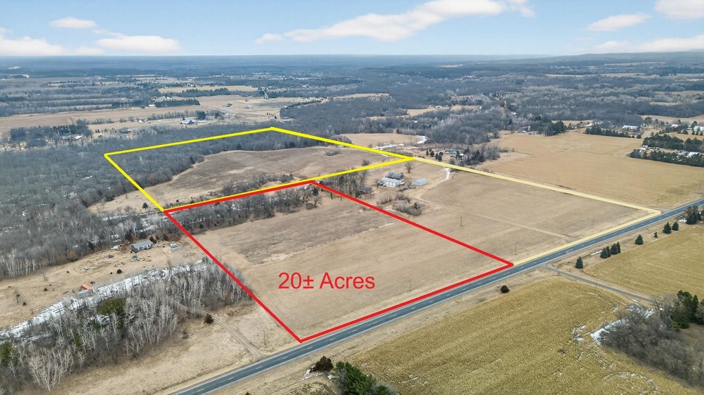
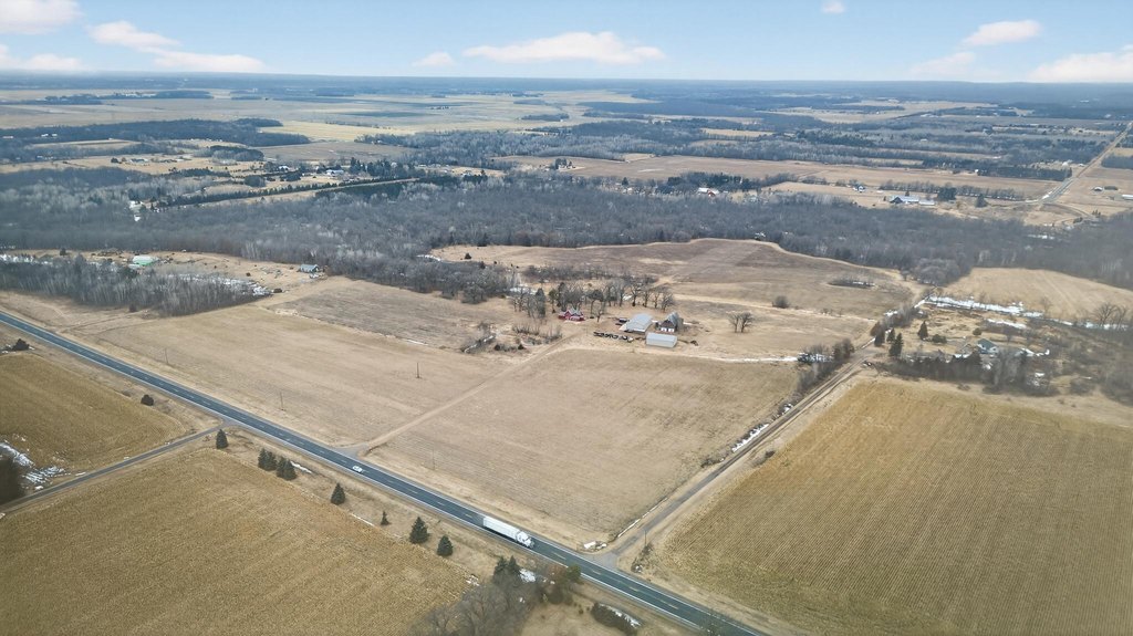
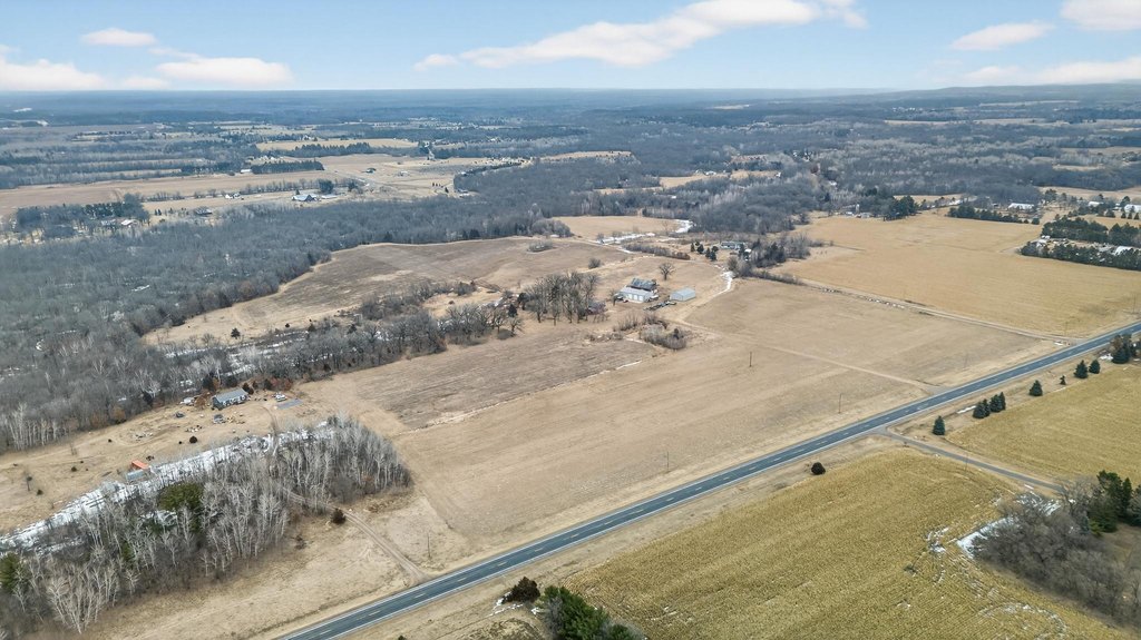
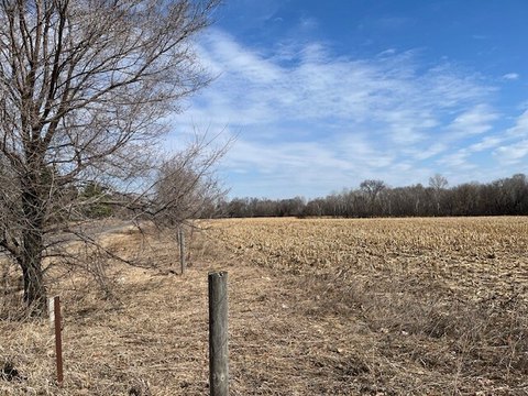
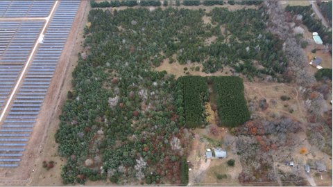
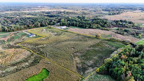
Offered for sale is a 20-acre land parcel with a mix of open areas and light woods. The property is described as having scenic views and a high level of privacy, with the flexibility to support a range of uses such as building a future home, operating a hobby or horse farm, or creating a recreational retreat. Please note that the house on 20 acres is no longer available, and the property should not be walked without a scheduled showing appointment.
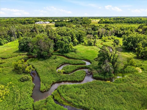
The parcel is located near I-35 and Hwy 95, with proximity to Wild River State Park and the Sunrise and St. Croix Rivers. Additional nearby outdoor and lifestyle opportunities mentioned in the remarks include Wild Mountain Ski Area, wineries, shopping, and regional recreation.
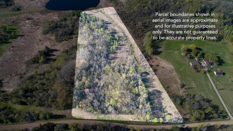
For buyers seeking more scale, additional purchase options are available, including an adjoining 40-acre parcel (MLS #7068608) or the entire 60-acre property (MLS #7085858). The adjoining 40-acre tract is described as heavily wooded, with the Sunrise River winding through it, and may have the potential to be divided into two 20-acre parcels subject to applicable approvals. This offering is best suited for buyers who want rural space with a balance of open ground and wooded character, with room to plan their preferred long-term use.
The parcel is located near I-35 and Hwy 95, with proximity to Wild River State Park and the Sunrise and St. Croix Rivers. Additional nearby outdoor and lifestyle opportunities mentioned in the remarks include Wild Mountain Ski Area, wineries, shopping, and regional recreation.
For buyers seeking more scale, additional purchase options are available, including an adjoining 40-acre parcel (MLS #7068608) or the entire 60-acre property (MLS #7085858). The adjoining 40-acre tract is described as heavily wooded, with the Sunrise River winding through it, and may have the potential to be divided into two 20-acre parcels subject to applicable approvals. This offering is best suited for buyers who want rural space with a balance of open ground and wooded character, with room to plan their preferred long-term use.
Key Highlights
- 20‑acre parcel with open land, light woods, scenic views, and abundant privacy
- Natural gas available
- Adjoining purchase options: 40‑acre parcel (MLS #7068608) or entire 60‑acre property (MLS #7085858)
Property Analytics
Location Intelligence
Current Use


Frequently Asked Questions
What type of property is this?
Agricultural land / Farmland - A private parcel with open land and light woods, suited for hobby farming, recreation, or future home-building plans.
Where is this agricultural land / farmland located?
The property is located at 12xxx St Croix Trail North Branch, MN.
What is the asking price?
The asking price for this property is $225,000.
What are key features of this property?
This property features: 20‑acre parcel with open land, light woods, scenic views, and abundant privacy; Natural gas available; Adjoining purchase options: 40‑acre parcel (MLS #7068608) or entire 60‑acre property (MLS #7085858)


