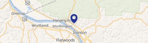
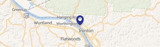
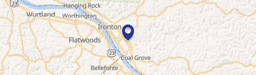
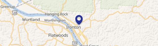
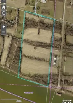
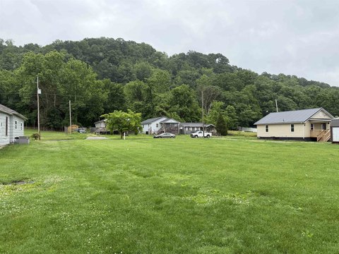
State Rte 52 Ironton, OH 45638
Property profile & analytics
State Rte 52, Ironton, OH 45638
- Commercial land
- 7.17 lot acres
Property ID
US66-3384589
The Realmo ID is a unique identifier assigned to every property, incorporating country codes and precise geo-coordinates for 300x300-foot land blocks. It enables standardized data collection and seamless integration of disparate sources such as ownership, tax, title data and physical specifications. By aggregating current and historical records, the Realmo ID powers advanced analytics and delivers deep, verifiable insights for real estate professionals.
Location Intelligence
Current Use by Public Records
- Commercial land
Property Details for State Rte 52
- Lot size
- 7.17 lot acres
- Property type
- Commercial land
- APN
- 29-038-0400.000
- APU
- 290380400000
Sales History
| Date | Price | Buyer | Seller | Deed Type | Mortgage |
|---|---|---|---|---|---|
| Jul 12, 2021 | — | Danco Sand & Gravel LLC | — | Deed · related | $250k · The Poca Valley Bank INC |
| Oct 25, 2018 | $200,000 | Mike Hurley | Danco Sand & Gravel LLC | Grant Deed | — |
| Apr 25, 2008 | $175,000 | Danco Sand & Gravel LLC | W Guy Spriggs | Deed | $150k · Peoples Bank NA |
| — | — | Danco Sand & Gravel LLC | — | Deed Of Trust · related | $86k · Peoples Bank & Trust |
Value Estimations
based on Realmo’s proprietary methodology
-
AI approach
-
CAP approach
-
Comparable approach
-
Alternative Use
Get a detailed, property-specific estimation — fast and free
Location Insight
- Map
- Local Demand
- City
- Ironton
- County
- Lawrence
- State
- Ohio
- Longitude
- -82.6379
- Latitude
- 38.491
- CBSA code
- 26580
- CBSA name
- HUNTINGTON-ASHLAND, WV-KY-OH METROPOLITAN STATISTICAL AREA
Property Tax & Assessments
Tax date
Tax Amount
Assessed Land Value
Assessed Improvement Value
Total Assessed Value
Applied Tax Rate
Land Market Value
Improvement Market Value
Total Market Value
2023
$80
$2,510
$0.00
$2,510
-
$7,170
$0.00
$7,170