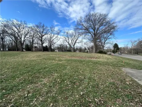
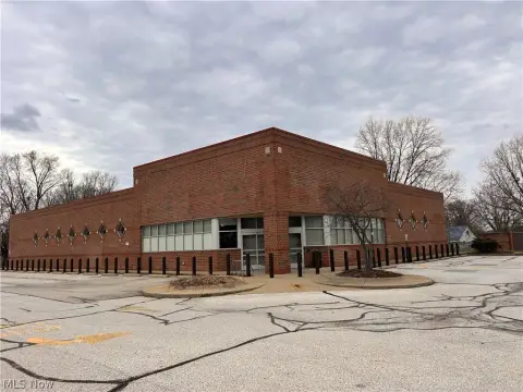
Niles Cortland Warren, OH 44484
Property profile & analytics
Niles Cortland, Warren, OH 44484
- Retail space
- 0.42 lot acres
Property ID
US66-3643230
The Realmo ID is a unique identifier assigned to every property, incorporating country codes and precise geo-coordinates for 300x300-foot land blocks. It enables standardized data collection and seamless integration of disparate sources such as ownership, tax, title data and physical specifications. By aggregating current and historical records, the Realmo ID powers advanced analytics and delivers deep, verifiable insights for real estate professionals.
Location Intelligence
Current Use by Public Records
- Retail space
Property Details for Niles Cortland
- Lot size
- 0.42 lot acres
- Property type
- Retail space
- APN
- 28-030300
- APU
- 28030300
Sales History
| Date | Price | Buyer | Seller | Deed Type | Mortgage |
|---|---|---|---|---|---|
| Mar 4, 2019 | — | Charles L Adgate JR. | Adgate,charles L | Quit Claim Deed · related | — |
| Apr 5, 2012 | — | Charles L Adgate SR. | Adgate,helen J | Affidavit Of Death · related | — |
| Oct 16, 2009 | — | Charles L Adgate | — | Trustees Deed · related | $15k · Farmers National Bank Canfield |
| May 17, 2005 | — | Charles L Adgate SR. | Adgate,charles L & Helen J | Quit Claim Deed · related | — |
Value Estimations
based on Realmo’s proprietary methodology
-
AI approach
-
CAP approach
-
Comparable approach
-
Alternative Use
Get a detailed, property-specific estimation — fast and free
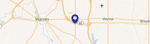
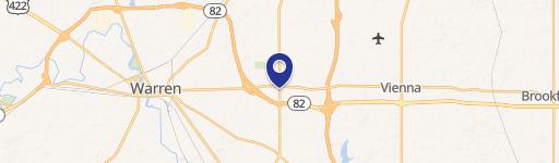
Location Insight
- Map
- Local Demand
- City
- Warren
- County
- Trumbull
- State
- Ohio
- Longitude
- -80.7398
- Latitude
- 41.2251
- CBSA code
- 49660
- CBSA name
- YOUNGSTOWN-WARREN-BOARDMAN, OH-PA METROPOLITAN STATISTICAL AREA
Property Tax & Assessments
Tax date
Tax Amount
Assessed Land Value
Assessed Improvement Value
Total Assessed Value
Applied Tax Rate
Land Market Value
Improvement Market Value
Total Market Value
2023
$1,536
$23,310
$0.00
$23,310
-
$66,600
$0.00
$66,600