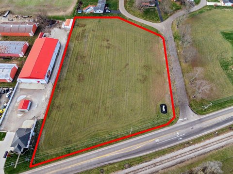
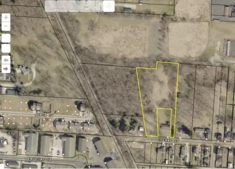
Mt Vernon Rd Newark, OH 43055
Property profile & analytics
Mt Vernon Rd, Newark, OH 43055
- Commercial land
- 0.80 lot acres
Property ID
US66-4307574
The Realmo ID is a unique identifier assigned to every property, incorporating country codes and precise geo-coordinates for 300x300-foot land blocks. It enables standardized data collection and seamless integration of disparate sources such as ownership, tax, title data and physical specifications. By aggregating current and historical records, the Realmo ID powers advanced analytics and delivers deep, verifiable insights for real estate professionals.
Location Intelligence
Current Use by Public Records
- Commercial land
Property Details for Mt Vernon Rd
- Lot size
- 0.80 lot acres
- Property type
- Commercial land
- APN
- 054-270270-00.006
- APU
- 5427027000006
Sales History
| Date | Price | Buyer | Seller | Deed Type | Mortgage |
|---|---|---|---|---|---|
| Oct 23, 2018 | — | Deo Drive Dev LLC | — | Grant Deed · related | $1.9M · First Nat'l Bk/waverly |
| Sep 18, 2015 | $3,825,000 | Deo Drive Development LLC | Deo Drive Partners LLC | Limited Warranty Deed | — |
| Apr 10, 2014 | $1,400,000 | Dee Drive Partners LLC | Continental 192 Fund LLC | Trustees Deed | $2.1M · First Bexley Bk |
Value Estimations
based on Realmo’s proprietary methodology
-
AI approach
-
CAP approach
-
Comparable approach
-
Alternative Use
Get a detailed, property-specific estimation — fast and free
Location Insight
- Map
- Local Demand
- City
- Newark
- County
- Licking
- State
- Ohio
- Longitude
- -82.4186
- Latitude
- 40.0845
- CBSA code
- 18140
- CBSA name
- COLUMBUS, OH METROPOLITAN STATISTICAL AREA
Property Tax & Assessments
Tax date
Tax Amount
Assessed Land Value
Assessed Improvement Value
Total Assessed Value
Applied Tax Rate
Land Market Value
Improvement Market Value
Total Market Value
2023
$1,382
$33,600
$0.00
$33,600
-
$96,000
$0.00
$96,000