
New search
Property profile & analytics
FOR LEASE
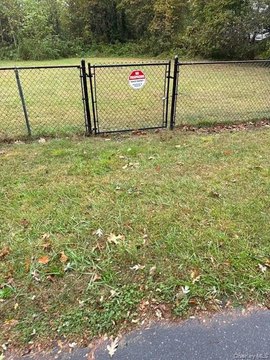
Commercial land
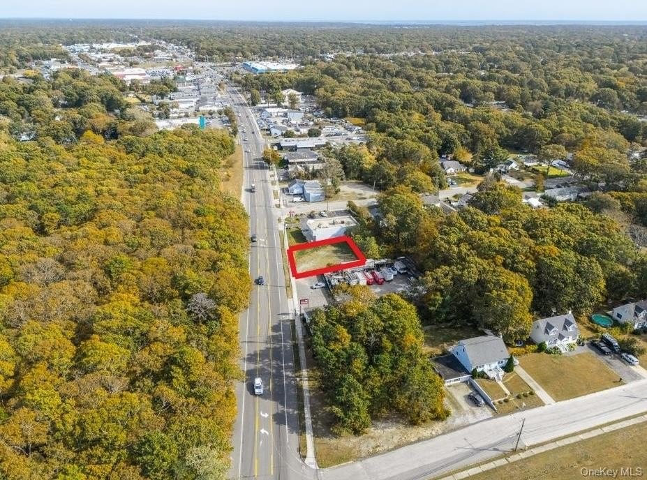
586 Montauk Hwy, Shirley, NY 11967
Entity Owned
9-yr Hold
Free & Clear
Property ID
US63-4757121
 For Lease
1 / 7
For Lease
1 / 7
$1,000/Mo
586 Montauk Hwy, Shirley, NY 11967
View Listing →
Property profile
Verified
Property type
Commercial land
Use group
VACANT COMMERCIAL LAND
Lot
0.24 ac (10,454 SF)
APN
0200-850.00-05.00-021.000
UPID
US63-4757121
Cap rate & NOI
Priority signal for investors
Implied cap rate, NOI & suggested price
Cap rate vs submarket · NOI estimate · 3 price anchors
Implied cap rate, NOI & suggested price
Cap vs submarket · NOI estimate · 3 price anchors
Value estimations
Realmo proprietary · 4 methods
AI Approach
AI
by Request
CAP Approach
CAP
by Request
Comparable Approach
Comparable
by Request
Blend (final)
Blend
by Request
Owner & transaction history
Domi Li INC · 9 yrs held
Domi Li INC
since 2016
3 recorded transactions
Zoning & alternative use
Permitted uses
Permitted uses
Allowed · conditional · prohibited
Cap rate
Implied · in-place · derived from last sale + estimated NOI
Implied Cap rate
#1
Implied · in-place · NOI ÷ last sale
In-place · derived from last sale + estimated NOI
Cap rate, NOI & submarket benchmark
Implied cap rate vs Shirley submarket · NOI estimate · Typical band, median & reading
Implied cap rate, NOI & submarket benchmark
Cap vs Shirley submarket · NOI estimate · typical band, median & reading
Refine your cap rate
8-question underwriting flow
1.
Property current status — Going-In vs Stabilized
2.
Price for denominator — asking / offer / market
3.
Leasing status & lease structure (NNN / Gross)
4.
Tenant risk profile & vacancy assumption
5.
Upload T12 / rent roll / OM (optional)
Refine in 60 seconds, get exact suggested price
T12 upload · Submarket benchmarks · Sensitivity grid
Suggested price · 3 cap rate anchors
Income approach @ 5% / 7% / 9% — aggressive / typical / conservative
Suggested price at 5% / 7% / 9% cap
Aggressive / typical / conservative · Implied $/SF per anchor · Sensitivity grid
Suggested price at 5% / 7% / 9% cap
Aggressive / typical / conservative · implied $/SF · sensitivity
Value
AI, CAP & Alternative Use estimations · Realmo proprietary blendValue Estimations
Based on Realmo’s proprietary methodology
AI Approach
CAP Approach
Comparable Approach
Alternative Use
Get a detailed, property-specific estimation — fast and free
Price per SF
Sale + rent benchmarks
Subject property
—
Submarket sale & rent benchmarks
Median sale $/SF · Asking & closed rent · Submarket vacancy
Submarket sale & rent benchmarks
Median sale $/SF · asking & closed rent · submarket vacancy
Property tax & assessments
Tax year 2020Property tax & assessments
Tax year 2020
Assessed value
$800
Assessed 2023
Previous assessed
$800
+0.0% YoY
Assessed land
$800
Land market value
$1,481
Total market value
$1,481
Applied tax rate
472,232.0000
Comparables
6 recent transactions · within 1.5 miComparable in this city
6 recent transactions
Comparable in this City


Similar Nearby for Sale


Similar Nearby for Lease


Recent comparable sales
Sale price & price/SF · Sale date & distance · Adjustments & confidence
Recent comparable sales
Sale price & $/SF · sale date & distance · adjustments
Property description
Physical attributes from public recordsBuilding & lot
Public records
Property type
Commercial land
Use group
VACANT COMMERCIAL LAND
Status
For Lease
Heating
NONE
Lot
0.24 ac (10,454 SF)
APN
0200-850.00-05.00-021.000
UPID
US63-4757121
Jurisdiction
SUFFOLK
Metro division
NASSAU-SUFFOLK, NY METROPOLITAN DIVISION
Zoning & alternative use
Zoning · permitted uses
Permitted & conditional uses
Allowed uses · Special-permit conditions · Prohibited uses
Permitted & conditional uses
Allowed · special-permit conditions · prohibited
Building & site characteristics
From public records
Heating
NONE
Lot
0.24 ac
Current owner
From public records · entity-resolved
Domi Li INC
Entity
Free & Clear · 9 yrs held
Mailing address
23 PARK CIR, SHIRLEY, NY 11967-2333
Ownership since
2016
Owner contacts — direct phone, email, and related entities
Decision-maker phone · Verified email · Related entities & filings
Owner contacts
Email · phone · related entities
Sales History
3 recorded events · public records
Date
Price
Buyer
Seller
Deed Type
Mortgage
Oct 6, 2016
—
Domi Li INC
Domi,selvie
Quit Claim Deed
related
—
Feb 23, 2016
$123,500
Selvie Domi
Harn Food LLC
Grant Deed
—
Oct 1, 2008
$1,592,000
Harn Food LLC
County Of Suffolk
Grant Deed
—
Coming soon
Costs & Benchmarks
Operating expenses, capex projections, utility benchmarks, and submarket comparables — all in one view.
Coming soon
Risks
Flood, climate, environmental, title, and tenant-concentration risk — surfaced with mitigations and source citations.
Try Rey
Ask anything about this address in plain English.
“Is 15.6% cap rate sustainable?” · “Best tenant mix for BU1?” · “What’s the redev upside?”
Full reports are paid
Unlock the full Property Analytics report
Start free for 7 days — no card required. Full owner contacts, all 4 valuations with methodology, refine flow, comparable adjustments, foot-traffic deep dive, export to PDF / CSV.


