
New search
Property profile & analytics
OFF-MARKET
Research & development properties
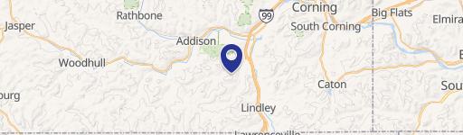
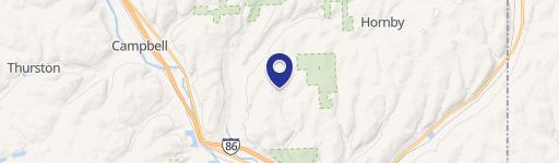
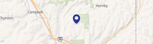
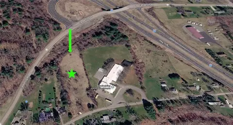
Manning Rdg Rd, Painted Post, NY 14870
Individually Owned
Free & Clear
Property ID
US63-0207119
Property profile
Verified
Property type
Research & development properties
Use group
DUMP SITE
Year built
1990
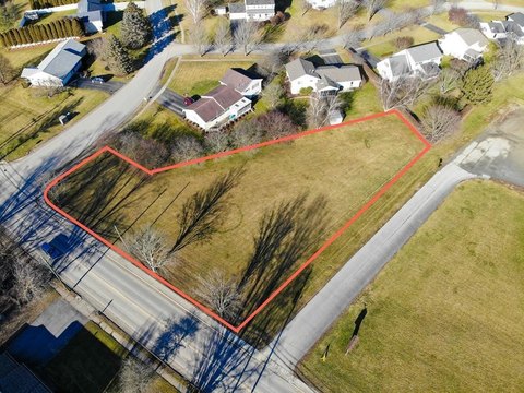
Lot
21.2 ac (923,472 SF)
Zoning code
COMM
APN
463000 262.00-01-023.000
UPID
US63-0207119
Cap rate & NOI
Priority signal for investors
Implied cap rate, NOI & suggested price
Cap rate vs submarket · NOI estimate · 3 price anchors
Implied cap rate, NOI & suggested price
Cap vs submarket · NOI estimate · 3 price anchors
Value estimations
Realmo proprietary · 4 methods
AI Approach
AI
by Request
CAP Approach
CAP
by Request
Comparable Approach
Comparable
by Request
Blend (final)
Blend
by Request
Owner & transaction history
Francis A Schosger
Francis A Schosger
since 2025
7 recorded transactions
Zoning & alternative use
COMM · Painted Post, NY
Permitted uses
Permitted uses
Allowed · conditional · prohibited
Cap rate
Implied · in-place · derived from last sale + estimated NOI
Implied Cap rate
#1
Implied · in-place · NOI ÷ last sale
In-place · derived from last sale + estimated NOI
Cap rate, NOI & submarket benchmark
Implied cap rate vs Painted Post submarket · NOI estimate · Typical band, median & reading
Implied cap rate, NOI & submarket benchmark
Cap vs Painted Post submarket · NOI estimate · typical band, median & reading
Refine your cap rate
8-question underwriting flow
1.
Property current status — Going-In vs Stabilized
2.
Price for denominator — asking / offer / market
3.
Leasing status & lease structure (NNN / Gross)
4.
Tenant risk profile & vacancy assumption
5.
Upload T12 / rent roll / OM (optional)
Refine in 60 seconds, get exact suggested price
T12 upload · Submarket benchmarks · Sensitivity grid
Suggested price · 3 cap rate anchors
Income approach @ 5% / 7% / 9% — aggressive / typical / conservative
Suggested price at 5% / 7% / 9% cap
Aggressive / typical / conservative · Implied $/SF per anchor · Sensitivity grid
Suggested price at 5% / 7% / 9% cap
Aggressive / typical / conservative · implied $/SF · sensitivity
Value
AI, CAP & Alternative Use estimations · Realmo proprietary blendValue Estimations
Based on Realmo’s proprietary methodology
AI Approach
CAP Approach
Comparable Approach
Alternative Use
Get a detailed, property-specific estimation — fast and free
Price per SF
Sale + rent benchmarks
Subject property
—
Submarket sale & rent benchmarks
Median sale $/SF · Asking & closed rent · Submarket vacancy
Submarket sale & rent benchmarks
Median sale $/SF · asking & closed rent · submarket vacancy
Property tax & assessments
Property tax & assessments
Assessed value
$42,400
Assessed 2023
Previous assessed
$42,400
+0.0% YoY
Assessed land
$42,400
Land market value
$47,111
Total market value
$47,111
Applied tax rate
460,300.0000
Comparables
6 recent transactions · within 1.5 miComparable in this city
6 recent transactions
Comparable in this City


Similar Nearby for Sale

Recent comparable sales
Sale price & price/SF · Sale date & distance · Adjustments & confidence
Recent comparable sales
Sale price & $/SF · sale date & distance · adjustments
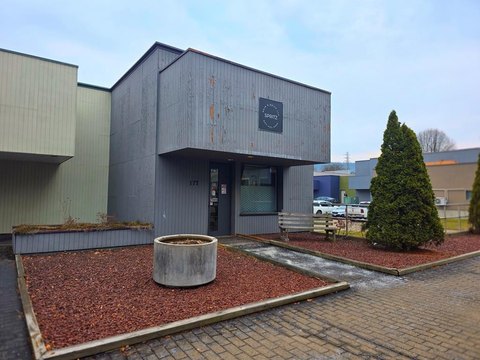
Property description
Physical attributes from public recordsBuilding & lot
Public records
Property type
Research & development properties
Use group
DUMP SITE
Status
Off-Market
Year built
1990
Heating
NONE
Lot
21.2 ac (923,472 SF)
Zoning code
COMM
APN
463000 262.00-01-023.000
UPID
US63-0207119
Jurisdiction
STEUBEN
Zoning & alternative use
COMM · Painted Post, NY
Zoning COMM · permitted uses
COMM · Painted Post, NY
Permitted & conditional uses
Allowed uses · Special-permit conditions · Prohibited uses
Permitted & conditional uses
Allowed · special-permit conditions · prohibited
Painted Post. Always verify with local authorities before improvements.
Building & site characteristics
From public records
Year built
1990
Heating
NONE
Lot
21.2 ac
Current owner
From public records · entity-resolved
Francis A Schosger
Individual
Free & Clear · 0 yrs held
Mailing address
PO BOX 4900, SCOTTSDALE, AZ 85261-4900
Ownership since
2025
Owner contacts — direct phone, email, and related entities
Decision-maker phone · Verified email · Related entities & filings
Owner contacts
Email · phone · related entities
Sales History
9 recorded events · public records
Date
Price
Buyer
Seller
Deed Type
Mortgage
Oct 29, 2025
—
Francis A Schosger
Nancy E Schosger
Warranty Deed
related
—
May 16, 2024
—
George D Fraser
Hakes C & D Disposal INC
Quitclaim Deed
related
—
Mar 21, 2024
$141,000
Bill E Dombroski
William R Howe
Warranty Deed
—
Jul 25, 2022
$70,000
Manning Rdg 70 Acr LLC
Holly Ft
Warranty Deed
—
Dec 30, 2019
$200,000
Hakes Candd Disposal INC
INC Finger Lakes Log Home
Deed
—
Apr 18, 2019
$59,500
Holly Ft
Melissa Grinnell
Warranty Deed
—
Apr 18, 2019
$22,000
Cts Property Mgmt LLC
Melissa Grinnell
Warranty Deed
—
Sep 17, 2018
$10,000
Hakes C&d Disposal INC
Nancy J Kohler
Warranty Deed
—
Jan 25, 2017
$38,000
Howard D. Potteriii
Stephen J Sullivan
Deed
—
Coming soon
Costs & Benchmarks
Operating expenses, capex projections, utility benchmarks, and submarket comparables — all in one view.
Coming soon
Risks
Flood, climate, environmental, title, and tenant-concentration risk — surfaced with mitigations and source citations.
Try Rey
Ask anything about this address in plain English.
“Is 15.6% cap rate sustainable?” · “Best tenant mix for BU1?” · “What’s the redev upside?”
You own Manning Rdg Rd?
List it free. Reach 20,000 daily buyers.
We’ve already pulled the facts. Confirm photos + price and you’re live in 2 minutes.
List this address →
Full reports are paid
Unlock the full Property Analytics report
Start free for 7 days — no card required. Full owner contacts, all 4 valuations with methodology, refine flow, comparable adjustments, foot-traffic deep dive, export to PDF / CSV.


