M-65 Glennie, MI 48737
Property profile & analytics
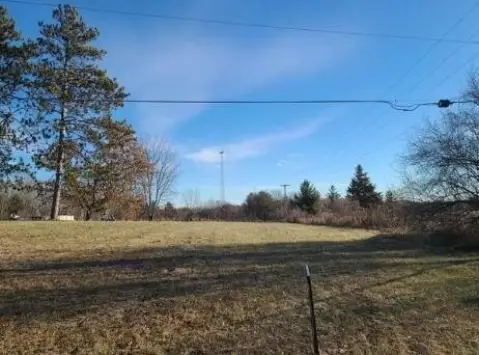
M-65, Glennie, MI 48737
- Commercial land
- 0.53 lot acres
Property ID
US43-3808395
The Realmo ID is a unique identifier assigned to every property, incorporating country codes and precise geo-coordinates for 300x300-foot land blocks. It enables standardized data collection and seamless integration of disparate sources such as ownership, tax, title data and physical specifications. By aggregating current and historical records, the Realmo ID powers advanced analytics and delivers deep, verifiable insights for real estate professionals.
Location Intelligence
Current Use by Public Records
- Commercial land
Property Details for M-65
- Lot size
- 0.53 lot acres
- Property type
- Commercial land
- APN
- 6000310000300
- APU
- 6000310000300
Sales History
| Date | Price | Buyer | Seller | Deed Type | Mortgage |
|---|---|---|---|---|---|
| Mar 19, 2010 | — | Galea Paul D Revocable Living Trust | Christopher Clouse | Quit Claim Deed · related | — |
| Mar 19, 2010 | $125,000 | Christopher Clouse | First Federal Of Northern Michgian | Warranty Deed | — |
| Sep 16, 2009 | — | First Federal Of Northern Michigan | Jack Stanger | Quit Claim Deed · related | — |
Value Estimations
based on Realmo’s proprietary methodology
-
AI approach
-
CAP approach
-
Comparable approach
-
Alternative Use
Get a detailed, property-specific estimation — fast and free
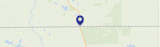
Location Insight
- Map
- Local Demand
- City
- Glennie
- County
- Iosco
- State
- Michigan
- Longitude
- -83.6956
- Latitude
- 44.5098
Property Tax & Assessments
Tax date
Tax Amount
Assessed Land Value
Assessed Improvement Value
Total Assessed Value
Applied Tax Rate
Land Market Value
Improvement Market Value
Total Market Value
2024
$154
$2,800
$0.00
$2,800
-
$5,600
$0.00
$5,600