Les Harrison E Dr Rochester, NY 14624
Property profile & analytics
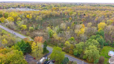
Les Harrison E Dr, Rochester, NY 14624
- Industrial land
- 7,680 SF
- 7.39 lot acres
Property ID
US63-4784913
The Realmo ID is a unique identifier assigned to every property, incorporating country codes and precise geo-coordinates for 300x300-foot land blocks. It enables standardized data collection and seamless integration of disparate sources such as ownership, tax, title data and physical specifications. By aggregating current and historical records, the Realmo ID powers advanced analytics and delivers deep, verifiable insights for real estate professionals.
Location Intelligence
Current Use by Public Records
- Industrial land
Property Details for Les Harrison E Dr
- Year built
- 1967
- Lot size
- 7.39 lot acres
- Zone code
- 06 - INDUSTRIAL
- Property type
- Industrial land
- APN
- 262600 118.07-1-9
- APU
- 2626001180719
Sales History
| Date | Price | Buyer | Seller | Deed Type | Mortgage |
|---|---|---|---|---|---|
| Jan 11, 2018 | — | Tech Park Owner LLC | — | Grant Deed · related | $62.7M · Cantor Com'l R/e Lndg |
| Aug 12, 2016 | — | Tech Park Owner LLC | — | Deed Of Trust · related | $6M · Us Bk |
| Mar 2, 2011 | — | Tech Park Owner LLC | — | Deed Of Trust · related | $5.2M · Us Bank NA |
| Aug 16, 2007 | $55,000,000 | Tech Park Owner LLC | Continental Industrial Cap LLC | Grant Deed | — |
| — | — | Tech Park Owner LLC | — | Deed Of Trust · related | $6M · Us Bk |
| — | — | Tech Park Owner LLC | — | Deed Of Trust · related | $10M · Us Bank NA |
Value Estimations
based on Realmo’s proprietary methodology
-
AI approach
-
CAP approach
-
Comparable approach
-
Alternative Use
Get a detailed, property-specific estimation — fast and free
Location Insight
- Map
- Local Demand
- City
- Rochester
- County
- Monroe
- State
- New York
- Longitude
- -77.7335
- Latitude
- 43.1559
- CBSA code
- 40380
- CBSA name
- ROCHESTER, NY METROPOLITAN STATISTICAL AREA
Property Tax & Assessments
Tax date
Tax Amount
Assessed Land Value
Assessed Improvement Value
Total Assessed Value
Applied Tax Rate
Land Market Value
Improvement Market Value
Total Market Value
0
$0.00
$221,700
$0.00
$221,700
-
$267,100
$0.00
$267,100