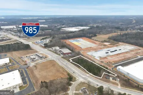
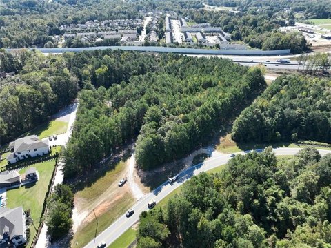
Gravel Spgs Rd Buford, GA 30519
Property profile & analytics
Gravel Spgs Rd, Buford, GA 30519
- Commercial land
- 3.34 lot acres
Property ID
US22-3538281
The Realmo ID is a unique identifier assigned to every property, incorporating country codes and precise geo-coordinates for 300x300-foot land blocks. It enables standardized data collection and seamless integration of disparate sources such as ownership, tax, title data and physical specifications. By aggregating current and historical records, the Realmo ID powers advanced analytics and delivers deep, verifiable insights for real estate professionals.
Location Intelligence
Current Use by Public Records
- Commercial land
Property Details for Gravel Spgs Rd
- Lot size
- 3.34 lot acres
- Zone code
- C2-GENERAL BUSINESS
- Property type
- Commercial land
- APN
- 7-143 -042
- APU
- 7143042
Sales History
| Date | Price | Buyer | Seller | Deed Type | Mortgage |
|---|---|---|---|---|---|
| Oct 28, 2022 | $38,968,892 | Buford Industrial LLC | Pme Oakmont Gravel Springs LLC | Warranty Deed | — |
| Sep 22, 2020 | — | Pme Oakmont Gravel Springs LLC | Parkside Walk LLC | Quit Claim Deed · related | — |
| Sep 22, 2020 | $4,350,000 | Pme Oakmont Gravel Springs LLC | Parkside Walk LLC | Grant Deed | — |
| Jul 18, 2006 | $59,325 | Gwinnett County | Parkside Walk LLC | Grant Deed | — |
Value Estimations
based on Realmo’s proprietary methodology
-
AI approach
-
CAP approach
-
Comparable approach
-
Alternative Use
Get a detailed, property-specific estimation — fast and free
Location Insight
- Map
- Local Demand
- City
- Buford
- County
- Gwinnett
- State
- Georgia
- Longitude
- -83.9433
- Latitude
- 34.0848
- CBSA code
- 12060
- CBSA name
- ATLANTA-SANDY SPRINGS-MARIETTA, GA METROPOLITAN STATISTICAL AREA
Property Tax & Assessments
Tax date
Tax Amount
Assessed Land Value
Assessed Improvement Value
Total Assessed Value
Applied Tax Rate
Land Market Value
Improvement Market Value
Total Market Value
2023
$3,321
$400,120
$0.00
$400,120
-
$1,000,300
$0.00
$1,000,300