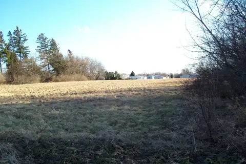
Grant Hwy Marengo, IL 60152
Property profile & analytics
Grant Hwy, Marengo, IL 60152
- Industrial properties
- 7.93 lot acres
Property ID
US28-3110609
The Realmo ID is a unique identifier assigned to every property, incorporating country codes and precise geo-coordinates for 300x300-foot land blocks. It enables standardized data collection and seamless integration of disparate sources such as ownership, tax, title data and physical specifications. By aggregating current and historical records, the Realmo ID powers advanced analytics and delivers deep, verifiable insights for real estate professionals.
Location Intelligence
Current Use by Public Records
- Industrial properties
Property Details for Grant Hwy
- Lot size
- 7.93 lot acres
- Property type
- Industrial properties
- APN
- 11-35-100-027
- APU
- 1135100027
Sales History
| Date | Price | Buyer | Seller | Deed Type | Mortgage |
|---|---|---|---|---|---|
| Apr 21, 2014 | — | 300 West LLC | — | Loan Modification, Consolidation And Extension · related | $3.6M · Voshel Marengo LLC |
| Mar 14, 2012 | — | Gerald I Nudo | — | Deed Of Trust · related | $3.7M · Rbs Citizens Bank NA |
| Jul 19, 2011 | — | 300 West LLC | — | Deed Of Trust · related | $3.8M · Rbs Citizens Bank NA |
| Jan 11, 2005 | — | 300 N West Street LLC | Arnold Engineering | Quit Claim Deed · related | — |
Value Estimations
based on Realmo’s proprietary methodology
-
AI approach
-
CAP approach
-
Comparable approach
-
Alternative Use
Get a detailed, property-specific estimation — fast and free
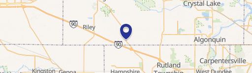
Location Insight
- Map
- Local Demand
- City
- Marengo
- County
- Mchenry
- State
- Illinois
- Longitude
- -88.6273
- Latitude
- 42.2506
- CBSA code
- 16980
- CBSA name
- CHICAGO-NAPERVILLE-JOLIET, IL-IN-WI METROPOLITAN STATISTICAL AREA
Property Tax & Assessments
Tax date
Tax Amount
Assessed Land Value
Assessed Improvement Value
Total Assessed Value
Applied Tax Rate
Land Market Value
Improvement Market Value
Total Market Value
2022
$901
$14,815
$0.00
$14,815
-
$44,445
$0.00
$44,445