967 Illinois Ave Bangor, ME 04401-2766
Property profile & analytics
967 Illinois Ave, Bangor, ME 04401-2766
- Office buildings
- 22,562 SF
- 4.11 lot acres
Property ID
US42-0110619
The Realmo ID is a unique identifier assigned to every property, incorporating country codes and precise geo-coordinates for 300x300-foot land blocks. It enables standardized data collection and seamless integration of disparate sources such as ownership, tax, title data and physical specifications. By aggregating current and historical records, the Realmo ID powers advanced analytics and delivers deep, verifiable insights for real estate professionals.
Location Intelligence
Current Use by Public Records
- USDA Natural Resource Conservation Service / Sustainability Organization
- Farm Service Agency / Sustainability Organization
- USDA Rural Development / Government Office
Property Details for 967 Illinois Ave
- Year built
- 1999
- Lot size
- 4.11 lot acres
- Zone code
- GC&S
- Property type
- Office buildings
- APN
- BANG M:101 L:010
- APU
- BANGM101L010
Sales History
| Date | Price | Buyer | Seller | Deed Type | Mortgage |
|---|---|---|---|---|---|
| Dec 23, 2020 | — | Houlton Holdings LLC | — | Deed Of Trust · related | $6.4M · First Nat'l Bk |
| May 2, 2005 | — | Dawn Til Done Farms | — | Deed Of Trust · related | $46k · Us Department Of Agriculture |
Value Estimations
based on Realmo’s proprietary methodology
-
Comparable approach
- Method
- Estimation
- Statistic Estimate
- $2,104,000
- AI Estimate
- $2,261,000
Market price range: $899k - $2.81MMarket price range: $899k - $3.11M -
Alternative Use
- Use
- Estimation
- OFFICE BUILDING
- $1,810,000 Current use
- COMMERCIAL (GENERAL)
- $2,505,000 Change: +39% Conversion: Easy
- RETAIL STORES
- $2,325,000 Change: +28% Conversion: Moderate
Get a detailed, property-specific estimation — fast and free
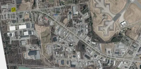
Location Insight
- Map
- Local Demand
- City
- Bangor
- County
- Penobscot
- State
- Maine
- Longitude
- -68.818
- Latitude
- 44.8192
- CBSA code
- 12620
- CBSA name
- BANGOR, ME METROPOLITAN STATISTICAL AREA
Property Tax & Assessments
Tax date
Tax Amount
Assessed Land Value
Assessed Improvement Value
Total Assessed Value
Applied Tax Rate
Land Market Value
Improvement Market Value
Total Market Value
2023
$50,502
$283,900
$2,353,300
$2,637,200
-
$0.00
$0.00
$0.00