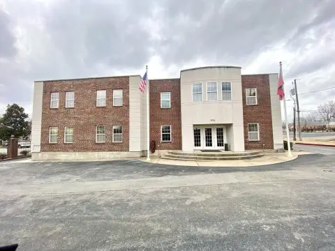
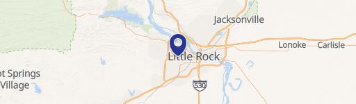
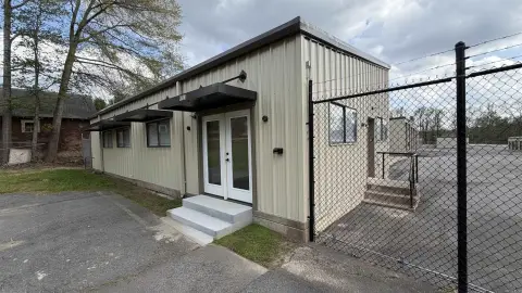
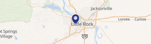
8612 Kanis Rd Little Rock, AR 72204-2322
Property profile & analytics
8612 Kanis Rd Little Rock, AR 72204-2322
- Office buildings
- 16,200 SF
- 1.78 lot acres
Property ID
US05-0301962
The Realmo ID is a unique identifier assigned to every property, incorporating country codes and precise geo-coordinates for 300x300-foot land blocks. It enables standardized data collection and seamless integration of disparate sources such as ownership, tax, title data and physical specifications. By aggregating current and historical records, the Realmo ID powers advanced analytics and delivers deep, verifiable insights for real estate professionals.
Location Intelligence
Current Use by Public Records
- Alliance Homecare Equipment / Home Health Care Service / Medical Equipment Supplier
- American HomePatient/Alliance / Home Health Care Service / Medical Supply Store
Property Details for 8612 Kanis Rd
- Year built
- 1993
- Lot size
- 1.78 lot acres
- Property size
- 16,200 SF
- Property type
- Office buildings
- APN
- 44L-084-04-002-00
- APU
- 44L0840400200
Value Estimations
based on Realmo’s proprietary methodology
-
CAP approach
- CAP Return
- Estimation
- 6%
- $2,740,000
- 6.5%
- $2,530,000
- 7%
- $2,350,000
-
Comparable approach
- Method
- Estimation
- Statistic Estimate
- $2,004,000
- AI Estimate
- $1,620,000
Market price range: $891k - $2.86MMarket price range: $461k - $2.54M -
Alternative Use
- Use
- Estimation
- OFFICE BUILDING
- $1,795,000 Current use
- COMMERCIAL (GENERAL)
- $3,015,000 Change: +68% Conversion: Easy
- MEDICAL BUILDING
- $2,660,000 Change: +48% Conversion: Easy
- RETAIL STORES
- $2,475,000 Change: +38% Conversion: Moderate
- NEIGHBORHOOD: SHOPPING CENTER
- $2,115,000 Change: +18% Conversion: Difficult
- AUTO REPAIR, GARAGE
- $1,855,000 Change: +3% Conversion: Difficult
Get a detailed, property-specific estimation — fast and free
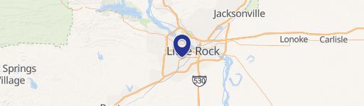
Location Insight
- Map
- Local Demand
- City
- Little Rock
- County
- Pulaski
- State
- Arkansas
- Longitude
- -92.3712
- Latitude
- 34.741
- CBSA code
- 30780
- CBSA name
- LITTLE ROCK-NORTH LITTLE ROCK, AR METROPOLITAN STATISTICAL AREA
Property Tax & Assessments
Tax date
Tax Amount
Assessed Land Value
Assessed Improvement Value
Total Assessed Value
Applied Tax Rate
Land Market Value
Improvement Market Value
Total Market Value
2024
$15,120
$72,834
$143,166
$216,000
-
$364,170
$715,830
$1,080,000