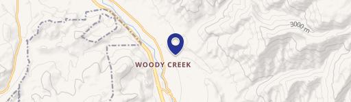
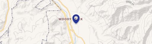
7943 Uppr Riv Rd Woody Creek, CO 81656
Property profile & analytics
7943 Uppr Riv Rd, Woody Creek, CO 81656
- Mining land & claims
- 100.00 lot acres
Property ID
US13-1003517
The Realmo ID is a unique identifier assigned to every property, incorporating country codes and precise geo-coordinates for 300x300-foot land blocks. It enables standardized data collection and seamless integration of disparate sources such as ownership, tax, title data and physical specifications. By aggregating current and historical records, the Realmo ID powers advanced analytics and delivers deep, verifiable insights for real estate professionals.
Location Intelligence
Current Use by Public Records
- Mining land & claims
Property Details for 7943 Uppr Riv Rd
- Lot size
- 100.00 lot acres
- Property type
- Mining land & claims
- APN
- 264316102010
- APU
- 264316102010
Sales History
| Date | Price | Buyer | Seller | Deed Type | Mortgage |
|---|---|---|---|---|---|
| May 29, 2007 | — | Elam Construction INC | — | Grant Deed · related | $2M · Alpine Bank |
| Jun 27, 2006 | — | Elam Construction INC | — | Trustees Deed · related | $506k · Alpine Bank |
| Apr 28, 2005 | — | Elam Construction INC | — | Trustees Deed · related | $500k · Alpine Bank |
| — | — | Elam Construction INC | — | Deed Of Trust · related | — |
| — | — | Elm Construction INC | — | Deed Of Trust · related | — |
Value Estimations
based on Realmo’s proprietary methodology
-
AI approach
-
CAP approach
-
Comparable approach
-
Alternative Use
Get a detailed, property-specific estimation — fast and free
Location Insight
- Map
- Local Demand
- City
- Woody Creek
- County
- Pitkin
- State
- Colorado
- Longitude
- -106.882
- Latitude
- 39.2724
- CBSA code
- 24060
- CBSA name
- GLENWOOD SPRINGS, CO MICROPOLITAN STATISTICAL AREA
Property Tax & Assessments
Tax date
Tax Amount
Assessed Land Value
Assessed Improvement Value
Total Assessed Value
Applied Tax Rate
Land Market Value
Improvement Market Value
Total Market Value
2023
$3,024
$115,480
$0.00
$115,480
-
$413,900
$0.00
$413,900