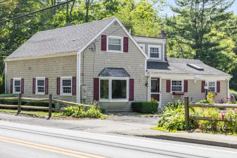
78 Rte 130 Forestdale, MA 02644-1405
Property profile & analytics
78 Rte 130, Forestdale, MA 02644-1405
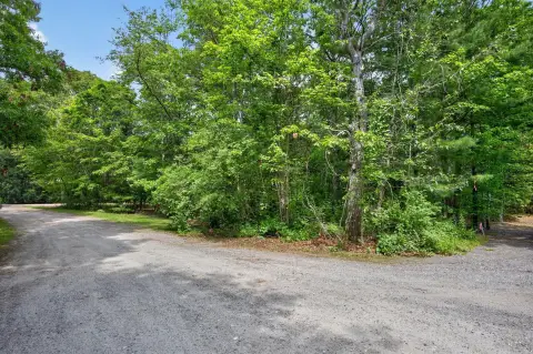
- Commercial land
- 11.40 lot acres
Property ID
US38-0592917
The Realmo ID is a unique identifier assigned to every property, incorporating country codes and precise geo-coordinates for 300x300-foot land blocks. It enables standardized data collection and seamless integration of disparate sources such as ownership, tax, title data and physical specifications. By aggregating current and historical records, the Realmo ID powers advanced analytics and delivers deep, verifiable insights for real estate professionals.
Location Intelligence
Current Use by Public Records
- Commercial land
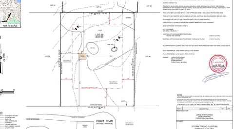
Property Details for 78 Rte 130
- Lot size
- 11.40 lot acres
- Zone code
- BL-1
- Property type
- Commercial land
- APN
- SAND M:0011 B:0241
- APU
- SANDM0011B0241
Sales History
| Date | Price | Buyer | Seller | Deed Type | Mortgage |
|---|---|---|---|---|---|
| Sep 16, 2013 | — | Forestdale Village LLC | — | Deed Of Trust · related | $200k · Robin Wilcox |
| Aug 29, 2013 | — | Forestdale Village LLC | — | Deed Of Trust · related | $300k · Leo V Marshall |
| Dec 31, 2009 | $1,820,000 | Forestdale Village LLC | Thompson,phyllis P | Grant Deed | $2M · John Stinson |
Value Estimations
based on Realmo’s proprietary methodology
-
AI approach
-
CAP approach
-
Comparable approach
-
Alternative Use
Get a detailed, property-specific estimation — fast and free
Location Insight
- Map
- Local Demand
- City
- Forestdale
- County
- Barnstable
- State
- Massachusetts
- Longitude
- -70.5048
- Latitude
- 41.686
- CBSA code
- 12700
- CBSA name
- BARNSTABLE TOWN, MA METROPOLITAN STATISTICAL AREA
Property Tax & Assessments
Tax date
Tax Amount
Assessed Land Value
Assessed Improvement Value
Total Assessed Value
Applied Tax Rate
Land Market Value
Improvement Market Value
Total Market Value
2024
$4,905
$454,200
$0.00
$454,200
-
$0.00
$0.00
$0.00