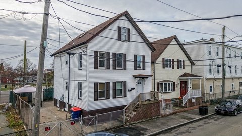
775 Brock Ave New Bedford, MA 02744-2355
Property profile & analytics
775 Brock Ave New Bedford, MA 02744-2355
- Retail space
- 1,800 SF
- 0.18 lot acres
Property ID
US38-1502278
The Realmo ID is a unique identifier assigned to every property, incorporating country codes and precise geo-coordinates for 300x300-foot land blocks. It enables standardized data collection and seamless integration of disparate sources such as ownership, tax, title data and physical specifications. By aggregating current and historical records, the Realmo ID powers advanced analytics and delivers deep, verifiable insights for real estate professionals.
Location Intelligence
Current Use by Public Records
- Gulf / Gas Station
- HARSS EXPRESS / Grocery & Convenience Store
Property Details for 775 Brock Ave
- Year built
- 1975
- Construction
- FRAME
- Lot size
- 0.18 lot acres
- Property size
- 1,800 SF
- Zone code
- MUB
- Property type
- Retail space
- APN
- NEWB M:0013 L:0036
- APU
- NEWBM0013L0036
Value Estimations
based on Realmo’s proprietary methodology
-
AI approach
-
CAP approach
-
Comparable approach
-
Alternative Use
Get a detailed, property-specific estimation — fast and free
Location Insight
- Map
- Local Demand
- City
- New Bedford
- County
- Bristol
- State
- Massachusetts
- Longitude
- -70.9145
- Latitude
- 41.6115
- CBSA code
- 39300
- CBSA name
- PROVIDENCE-NEW BEDFORD-FALL RIVER, RI-MA METROPOLITAN STATISTICAL AREA
Property Tax & Assessments
Tax date
Tax Amount
Assessed Land Value
Assessed Improvement Value
Total Assessed Value
Applied Tax Rate
Land Market Value
Improvement Market Value
Total Market Value
2024
$9,422
$140,100
$237,400
$377,500
-
$0.00
$0.00
$0.00
Comparable in this City


Similar Nearby for Sale


Similar Nearby for Lease


Property Visit Statistics
-
Visits by month1.6k
-
Visitors by month2.4k
-
Avg Time on site9 min


