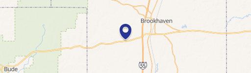
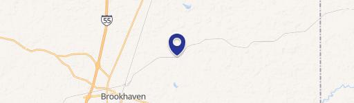
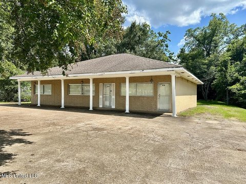
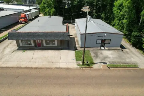
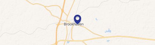
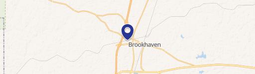
771 Industrial Park NE Rd Brookhaven, MS 39601-2065
Property profile & analytics
771 Industrial Park NE Rd, Brookhaven, MS 39601-2065
- Retail space
- 9,230 SF
- 1.29 lot acres
Property ID
US50-1914548
The Realmo ID is a unique identifier assigned to every property, incorporating country codes and precise geo-coordinates for 300x300-foot land blocks. It enables standardized data collection and seamless integration of disparate sources such as ownership, tax, title data and physical specifications. By aggregating current and historical records, the Realmo ID powers advanced analytics and delivers deep, verifiable insights for real estate professionals.
Location Intelligence
Current Use by Public Records
- Dollar General / Discount Store
- Western Union / Bank / Credit Union
Property Details for 771 Industrial Park NE Rd
- Year built
- 2020
- Construction
- WOOD
- Lot size
- 1.29 lot acres
- Property type
- Retail space
- APN
- B87-06 -3 -111.01
- APU
- B8706311101
Sales History
| Date | Price | Buyer | Seller | Deed Type | Mortgage |
|---|---|---|---|---|---|
| Apr 29, 2020 | — | Mdc Coast 21 LLC | Hsc Brookhaven LLC | Special Warranty Deed | — |
| Oct 22, 2019 | — | Hsc Brookhaven LLC | Suco Co | Quit Claim Deed | — |
| Jan 5, 2018 | — | James D Dalton | Ole Brook Jump And Jive LLC | Warranty Deed | — |
Value Estimations
based on Realmo’s proprietary methodology
-
AI approach
-
CAP approach
-
Comparable approach
-
Alternative Use
Get a detailed, property-specific estimation — fast and free
Location Insight
- Map
- Local Demand
- City
- Brookhaven
- County
- Lincoln
- State
- Mississippi
- Longitude
- -90.4446
- Latitude
- 31.6001
- CBSA code
- 15020
- CBSA name
- BROOKHAVEN, MS MICROPOLITAN STATISTICAL AREA
Property Tax & Assessments
Tax date
Tax Amount
Assessed Land Value
Assessed Improvement Value
Total Assessed Value
Applied Tax Rate
Land Market Value
Improvement Market Value
Total Market Value
2023
$12,049
$0.00
$0.00
$82,064
-
$45,150
$501,940
$547,090