
762 Quaker Hwy, Uxbridge, MA 01569
 For Sale
1 / 8
For Sale
1 / 8
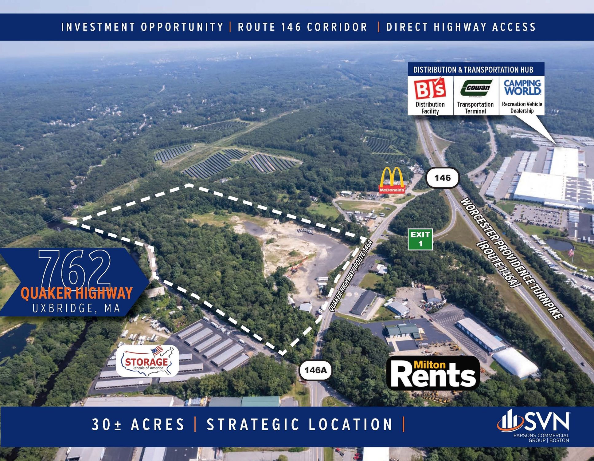
This exceptional ±30-acre commercial land parcel in Uxbridge, Massachusetts, presents a unique investment opportunity. Located at 762 Quaker Highway (Route 146A), this property boasts a highly visible location directly across from Exit 1 of Route 146, the Worcester-Providence Turnpike, experiencing approximately 30,000 average daily traffic. The site, encompassing two parcels with an APN of 125-64-0, offers approximately 20 buildable acres. Previously used as a sand and gravel pit and more recently as a truck parking lot, the land is zoned for Industrial B (IB) and Agricultural (A) uses. Its strategic location on the Massachusetts/Rhode Island border offers easy access to both states' amenities and resources, situated approximately 21 miles north of Worcester and 18 miles south of Providence, RI. The property benefits from its position within a thriving commercial corridor, neighboring major distribution and manufacturing facilities such as Medline Industries, BJ's Wholesale Club, and Amazon. This area has seen significant recent growth, with over 3 million square feet of new or under-construction commercial space. The property's size and location make it ideal for a variety of commercial developments, including big-box retail, industrial uses, warehousing, and distribution centers. This is a rare opportunity to acquire a substantial land parcel in a high-demand location with excellent highway access. The lot size ranges from 2.03 to 31.35 acres.
Cap rate
Implied · in-place · derived from last sale + estimated NOIValue
AI, CAP & Alternative Use estimations · Realmo proprietary blendProperty tax & assessments
Tax year 2024Comparables
6 recent transactions · within 1.5 miComparable in this City


Property description
Physical attributes from public recordsZoning & alternative use
AG · Uxbridge, MAUxbridge. Always verify with local authorities before improvements.
Costs & Benchmarks
Operating expenses, capex projections, utility benchmarks, and submarket comparables — all in one view.
Risks
Flood, climate, environmental, title, and tenant-concentration risk — surfaced with mitigations and source citations.


