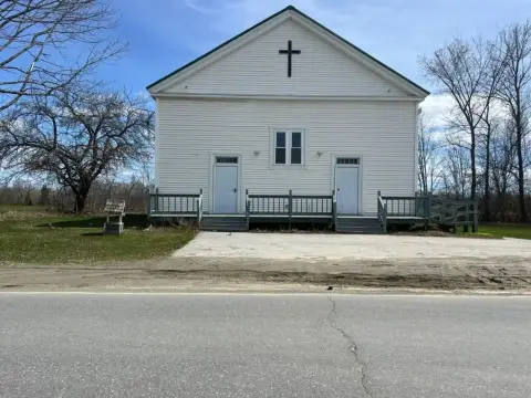
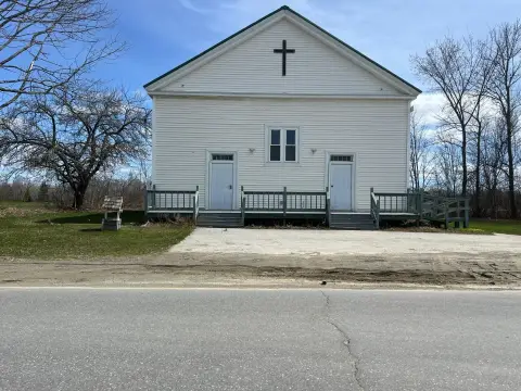
744 Grant Rd Corinth, ME 04427-3541
Property profile & analytics
744 Grant Rd, Corinth, ME 04427-3541
- Banks
- 3,464 SF
- 10.71 lot acres
Property ID
US42-0552008
The Realmo ID is a unique identifier assigned to every property, incorporating country codes and precise geo-coordinates for 300x300-foot land blocks. It enables standardized data collection and seamless integration of disparate sources such as ownership, tax, title data and physical specifications. By aggregating current and historical records, the Realmo ID powers advanced analytics and delivers deep, verifiable insights for real estate professionals.
Location Intelligence
Current Use by Public Records
- Banks
Property Details for 744 Grant Rd
- Year built
- 2003
- Construction
- CONCRETE
- Lot size
- 10.71 lot acres
- Property type
- Banks
- APN
- CORH M:03 L:008
- APU
- CORHM03L008
Sales History
| Date | Price | Buyer | Seller | Deed Type | Mortgage |
|---|---|---|---|---|---|
| Jun 1, 2021 | $222,000 | Ercole A Pallotto | Fnma | Quit Claim Arm's Length For Ne States | — |
| May 9, 2011 | — | Rebecca Staples | Corinth Town Of | Grant Deed · related | — |
| Feb 23, 2005 | — | Brian S Staples | — | Deed Of Trust · related | $55k · Machias Savings Bank |
| Feb 8, 2005 | — | Brian S Staples | — | Deed Of Trust · related | $200k · Machias Savings Bank |
Value Estimations
based on Realmo’s proprietary methodology
-
AI approach
-
CAP approach
-
Comparable approach
-
Alternative Use
Get a detailed, property-specific estimation — fast and free
Location Insight
- Map
- Local Demand
- City
- Corinth
- County
- Penobscot
- State
- Maine
- Longitude
- -68.9622
- Latitude
- 44.9437
- CBSA code
- 12620
- CBSA name
- BANGOR, ME METROPOLITAN STATISTICAL AREA
Property Tax & Assessments
Tax date
Tax Amount
Assessed Land Value
Assessed Improvement Value
Total Assessed Value
Applied Tax Rate
Land Market Value
Improvement Market Value
Total Market Value
2023
$2,858
$36,200
$177,900
$214,100
-
$0.00
$0.00
$0.00