Property profile & analytics
7350 Harford Rd Baltimore, MD 21234-7129
- Retail space
- 12,192 SF
- 0.42 lot acres
OFF-MARKET
Last Sale
Dec 06, 2021
Dec 06, 2021
$2,171,886
Value Estimations
$2,070,000
Show details
Cap Rate Potential
8.3%
Retail space
Location Intelligence
Property ID
US40-1317174
The Realmo ID is a unique identifier assigned to every property, incorporating country codes and precise geo-coordinates for 300x300-foot land blocks. It enables standardized data collection and seamless integration of disparate sources such as ownership, tax, title data and physical specifications. By aggregating current and historical records, the Realmo ID powers advanced analytics and delivers deep, verifiable insights for real estate professionals.
Current Use by Public Records
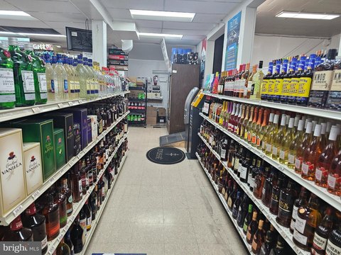
- Dollar General / Grocery & Convenience Store / Food Market
- Western Union / Bank / Credit Union
Property Details for 7350 Harford Rd
- Year built
- 1947
- Construction
- BRICK
- Lot size
- 0.42 lot acres
- Property size
- 12,192 SF
- Zone code
- C-2
- Property type
- Retail space
- APN
- 27-36-5475 -010B
- APU
- 27365475010B
Value Estimations
based on Realmo’s proprietary methodology
-
AI approach
- Method
- Estimation
- Statistic approach
- $2,085,000
-
CAP approach
- CAP Return
- Estimation
- 6%
- $2,875,000
- 6.5%
- $2,655,000
- 7%
- $2,465,000
-
Comparable approach
- Method
- Estimation
- Statistic Estimate
- $1,957,000
- AI Estimate
- $1,953,000
Market price range: $1.05M - $2.91MMarket price range: $1.13M - $3.16M -
Alternative Use
- Use
- Estimation
- RETAIL STORES
- $2,055,000 Current use
- OFFICE BUILDING
- $2,970,000 Change: +45% Conversion: Easy
- AUTO REPAIR, GARAGE
- $2,815,000 Change: +37% Conversion: Difficult
- RESTAURANT
- $2,770,000 Change: +35% Conversion: Easy
- NEIGHBORHOOD: SHOPPING CENTER
- $2,235,000 Change: +9% Conversion: Moderate
- COMMERCIAL (GENERAL)
- $2,010,000 Change: -2% Conversion: Easy
- WAREHOUSE, STORAGE
- $1,855,000 Change: -10% Conversion: Difficult
- MEDICAL BUILDING
- $1,770,000 Change: -14% Conversion: Difficult
Get a detailed, property-specific valuation — fast and free
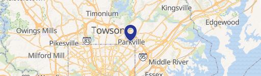
Location Insight
- Map
- Local Demand
- City
- Baltimore
- County
- Baltimore City
- State
- Maryland
- Longitude
- -76.5462
- Latitude
- 39.3704
- CBSA code
- 12580
- CBSA name
- BALTIMORE-TOWSON, MD METROPOLITAN STATISTICAL AREA
Property Tax & Assessments
Tax date
Tax Amount
Assessed Land Value
Assessed Improvement Value
Total Assessed Value
Applied Tax Rate
Land Market Value
Improvement Market Value
Total Market Value
2023
$43,679
$0.00
$0.00
$1,850,800
-
$217,200
$1,685,400
$1,902,600