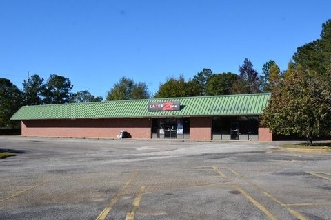
7210 Airport Blvd Mobile, AL 36608-4504
Property profile & analytics
7210 Airport Blvd Mobile, AL 36608-4504
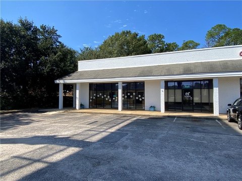
- Retail space
- 5,070 SF
- 0.24 lot acres
Property ID
US03-0426424
The Realmo ID is a unique identifier assigned to every property, incorporating country codes and precise geo-coordinates for 300x300-foot land blocks. It enables standardized data collection and seamless integration of disparate sources such as ownership, tax, title data and physical specifications. By aggregating current and historical records, the Realmo ID powers advanced analytics and delivers deep, verifiable insights for real estate professionals.
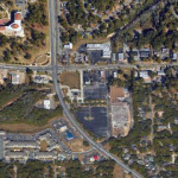
Location Intelligence
Current Use by Public Records
- Direct Auto Insurance / Insurance Agency
- Bayside Insurance Agency / Insurance Agency
- Mobile Shoe Hospital / Clothing & Fashion Store
- House of Kabob & Gyros / Restaurant
- Touch Wireless Co. / Computer & Electronic Repair / Tech Support Center
Property Details for 7210 Airport Blvd
- Year built
- 1994
- Lot size
- 0.24 lot acres
- Property size
- 5,070 SF
- Property type
- Retail space
- APN
- 28 04 19 1 001 063.XXX
- APU
- 2804191001063XXX
Value Estimations
based on Realmo’s proprietary methodology
-
Comparable approach
- Method
- Estimation
- Statistic Estimate
- $956,000
- AI Estimate
- $453,000
Market price range: $409k - $1.43MMarket price range: $209k - $795k -
Alternative Use
- Use
- Estimation
- RETAIL STORES
- $1,040,000 Current use
- RESTAURANT
- $1,015,000 Change: -3% Conversion: Easy
- MEDICAL BUILDING
- $980,000 Change: -6% Conversion: Difficult
Get a detailed, property-specific estimation — fast and free
Location Insight
- Map
- Local Demand
- City
- Mobile
- County
- Mobile
- State
- Alabama
- Longitude
- -88.2113
- Latitude
- 30.6876
- CBSA code
- 33660
- CBSA name
- MOBILE, AL METROPOLITAN STATISTICAL AREA
Property Tax & Assessments
Tax date
Tax Amount
Assessed Land Value
Assessed Improvement Value
Total Assessed Value
Applied Tax Rate
Land Market Value
Improvement Market Value
Total Market Value
2023
$4,188
$18,140
$46,980
$65,120
-
$90,700
$234,900
$325,600