Property profile & analytics
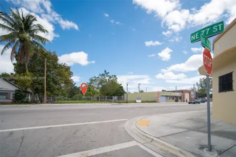
675 88th Ter Miami Shores, FL 33138-3363
- Commercial land
- 0.85 lot acres
OFF-MARKET
Value Estimation
Location Intelligence
Property ID
US18-3500218
The Realmo ID is a unique identifier assigned to every property, incorporating country codes and precise geo-coordinates for 300x300-foot land blocks. It enables standardized data collection and seamless integration of disparate sources such as ownership, tax, title data and physical specifications. By aggregating current and historical records, the Realmo ID powers advanced analytics and delivers deep, verifiable insights for real estate professionals.
Current Use by Public Records
- Commercial land
Property Details for 675 88th Ter
- Lot size
- 0.85 lot acres
- Zone code
- 6200:COMMERCIAL,ARTERIAL
- Property type
- Commercial land
- APN
- 30-3206-012-0010
- APU
- 3032060120010
Value Estimation
Powered by Realmo proprietary methodology
Last update: July 3, 2025
-
CAP approach
-
Comparable approach
-
Alternative Use
Location Insight
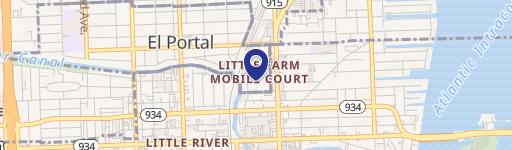
- Map
- Local Demand
- City
- Miami Shores
- County
- Miami-dade
- State
- Florida
- Longitude
- -80.1835
- Latitude
- 25.8571
- CBSA code
- 33100
- CBSA name
- MIAMI-FORT LAUDERDALE-MIAMI BEACH, FL METROPOLITAN STATISTICAL AREA
Property Tax & Assessments
Tax date
Tax Amount
Assessed Land Value
Assessed Improvement Value
Total Assessed Value
Applied Tax Rate
Land Market Value
Improvement Market Value
Total Market Value
2023
$35,385
$2,412,280
$0.00
$2,412,280
-
$2,412,280
$0.00
$2,412,280